Showing posts with label Planning. Show all posts

Friday, December 10, 2021

Villastaden (Villa City): An Unsuccessful Attempt at Zoning an Enclave of Single-Family Homes


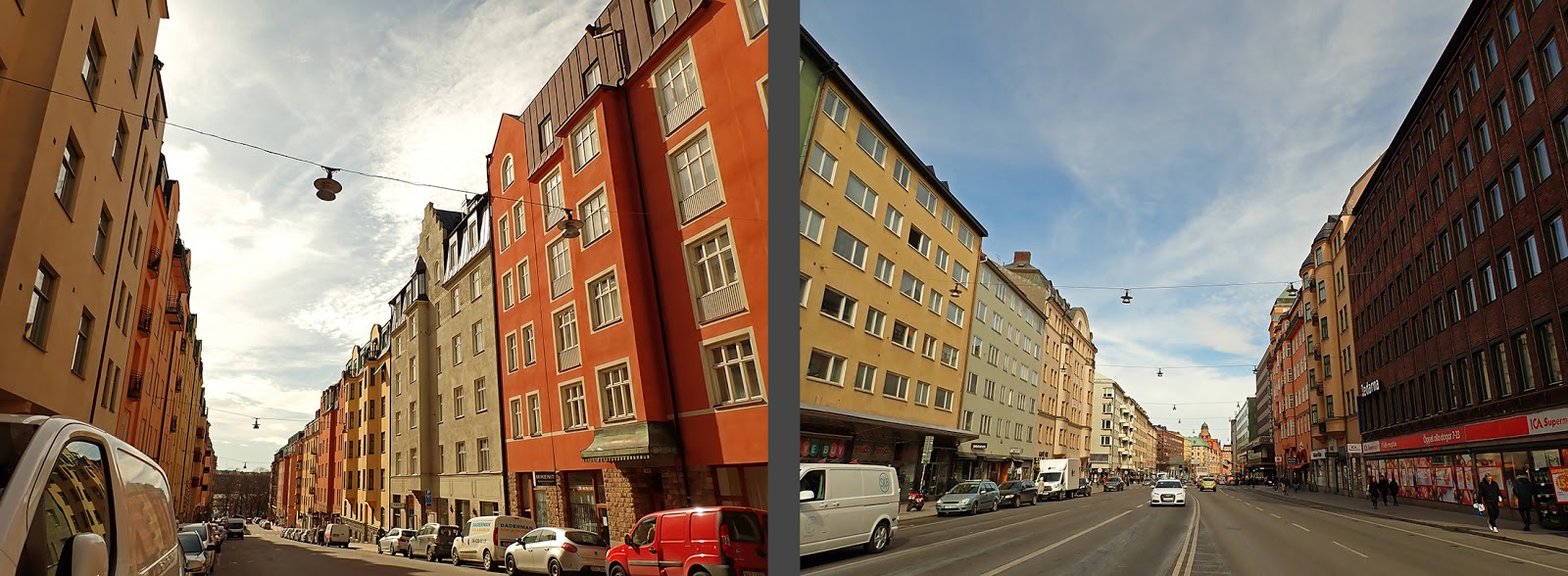
Most of what is today Central Stockholm was rural in character well into the 19th century, but that rural character was quickly evaporating as block after block of five-story apartment houses were erected firewall to firewall.  The quick and relentless march of urbanity was a natural response to Stockholm’s growing population, its housing crisis, the poverty of the majority of its citizens, and the steepening land prices.  Building densely was quite simply the only way to build given the financial constraints of both the builders and the renters.  Density was also the only convenient way to build—one’s feet were generally the only option for transportation, and density meant that everything you needed for your daily existence was within walking distance.

Five-story apartment buildings built out to the lot line at the street and abutting the adjacent buildings was also the only legal way to build in the city as specified in the Stockholm Building Code of 1876.  While the building code did allow for the occasional narrow garden between the street and the building line, this practice had never been tested because of market demands to maximize building area on expensive lots. 

From the very beginning, the relentless, growing grid of apartment buildings had its detractors.  These blocks were denigrated as “stone deserts” because of the lack of greenspace, and probably also because this degree of urbanity was in sharp contrast to the small-scale farms, barns, cottages, and kitchen gardens which had recently inhabited these lots.  Even so, Stockholmers seemed generally content to live in the apartment buildings, and even the exceptionally wealthy resided in apartment buildings, albeit ones designed to look like French chateaux.  


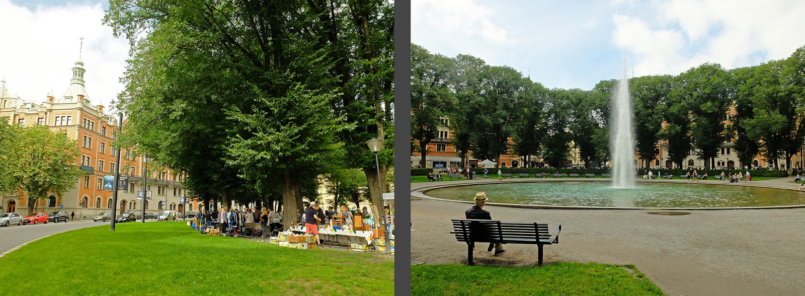
To escape the urban grid, poor Stockholmers had to make do with daytrips to nearby, generous greenspaces like Djurgården and Gärdet while wealthy Stockholmers retreated to their nearby suburban farms or malmgårdar or to their summer cottages.

Malmgårdar and summer cottages were never designed to be lived in year round and were impractical to heat.  I’m sure that the occasional eccentric made do with living in a summer cottage through the winter, but just like in London, Stockholm’s seasons were well defined.  In the summer, one retreated to one’s summer “cottage.”  In the winter, one lived in one’s apartment in town and participated in the social season.  

Villastaden, or “Villa City,” was Sweden’s first challenge to this norm.  Villastaden was designed to combine the best of both worlds—the greenery, the light and airiness, and the freedom and independence of the free-standing single-family cottage was to be combined with the convenience of the city and the year-round standard of an apartment building.  Villastaden, like its precedents in Berlin and Vienna, was a reaction to the growing, dense cityscape.  But unlike later leafy suburbs, Villastaden’s creators did not want to leave the city.  Instead, they wanted to create a green oasis within it. 

 
Establishment, Planning, and Easements
Villastaden was conceived of by Henrik Palme and it was financed through the company AB Stockholms Byggnadsförening which bought several parcels of tobacco-growing land at the northern edge of the Östermalm area so recently planned (but not yet ratified) in 1874.  Villastaden was never meant to be a large area—originally, it was confined to a six block area with only 100ish lots.  The layout of the right-angled blocks had already been determined by the 1874 plan for Östermalm and are hardly the winding, romantic streets that we associate with contemporary single-family housing developments like Olmstead’s Riverside outside of Chicago.  Instead, Villastaden can be more closely compared to Millionaires’ Row in Chicago or the Gilded Age mansions of Fifth Avenue in New York.  Again, these right-angled blocks serve to remind that unlike Riverside, Villastaden was conceived to be within the city, not outside of it.    

When AB Stockholms Byggnadsförening bought the tobacco fields in 1874, the area was hardly an attractive environment to attract the wealthy.  Humlegården park was known for its prostitutes and thieves, and the city’s rapid urbanization had not yet reached so far.  Yet buying up the land was a pretty safe bet as it was clear after the Plan for Östermalm was drawn up in 1874 that the area would be soon built up, and the ongoing construction of the Royal Library in Humlegården ensured that the park would soon be cleaned up.    

Villastaden would never had been able to get a head start on development before the rest of “Upper Östermalm” if it weren’t for AB Stockholms Byggnadsförening’s connections with the city council—several of the owners of the real estate investment company just happened to sit on the city council in leadership positions.  While the plan for the rest of Östermalm languished through an eighteen year process of debates, proposals, and counterproposals and wasn’t ratified until 1884, a tiny, six-block “part plan” for Villastaden was broken out of the larger Östermalm plan in 1874 and ratified in 1875.  This plan seems to only have specified the location of streets and not much else, and the connection to the future Valhallagatan was only dashed in since Valhallagatan wouldn’t be decided until 1884.

The Plan for Villastaden, ratified in 1875 *
 

I have not found any documentation as to why the part plan for Villastaden did not contain any requirements other street locations and widths when the reason for the part plan’s existence in the first place was that the landowner wished to create an enclave of single-family homes.  Why not write in zoning for single-family homes and setbacks from the street into the plan?  My educated guess is that there were two main reasons.  First, zoning and setbacks were completely foreign ideas to the Swedish planning process.  Planning in general was in its infancy, and there simply wasn’t a legal framework for writing such requirements into the part plan.  Additionally, the plan for larger Östermalm was clearly controversial—it has been debated and re-debated for more than ten years already—and AB Stockholms Byggnadsförening wouldn’t have wanted to cause any controversy.  It was probably a strategic decision to let the part plan remain as simple as possible in order to ensure as speedy of a ratification as possible.  Without ratification, AB Stockholms Byggnadsförening would have been stuck with a sizeable parcel of land that was impossible to develop in the near future.  

Architect Axel Kumlien's vision of Villastaden's character, 1875  *
 

While Villastaden’s grid blocks were predetermined by the plan for Östermalm, how the lots were to be parceled was not.  Immediately after the part plan was ratified in 1875, AB Stockholms Byggnadsförening began to sell lots.  The lots were relatively small given their purpose, but that made them a bit more affordable.  Because the plan for Villastaden hadn’t specified much other than the location of streets, the lots were sold with easements requiring that they be built with buildings “in villa style” and with necessary outbuildings (stables, outhouses, etc).  The easement also stated that buildings could not be built out to the lot line but were to be at least 20 feet (6 meters) from the street and freestanding from the neighboring buildings.  It is important to note that while two-family houses were specifically allowed by the easement, the easement did not specifically require single-family houses.  Only single-family house “style” buildings were required.  This was not an intentional loophole,  and it was just a matter of time before it would be exercised.  

One of Villastaden's original duplexes


AB Stockholms Byggnadsförening had no sooner sold the lots on fivish of the six blocks when the real estate company was closed.  It wasn’t a matter of bankruptcy, rather, the economy was slowing down and the company owners wanted to get out while ahead.  This meant that there was no longer any overarching body regulating how Villastaden was developed, and it was left up to the regular city permitting process to make sure that new buildings met the easement requirements.  

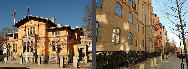
Even so, Villastaden was a successful and exclusive single-family enclave in the beginning.  Large, single-family villas were built, often on plinths above the street due to topography.  The houses’ physical height over the street gave them an even more imposing and impressive character.  In the gardens, the lots were planted with greenery, creating a distinctly different atmosphere than the “stone desert” of apartment buildings built shoulder to shoulder and out to the lot line at the street just a few blocks away.  The houses were designed by the period’s starchitects and many of the houses were inhabited by the city’s intellectual and cultural elite, including several of the starchitects themselves.  

This photograph from somewhere between 1881-1885 shows the original single-family house nature of Villastaden *

 
Buying into and building in Villastaden wasn’t something that one could do on a professor’s or architect’s or musician’s  salary.  Instead, these intellectual and cultural personalities came from established families and had sizeable personal fortunes that allowed for more extravagant lifestyles than would otherwise had been possible.  And while the houses built in Villastaden were unprecedentedly luxurious for Stockholm (aside from the royal palaces of course), they are tiny in comparison to the mansions of Millionaires’ Row in Chicago or Fifth Avenue in New York.  Contrary to the likes of the Fields and the Vanderbilts, the families in Villastaden had no need to flaunt and proclaim their wealth because they had been a part of the establishment since the 1700’s.  Villastaden’s early villas were generally inspired by Italian Renaissance villas which had been built for the patrons of the arts who wanted to live the good life while out in the countryside.  Mansions on Millionaires’ Row and on Fifth Avenue were generally inspired by French Chateau which were a show of power and strength.  The houses in Villastaden and the mansions in Chicago and New York had entirely different social objectives and therefore took on entirely different architectonic expressions.   

Architect Ernst Jacobsson's 1877 drawings for an Italian Renaissance-inspired villa in Villastaden *

 
Villastaden was more segregated than the rest of Stockholm.  Even other fancy parts of Östermalm including Strandvägen were relatively integrated as the wealthy lived in the buildings along the street and the working class lived in the courtyard buildings.  But in Villastaden, the very nature of the district with its single-family houses meant that there was no housing available of the working class (if you don’t count servants who lived in the attics—in 1920, more than half of the population of Villastaden was maids, butlers, cooks, scullery maids, laundresses, stable boys, chauffeurs, ladies’ maids, and the like.)  

Changing Times and Legal Tests
The two blocks to the east of Biblioteksgatan (today Floragatan) had originally been meant to be a part of Villastaden, but  AB Stockholms Byggnadsförening closed for business before they were developed.  These blocks ended up having a significantly different character than the other four blocks.  In this map from 1885, Villastaden’s high point as an enclave of single-family houses, it is already clear that the blocks east of Biblioteksgatan (Floragatan) were developed more like the rest of Stockholm with apartment buildings built out to the lot lines.   

This map from 1885 shows the original six blocks of Villastaden.  The first four blocks were built out as villas, but the eastern two blocks deviate sharply.  *


As lot prices in Villastaden grew higher and higher, the circle of people able to buy villas in the area became smaller and smaller, and apartment buildings grew more and more tempting.  The earliest apartment buildings in Villastaden were respectful of the original intent of the area.  For example, Zettervall’s apartment building on the corner of Biblioteksgatan (Floragatan) and Karlavägen is only three stories and is only slightly larger in scale than its neighbors and according to outward appearances could have been a single-family dwelling.  It was set back from the street and freestanding. 

The building on the left is one of Villastaden's first apartment buildings.  The scale could still be interpreted as fitting a villa. *

The same could more-or-less be said for Kumliens’ apartment buildings on Villagatan.

The apartment building on the right was originally the same height as the apartment building on the left--both were well within the scale of a large villa.

But as development pressures grew, new apartment buildings in the area grew taller, larger, and less respectful of the original single-family intent.


These apartment buildings were not intended for Stockholm’s middle or lower classes.  Instead, they were giant, luxurious apartments with up to 17 “main” rooms plus kitchens, storerooms, and small bedrooms for the servants.  These apartments were built with the very newest technologies including central heating and ventilation.  While the new apartment buildings changed Villastaden’s appearance, they were not meant to change Villastaden’s social makeup.

Debates raged between architects and owners and the city permitting office – did the easements for setbacks and “villa-style” buildings still apply after AB Stockholms Byggnadsförening closed for business?  Did “villa-style” encompass a limitation in building height?  In 1881, the King stepped in and declared that the easements for setbacks still applied but that the city building code applied regarding the building’s height.  Apartment buildings in Villastaden still had to be set back from the street and freestanding from neighboring buildings, but they could be five stories tall.  

Because AB Stockholms Byggnadsförening had not sold the lots east of Biblioteksgatan (Floragatan) with easements, in 1883, the City Architect successfully carried out a change in the city plan to require that all buildings along Biblioteksgatan (Floragatan) were to be built with a setback from the street.  However, buildings along this street were not required to be freestanding from their neighbors. 


In 1885, several property owners started legal proceedings to have the easements terminated.  The case went all the way to Sweden’s supreme court but was unsuccessful—the easements remained.  But this didn’t stop a demolition frenzy in Villastaden as villa owners sold their lots to builders who razed the original single-family houses to make way for more profitable apartment buildings.  Even Villastaden’s founder, Henrik Palme, sold his villa for demolition.  In 1889, he founded the fancy suburb of Djursholm and moved there instead.  

Another real estate investor fought the easement by submitting permit drawings for an apartment building built out to the street.  The permit was denied several times until the case was taken before various courts.  Eventually, the Supreme Court heard the case and found in favor of the real estate developer.  Construction began but was stopped by the King in 1892 who decided that the easements were still valid and that the real estate investor must abide by them.  

In 1889, another small change in the city plan was driven through, despite protests from the property owners.  Now even Villagatan had compulsory set backs according to the city plan.  I am curious why the plan didn’t encompass Villastaden’s cross streets or the east side of Engelbrektsgatan.

In 1902, two more lot owners tried to have their easements terminated.  Based on precedent, the request was denied, but now the King stepped in yet again and slightly reversed his previous dictates, deciding that only the easement requiring a set back from the street was valid.  The easement requiring freestanding buildings was no longer valid.  This resulted in several apartment buildings at the northern end of Villagatan that are set back from the street but that abut the neighboring buildings with firewalls.  It is unclear to me why the King was stepping into these relatively insignificant matters at all, much less why the same king would change his mind on the validity of certain easements within a relatively short timespan.  Yes, these easements had a significant impact on tiny Villastaden, but they had no impact on Stockholm as a whole.      

Yet another case in 1902 demonstrates how the King’s meddling changed Villastaden’s character.  Another permit application for an apartment building built out to the street on Östermalmsgatan and to the lot lines on both sides was denied by the city.  In response, the city tried to make yet another change to the city plan to require setbacks along Östermalmsgatan.  The King refused to ratify the change and instead determined that the apartment building should be allowed to be built out to the lot line at the street.  Even today, this is one of the only buildings in Villastaden that doesn’t have a setback.  


Stureparken
This pocket park isn’t really in the area today encompassed by Villastaden, but it serves as Villastaden’s almost private park, much more so than Humlegården which is used by the city at large.  Since the 1600’s, the park had been a graveyard for Östermalm’s poor who couldn’t afford burial at a church.  In the 1700’s and 1800’s, the graveyard was used to contain cholera victims, keeping the dangerous corpses out of the city center.  In the late 1800’s, the church intended to build upon the land, but those plans were put aside when it was found that the church didn’t actually own the land—it was actually the city’s property.  In the early 1900’s, the city removed the cemetery and created a park instead.   


Villastaden Today
The demolition of villas and the building of apartment buildings in Villastaden continued into the post-war years, but real estate prices remained high and the new buildings were almost without exception designed by the day’s leading architects.  Eventually, the sky-high real estate prices meant that office buildings began to replace even the apartment buildings.  Even so, the slightly suburban character of Villastaden remains.  Even the office buildings are set back from the street and are freestanding from their neighbors and a few remaining villas are still standing, reducing the overall scale of the neighborhood.  


However, the villas are almost without exception not residences in this day in age.  After the First World War, the financial world’s elite replaced the intelligentsia in Villastaden, and they hired the leading architects of the day to renovate the aging villas and to give them a more modern face lift.  And after the Second World War, most of the villas and even several of the apartment buildings were bought by various countries to be used as embassies.  Today, Villastaden hosts the embassies of Bulgaria, Romania, the Czech Republic, Poland, Malaysia, Thailand, and Colombia.      


While most of the apartment buildings are still residential in function, they hardly cater to a more mixed clientele now than in the past.  Villastaden claims Stockholm’s (and therefore Sweden’s) second-highest real estate prices, second only to Strandvägen

This air of exclusivity is reinforced by the neighborhood’s greenery.  Not only is it close to the giant Humlegården and smaller Stureparken parks, but the streets are lined with well-tended street gardens which separate the buildings from the street and sidewalk.  These street gardens are generally slightly raised above the sidewalk level and they are all fenced off from the street, reinforcing the psychological distance between those who may walk on the sidewalk (everyone) and those who may enter the buildings (a select few).  


A general observation about street-side gardens at buildings with setbacks from the street:  First, the street gardens are only successful if they are enclosed with a fence or wall.  When not enclosed, they become strange no-mans-lands between the public and private realms, and even when in very exclusive areas, these street-side gardens tend to be filled with bicycle parking or are generally a bit neglected.  Unenclosed street-side gardens are also less successful at establishing a psychological distance between sidewalk and apartment building, and do a much poorer job of psychologically shielding ground-floor apartments from the street.  

A less successful street-side garden in another part of the city
    

Another contributing factor to the exclusive air of the neighborhood is that while it is surrounded by destinations and thoroughfares (Humlegården, Karlavägen, Valhallavägen), the neighborhood itself is  little bit “off.”  One has no reason to pass through the neighborhood, public transportation is relegated to the neighborhood’s periphery, and street connections to Valhallavägen are physically cut off, decreasing the amount of car traffic through the area. 


Conclusion
With its greenery, Villastaden has its appealing aspects, but it is a small and relatively insignificant corner of Central Stockholm or even of Östermalm.  With its setbacks and freestanding buildings, Villastaden’s pattern of development deviates dramatically from the rest of Stockholm.  Yet it isn’t the development pattern that seems significant here.  Instead, it is the question of how a deviating development pattern can be legally enforced.  Clearly, easements were not the answer as they were challenged again and again and sometimes set aside.  Royal verdicts notwithstanding, the only reliable way to provide for and to enforce a development pattern that deviated from the city building code was to enshrine it in the city plan.  In other words, to legally zone it.  

Villastaden was Stockholm’s first experiment with zoning that didn’t strictly adhere to the city building code.  It wasn’t a very successful experiment.  But it did teach the city how to more successfully do it in the future.  It wouldn’t be long until the city planning office tried again to create a neighborhood that deviated from the norm, and this time, the deviations would be enforceable and lasting.   


Sources:
Fredric Bedoire, Villastan: En sluten värld för Stockholms ekonomiska och kulturella elit (2017)
Bengt Edlund, Vårt gröna Stockholm: Parker, parklekar, promenader och konst (2018)
Alla Tiders Stockholm (2014)

Images:
All of the images are my own except for
*Fredric Bedoire, Villastan: En sluten värld för Stockholms ekonomiska och kulturella elit (2017)


Tuesday, March 31, 2020

The Lindhagen Plan


In two of my recent posts, I’ve written about how mid-nineteenth century Stockholm was grappling with the question of if the city needed a comprehensive plan, and if so, what that plan might look like.  The first comprehensive proposal was rejected, not because it lacked vision and common sense (which it did), but because the public works department  didn’t want to be told what to do—instead, the department decided to make its own comprehensive plan. 

Wallström and Rudberg’s plan had admittedly lacked a sense of hierarchy as well as a sense of higher purpose.  The plan was too detail-oriented with clumsy junctions and connections between important thoroughfares.  W&R’s plan ignored critical topographical features and made no apologies about erasing other significant landmarks in the landscape.  The committee also criticized the plan because it had (purposefully) overlooked the oldest, most entrenched parts of the city.

In 1864, there was no such profession as city planning.  Lindhagen, the committee’s president, was a lawyer.  Other committee members included Ekman and Hawerman who were architects, Leijonacker who was a military engineer, and Alm who was a builder.  Although Lindhagen was professionally the least suited to the task, he was definitely the group’s leader and much of the plan’s visionary nature seems to have stemmed directly from him; today the plan bears his name.      

Overarching Concepts
Many features of the Lindhagen Plan are recycled from Wallström and Rudberg’s plan, but the Lindhagen committee’s major contributions were an overarching concept and a Stockholm-based design.  Lindhagen’s starting point was movement into and through the city, and the plan’s focus was a hierarchical system of streets that would provide for natural, efficient traffic flow (without the awkward junctions from W&R’s plan).  While beautification doesn’t seem to have been an explicit goal, the avenues and boulevards weren’t merely meant to expedite the flow of traffic, but they were also meant to serve as arteries circulating light and air through the city.  The airy, tree-lined boulevard system was by default a beautiful counterpoint to the city’s older, narrower street grid.
Lindhagen's boulevard system.  Red = built more-or-less as planned.  Orange = unbuilt.

There were plenty of contemporary examples of European cities building new, modern boulevard systems.  Vienna’s ring boulevard replaced the outdated ring wall fortifications and Haussman’s boulevard system in Paris are but two of the era’s most famous examples.  Lindhagen’s boulevards were well within the prevailing contemporary ideal, but Lindhagen gave his system a specific, Stockholm-based flavor.  While Paris’s boulevards lead to specific monuments, public places, or important buildings, Stockholm’s boulevard system ends at green areas or at the water and lead to views of nature.  Lindhagen recognized Stockholm’s unique adjacency to relatively undisturbed natural areas as well as the unique omnipresence of water, and the plan purposefully wove bustling city and restorative nature together.   
Lindhagen's boulevards don't lead to monumental buildings or squares; instead they lead to nature and water.

Connecting Future Suburbs to the City

One of the most forward-thinking aspects of Lindhagen’s plan was that it allowed for direct, convenient connections from the surrounding countryside into the city.  In our era of superhighways, such direct connections seem like a city-planning given, but one look at Wallström and Rudberg’s earlier plan shows that that was not the case.  W&R seem to have thought of Stockholm in a bubble; Lindhagen planned Stockholm in relation to its surroundings.  While Lindhagen was probably designing connections to distant towns and for the transportation of food and supplies into the city from farms, the direct connections that Lindhagen planned ended up dictating the location of future suburbs.  
Lindhagen's suburban access.  Red = built more-or-less as planned.  Orange = unbuilt (as planned).

Suburban access as built

From the west, Bromma was to be connected to the city with an arrow-straight boulevard across Kungsholmen.  This would become the future street Drottningholmsvägen.  At a traffic circle and major junction at Fridhemsplan, the boulevard would kink northward a bit and head straight into downtown. Both sections of this connection across Kungsholmen would cut across the island’s street grid at a diagonal, but only the more out-of-town section was built. 
The eastern section of Drottningholmsvägen is a distinct city boulevard, but west of Fridhemsplan it quickly becomes a suburban highway.

Travelers from Solna and Uppsala to the northwest were to be connected to Sveavägen, the city’s grandest boulevard and an arrow-straight shot from the water at Brunnsviken down to the Royal Palace across the water in the Old Town Gamla Stan.  The 70 meter-wide avenue, Sveavägen, was to be Stockholm’s Champs-Elysees and run parallel to the city’s street grid through the entire city. 
Sveavägen
This grandiose boulevard was the one exception to Lindhagen’s rule that boulevards would offer vistas of natural areas instead of buildings, but he was not the first to propose it—Sveavägen and its terminus at the Royal Palace had been envisioned several times throughout history at least since Jean de la Valle’s proposal in the 1600’s.  This street was eventually built, but it was never as grandiose as planned (as planned it would have eradicated both Aldolf Fredrik’s Church and the market square Hötorget) and it was never extended all the way through to the palace. 
Aldolf Fredrik’s Church and the market square Hötorget were not demolished to make way for a wider Sveavägen


From Roslagen to the north, travelers were to be funneled into town along a new, arrow-straight avenue  almost paralleling the city’s most grandiose boulevard.  This avenue would replace a natural but stinking creek, Rännilen, and lead directly to an enlarged Berzelii park and the water at Nybroviken.  Birger Jarlsgatan was built, but not as a straight shot from suburb to water as envisioned.
Birger Jarlsgatan and Nybroviken

From the east and the large island of Lidingö, travelers would enter the city at a traffic circle at Karlaplan and then continue toward downtown on a boulevard cutting diagonally across Östermalm’s street grid.  Because Östermalm was getting built out at such a frenetic pace and the planning office couldn’t wait for a decision on a city-wide, comprehensive plan, this diagonal avenue was left out of the short-sighted, stop-gap plan that dictated Östermalm’s growth.  (I will cover this plan more in depth in another post.)  The route in from Lidingö ended up being built as more of a ring road, part of which has recently been dug into a tunnel. 

Travelers from Nacka to the southeast would connect via a bridge at Danstull to the blasted, filled-out highway Stadsgården.  The waterside avenue would continue around the north side of Södermalm, becoming today’s Söder Mälarstrand.  This route was built according to Lindhagen’s plan.
Stadsgården and Söder Mälarstrand

From Årsta to the south, Götgatan would be widened and extended to a bridge at Skanstull.  This was built, and would eventually even became a highway tunneling under the island of Södermalm.
Götgatan leading south (toward today's Globen arena)
   
Hornsgatan was to be extended to link up with a bridge from the southeast and Liljeholmen.  This connection had also been drawn by Wallström and Rudberg.  As built, this connection ended up involving a ninety degree turn, but the general idea was carried out none-the-less.  

All of these connections into the city ended up being of utmost important in the city’s future expansion.  Every single one of the city’s current suburbs uses one of these connections into the city, and in some cases, even the subway follows these routes.     

Street Grid and Blocks
Like Wallström and Rudberg’s plan, the Lindhagen plan basically extends the existing 17th century network of street grids out to the city’s judicial boundary.  Since Örnehufvud’s plan of 1636, different districts have had differently angled grids radiating out from the Royal Castle, and natural features such as the steep Brunkeberg ridge and the no longer visible creek Rännilen served as the boundaries between districts.  
Radial streets according to Örnehufvud’s plan of 1636
Lindhagen’s plan extends these grids with one exception: he decided that both the eastern and western parts of Norrmalm should follow the same grid despite the Brunkerberg ridge.  While Lindhagen accommodated exisitng streets according to the 17th century radial plan, new streets in eastern Norrmalm were to follow western Norrmalm’s grid.  The grid in this part of the city was built according to Lindhagen's plan.
Radial Streets in Norrmalm with two slightly shifted grids according to the 17th century plan.  Later development simplified into one grid.

There is a good bit of variation of block size throughout the city.  While some new areas have uniform blocks, other block sizes vary quite a lot—some are square, some are long and narrow, some are quite large.  Blocks that are adjacent to existing blocks or to the water or to the city’s boundary have an irregular form.  I’m not really sure why Lindhagen drew so many different block sizes, but I’m guessing that the variation resulted from practical constraints more than aesthetics. 

Each square of the right-angled grid was envisioned as a closed block with continuous facades completely enclosing the block.  Except in a few outer areas, building facades were to be at the street and lot line.  Both the northern half of Norrmalm and the western part of Kungsholmen were to have narrow gardens between the street and the facade, but even these blocks were to be completely enclosed by buildings.  These gardens were envisioned as a part of the arterial network of green spaces bringing fresh air from the countryside into the city.
While some areas of the city do have narrow strips of garden between building and street, it is not nearly as widespread as Lindhagen's plan called for; with a couple of exceptions, these narrow street gardens are mostly in different areas than the more "suburban" areas on the outskirts of Lindhagen's plan.

Boulevards Through and Around the City
The street grid was to march steadily across the city, but Lindhagen provided for a good bit of relief and variation to break off the potentially monotonous pattern.  I don’t actually think that Lindhagen’s aim with all of the diagonal boulevards was for variation—instead, he was aiming for efficient traffic circulation—but the tree-lined boulevards did provide a break from the repetitive grid none-the-less. 

Because these boulevards were to serve a double purpose, both to efficiently siphon out-of-town traffic into the city and to efficiently circulate the traffic throughout the city, I have already mentioned many of Lindhagen’s boulevards above.  However, it is worth going through them again and looking more closely at how they relate to the city as opposed to outlying areas.  
Lindhagen's boulevard system.  Red = built more-or-less as planned.  Orange = unbuilt.
The boulevard system as built

The thoroughfare leading in to town from Bromma was to be an arrow-straight boulevard across western Kungsholmen (Drottningholmsvägen).  At a traffic circle and major junction at Fridhemsplan, the boulevard would change character to a narrower avenue and kink northward a bit to head straight toward a bridge over Klara Canal toward downtown and the existing street Kungsgatan.  Kungsgatan would be significantly widened and would pass by a new central food market and continue through downtown.  The avenue would (magically) pass through the Brunkeberg ridge, over the Champs-Elysees-like Sveavägen, kink again, and then head diagonally across Östermalm.  At the park-like traffic circle of Karlaplan, the avenue would continue out of town toward the island of Lidingö.
Lindhagen's proposal vs. Today's reality


The park/traffic circle at Karlaplan was the only one of Lindhagen’s planned circles to actually be built, but it is not connected to these Bromma-to-Lidingö boulevards as planned. 
Karlaplan
The connection across Kungsholmen toward Bromma was built, but the rest of the avenue cutting across downtown and Östermalm was not built.  Instead, traffic from Bromma must make two 90 degree turns in order to continue into town and to Kungsgatan.  Kungsgatan was widened, and it did eventually cut through the Brunkeberg ridge, but it was never extended across Östermalm.
The older section of Kungsgatan and the more modern section breaking through the Brunkeberg ridge (the bridge is for a street atop the ridge)

On the northern side of Kungsholmen, a wide avenue would follow the waterline of Klara Canal.  A similar wide avenue would also follow the north shore of the canal on the mainland.  Uncharacteristically for Lindhagen, these avenues would peter out onto narrower streets.  These avenues weren't built as planned, perhaps because they weren't all that well planned in the first place.

Another important East-West thoroughfare was the tree-lined boulevard leading from Karlberg Palace into the middle of Norrmalm.
Lindhagen's proposal vs. Today's reality
This boulevard became Karlbergsvägen and was built almost as planned.  
Karsbergvagen
Karlbergsvägen would meet up with a new major east-west thoroughfare at a new park; this second thoroughfare became today’s Odengatan.  
Odengatan
Odengatan marched across the entire Norrmalm district to end at a park in Östermalm.  A variation of Karlbergsvägen had been shown by Wallström and Rudberg, but they didn’t draw an avenue similar to Odengatan.

Interestingly, Lindhagen did not allow for any major public space where the two thoroughfares met up, but the triangle-shaped Odenplan was left open except for a large church occupying the center of the space.  Lindhagen did plan for a new parish church in approximately this location, but not for the open junction.
Odenplan and Gustaf Vasa Church

A third east-west thoroughfare was planned to cut across Kungsholmen and connect to lower Norrmalm and then to march across downtown.  
Lindhagen's proposal vs. Today's reality
From Kungsholmen’s northwestern shore (the water here is called Ulvsunda Lake but it’s really just a large bay in Lake Mälaren), a tree-lined boulevard (approximately today’s tree-lined Lindhagensgatan, named after Lindhagen himself) would cut diagonally across the island and connect to a tree-lined boulevard following Kungholmen’s southern shore (today’s Norr Mälarstrand).
Lindhagensgatan and Norr Mälarstrand
The boulevard would then connect to a bridge over Klara Canal to the traffic junction at Tegelbacken.  From there, existing streets would be widened to accommodate the new through-avenue which would cross the grandiose boulevard Sveavägen, cross the park Kungsträdgården, and end at Berzelii Park and the new Birger Jarlsgatan avenue.  A more kinked version of this thoroughfare had been drawn by Wallström and Rudberg, and while parts of the scheme were built, the connections were never realized.   

On the island of Södermalm, a ring boulevard would connect the freshwater of Lake Mälaren to the salt water of the Baltic Sea.
Lindhagen's proposal vs. Today's reality
This ring street was very similar to Wallström and Rudberg’s proposal, but instead of starting and ending at the steep, hilly parks of Skinarviksberget and Vita Bergen, Lindhagen’s tree-lined boulevard would somehow magically cut through the steep elevation differences to the water.  Lindhagen’s proposal was generally much more realistic in regard to topography than W&R’s plan, but this was one example where the Lindhagen plan ignores topographical realities.  Today, Ringvägen more-or-less dead ends into the parks like W&R’s proposal.
Ringvägen

I have already written about the widened Hornsgatan and the widened Götgatan to connect with Liljeholmen and Årsta respectively, but yet another east-west thoroughfare in Lindhagen’s plan was to widen the existing street Folkungagatan.  This avenue would connect the harbor and industrial area at Tegelviken and shoot straight across the island to the water of Årsta Bay.  This was another connection from salt to sweet water across the island of Södermalm, and it was also shown in Wallström and Rudberg’s plan.
Lindhagen's proposal vs. Today's reality
While Folkungagatan did become a major thoroughfare from the harbor at Tegelviken, it was never extended across the western half of the island.
Folkungagatan and Tegelplan where Folkungagatan meets the sea (to the right of the photo)

Both the north and south shores of Södermalm would also be lined with wide avenues. 
Lindhagen's proposal vs. Today's reality
These were much like W&R’s plan, and like the waterside avenues on either side of Klara Canal, these on Södermalm have a bit of an indistinct character and peter out on one side without connecting to another major thoroughfare.  Söder Mälarstrand on the north side of the island would be built, but the shore was never developed on the south side of the island along Årsta Bay.
Söder Mälarstrand did become a thoroughfare, but the southern side of the island was left undeveloped.
 
I have already covered two of the most important north-south thoroughfares of Lindhagen’s plan, but there were several more.  From the southern shore of Kungsholmen, a new avenue would cross the island, cross a bridge over Klara Canal to the mainland, and continue northward into Vasastan.  At a large traffic circle, one could choose to continue northward and connect to Karlbergsvägen, turn onto Odengatan, or head southeast into downtown along a new avenue eventually connecting to the parade boulevard Sveavägen.
Lindhagen's proposal vs. Today's reality

The southern part of St. Eriksgatan is much more of a neighborhood street than a thoroughfare, but northern St. Eriksgatan is a major thoroughfare today and corresponds to this part of Lindhagen’s plan. 
St. Eriksgatan.  To the left/south, a neighborhood scale.  To the right/north, scaled as an avenue, but without the trees.
Instead of a traffic circle, the square and junction of St. Eriksplan serves the same purpose of connecting  Karlbergsvägen, Odengatan, and Torsgatan which does head south into downtown.
St. Eriksplan
However, Torsgatan was never directly connected to Sveavägen as in Lindhagen’s plan.
Torsgatan

Like Wallström and Rudberg, Lindhagen also proposed that the square of Kungsholmstorg would continue northward as a wide avenue and terminate in a park.  This was never realized.
Kungsholmstorg and Scheelegatan which wasn't widened into an avenue.

On the northern edge of town, a tree-lined ring boulevard would follow the city’s boundary line (which until recently had also been a toll fence).  Wallström and Rudberg had also drawn a ring boulevard, although their version had far more traffic circles.
While this ring boulevard was built, the western edge was built as more of a regular city street than as a stately boulevard.
Norra Stationsgatan, to the right on a neighborhood scale instead of an avenue or boulevard.
 On the east side of town, Valhallavägen
Valhallavägen
was extended farther out of town than the toll fence, and Oxenstiernsgatan became the edge instead of the old toll boundary at Narvavägen.
Närvavägen


Lindhagen’s plan shows a clear hierarchy of streets.  Grandest is the Champs-Elysees-wide Sveavägen at 70 meters in breadth.  Several tree-lined boulevards were planned to be 40 meters wide.  Avenues were about 30 meters wide, and “regular” city streets were of varying smaller widths.  While the street widths do correspond to expected traffic density, Lindhagen’s boulevards aren’t only meant for rush-hour traffic.  They are also meant for strolls, for pumping clean air into the city, and for providing a green counterpoint to the dense city.

The plan calls for the widening of a number of existing streets.  In order to keep costs down, Lindhagen proposed that one side of the street would be kept and that the street would be widened only in one direction.  The city would not force the widening (thus having to spend a lot of money all at one time to buy the new rights to the needed land) but all new buildings built along the street would be built at the new lot line.  The street would thus be widened successively, over time.


The Waterfront
Like Wallström and Rudberg, Lindhagen proposed that every single bit of waterfront would be made public.  The city would buy all the land closest to the water and fill out the shoreline to make smooth, continuous quays and streets.  Stone quays would stabilize the entire shoreline (except for western Kungsholmen) and create stately waterside promenades.  This is perhaps one of the most important contributions from both plans—taking the shore from private owners and giving it to the people.
Stone quays by the Opera and at Nybroviken

Lindhagen also recognized that the omnipresence of water was one of Stockholm’s most striking and most unique features, and he planned the water as handsome “objectives” or ending points for his avenues and boulevards.  One promenades toward the water and then is able to walk alongside it on the public quaysides.
Lindhagen's boulevards don't lead to monumental buildings or squares; instead they lead to parks, water, and nature.

The quays were also pragmatic—the city already had lots of boat traffic, for the transport of both goods and of people, and stone quaysides were much more practical than muddy embankments.  Solid quays also allowed for railroad spurs for the transportation of goods to and from the harbors.  Filling out the land to make smooth shorelines was also a good opportunity for creating wide streets with good traffic flow in an otherwise dense city.
New quaysides proposed in the Lindhagen Plan

Lindhagen’s dual attitude toward the waterfront—he saw it both as a romantic feature and as a utilitarian link in the city’s infrastructure—has flavored much of Stockholm’s city planning ever since, and the pendulum continues to swing between function and feature.

Parks
Lindhagen didn’t leave a lot of open, market or square-type spaces in his plan.  He wrote that open spaces “might give a pleasant impression, but in a city plan they have little meaning compared to streets which create a well thought-out, complete system of communication.”  In other words, while Lindhagen was obviously impressed by Paris’ Champs-Elysees, he wasn’t enamored of Places Vendome.

However, Lindhagen’s plan does have numerous parks and green spaces.  Even several existing open plazas such as Norrmalmstorg and Tegelbacken were re-envisioned with formal gardens.  Like Wallström and Rudberg’s plan, the majority of Lindhagen’s parks are on hard-to-build upon areas with steep topography and bulbous outcroppings of granite.  These high spaces also had the benefit of having great views and cleaner air.  Large swaths of the outer areas of the city like western Kungsholmen and western Vasastan near Karlberg Palace were left completely undeveloped—I think that Lindhagen just couldn’t envision that the city would ever stretch out so far.
Lindhagen's city parks.  Red = parks today.  Orange = other use today.

On Kungsholmen, the Lindhagen plan leaves both steep Kronoberg and the cliffs at Kungsklippan as parks.  Kronoberg did in fact become a park,
Kronobergsparken rising above the surrounding neighborhood.

but Kungsklippan was eventually built upon.
Stairs up to and buildings on the high area of Kungsklippan

In Norrmalm och Vasastan, all of today’s parks were envisioned by Lindhagen including Vasaparken,
Vasaparken rising above the neighborhood.

Observatorielunden, 
Left: Observatorielunden is atop Brunkeberg ridge.  Right: view from Observatorielunden.
Vanadisparken,
Left: view from Vanadislunden.  Right: green Vanadislunden.
and Bellvue.  
Left: the ridge of Bellvue.  Right: View from Bellvue.
Lindhagen had an additional park at Sabbatsberg where a modern hospital was eventually built.
The grounds of Sabbatsberg hospital are very green and parklike, but the area isn't officially a park.

Today’s park Tegnerlunden was the site of a new church in Lindhagen’s Plan (a replacement for Adolf Fredrik which would be demolished to make way for the extra-wide Sveavägen, but Sveavägen was never made so wide that the church had to be demolished). 
Tegnerlnden rising above the surrounding streets

In Östermalm, Humlegården was left unbuilt and it was also connected to the large green spaces north of the city in Norra Djurgården with an extensive green wedge of park.  Humlegården remains today but the wedge was not left as park.
Humlegården


Extensive areas of western Södermalm such as Tanto, the area where the Söder Hospital is today, and Högalidsparken were to be left as open green spaces.
Söder Hospital
All of these sections are steep and bulbous, and Lindhagen was probably leaving them unbuilt due to a combination of their topography and because they were way out on the outskirts of the city.  Tanto
Tantolunden
and Högalid are parks today.
Högalidsparken

Even though he cut through the cliffs at Skinnarviksberget, he left the surrounding areas as parks, and they remain so today.
Skinnarviksberget
A very steep slope leading down to the water was left unbuilt as well as two large blocks south of the Southern train station.  The area next to the train station was actually swampy instead of steep and bulbous, but this park had been called for since Bildt’s first plan requirements.
Fatbursparken near the old Southern train station.

On the eastern side of Södermalm, the high, steep areas of Mosebacke, Ersta, Vitabergen, Åsöberget, and Fåfängen were to be left open as green parks.  Mosebacke became an entertainment terrace,
Moseback terrace and view from the terrace
 Ersta became a hospital, 
Left: Looking up to the Ersta Hospital grounds.  Right: View from the Ersta Hospital grounds with hospital chapel belltower in foreground.
and Åsöberget was never cleared of its small-scale worker’s housing,
Worker's housing on Åsöberget

but both Vitabergen
Vitabergsparken
and Fåfängen are parks today.

The unbuildable terrain was definitely a contributing factor, but Lindhagen’s other motive for proposing such a large number of green spaces was that he believed that parks should be near to all and available to all.  He felt that parks were a necessary, healthy contrast to the chaos of city life and wrote that “countryside-like nature has beneficial effects”.  Not just wealthy flâneurs should have access to the parks, but they were just as or perhaps even more important for the poor.

At the same time as the Lindhagen plan seems to advocate for the poor with park access, it also displaces them.  Despite being hard to develop, these high, rocky places were not devoid of housing—indeed, these areas had long been Stockholm’s shantytowns and housed a huge number of poor in small, ramshackle cottages.  Lindhagen’s park system cleared many of these heights of the more-or-less illegally-built but long-tolerated cottages.  A few examples, such as Åsöberget and the edge of Skinnarviksberget, were allowed to remain and give glimpses of what all of these high areas once looked like.  
Worker's housing at Åsöberget and Skinnarviksberget

While Lindhagen did propose a few more formal gardens downtown, the other parks were to have the “natural” lines of English gardens.  These natural lines were felt to be important for the relaxation process.

Lindhagen envisioned the tree-lined boulevards and the parks as forming a coherent system of green spaces throughout the city.  Even the narrow gardens between street and building on the outskirts of the city were seen as parts of this green system.  Just about every park was “extended” throughout the entire city by means of the boulevards and the narrow street-front gardens. 

Markets

Markets in the Lindhagen plan were even more scarce than in Wallström and Rudberg’s plan.  Like W&R, Lindhagen proposed a new market hall near the central train station, but instead of having its own square and transport canal, Lindhagen’s proposal was that the market would share the square in front of the train station.  In Östermalm, Lindhagen’s proposal was for a market hall near the water adjacent to Berzelii Park instead of being embedded in the fabric of the neighborhood.  This was a very formal and prominent placement, and the Royal Theater ended up being built in that location instead.  Like W&R, Lindhagen thought that a food market should share the square by the Southern railroad station.  The entire island of Kungsholmen and all of Vasastan were planned without markets.
Lindhagen's scant proposal for markets.  Red = a market was eventually built near the proposed location.  Orange = there used to be a series of market halls near the central station, but they have since been demolished.
 
Other Amenities

In addition to markets, Lindhagen planned the location of new parish churches.
Churches according to the Lindhagen plan.  Blue = already in existance at the time of the plan.  Red = built more-or-less as planned.  Orange = unbuilt.


Stockholm's churches today.  Blue = already in existance at the time of the Plan.  Red = built more-or-less according to the Lindhagen Plan.  Orange = built after the Lindhagen Plan and not included on in the Plan.

There was to be a new church in Norrmalm to replace Aldolf Fredrik’s Church that would have to be demolished to make way for Sveavägen (not built since Aldolf Fredrik was never demolished), one on Kungsholmen adjacent to Kronoberg Park (a church was built near here but it is more of a coincidence as it is not part of the national Swedish Church), one in the middle of Vasastan (near the location of today’s Gustaf Vasa Church at Odenplan), one on a steep hill in Östermalm (where St. Johannes is today), and one in the middle of Södermalm on another hilltop (Allhelgona or All Saints Church).
St'Johannes and Allhelgona churches
 
Aside from the three markets and the churches, Lindhagen did not designate the placement of any other significant public buildings.  No theaters, no museums, no government buildings, no monuments were planned to anchor vistas or boulevards.  Instead, Lindhagen intended Stockholm’s watery and green nature to provide the vistas.

Lindhagen did, however, designate an industrial district around Hammarby Lake.  This district is not visible on the map and is only defined in his written description of the plan.  Lindhagen described the lake as an industrial area “designated by nature.”  This area was already the site of several industries and the intensity of industrial development would only increase over the next ~70 years. 

Politics
Wallström and Rudberg’s plan was reviewed and rejected in 1864, and the Lindhagen Plan was published in 1866.  While W&R’s proposal had been positively received in the press, the Lindhagen Plan received mixed reviews.  Reviewers found the plan compelling, but it was seen as too grand and too expensive.  Unrealistic to say the least.  It’s an interesting attitude because it seems that the critics would rather have a cheaper but only half-functional plan than a visionary plan that would both beautify the city and make it more efficient for transport.  It was an incredibly short-sighted attitude that is unfortunately repeated again and again.

The city council dillydallied without making a decision on the plan for eight years.  They debated the pros and cons of the plan, but mostly they debated small, local details that were of (monetary) interest to themselves and not the plan’s vision.  It is worth noting that the current voting system was probably a major contributing factor to the delay—at the time, votes were weighted according to how much land one owned.  Huge landowners and building companies with large chunks of real estate probably had the most to loose with such a grandiose plan with such wide boulevards and avenues, and they were more interested in dividing their land into buildable lots than in a comprehensive plan for a functioning city.  These landowners had the most influence over the city council. 

Another reason for the delay is that the new system of city governance (local instead of royal) was still unproven and no one knew who had the right to decide on and carry out measures.  None of the departments had a budget or money to allocate. 

Another factor was that in the 1860’s, Sweden was experiencing an economic depression.  Not much was being built anyway, so the city council probably didn’t feel a lot of pressure to decide on a plan.  But by the 1870’s, the economy was in an upswing and Stockholm was experiencing a housing crisis.  While the large construction companies had blocked any action on the plan in the 1860’s, the changing market meant that they were clamoring for action by the 1870’s.  They were even trying to convince the city that despite the expense of expropriating land and building roads, carrying out the plan would be profitable for the city because of the increased tax base. 

But when the city council took up Lindhagen’s plan again in 1874, they still hemmed and hawed for another five years before deciding anything.  The city still didn’t have any civil servants to carry out the plan.  Also, the King had asked Lindhagen to draft an updated national building ordinance, and the city probably wanted to wait for the new legislation before voting for a plan that could soon be outdated.  I’ll be writing more about the 1874 National Building Ordinance and its influence in another post. 

Stopgap Measures
The King had grown fed up with Stockholm’s lack of interest in a comprehensive city plan and sent in Bildt to get the show on the road in 1862.  It took the city seventeen years to approve a plan, and in the mean time, the city was steadily expanding block by block.  In order to accommodate the growth, the city council was forced to create and approve plans for smaller areas of the city.  While some of the plans were small and relatively insignificant in the scheme of things, the plan for Östermalm (which I'll cover in a later post) was a shortsighted stopgap measure with consequences that still echo today.

In 1861, Wallström drew up plans for a private land owner to divide a large plot of land between the streets Döbelnsgatan and Luntmakaregatan into lots and two new cross streets (Rosengatan and Kammakargatan). 

While Kammakargatan was eventually extended as a cross street throughout the area, Rosengatan was never extended. 

This example clearly shows that planners weren’t quite sure what an appropriate block size should be.  Should they be square or should they be oblong?  The cross street Rosengatan divides the block into very small blocks, and it seems that the city was transitioning from the intimate scale of the 17th and 18th centuries to a more modern 19th century scale.
the short Rosengatan
Another example of a stopgap plan from 1873 was at the eastern edge of Humlegården park.  Here, a developer had bought a huge tract of land that needed to be subdivided into lots, blocks, and streets.  First, the developer asked the city to extend Sturegatan along the eastern edge of the park as planned.  The next step was to divide the extremely long block with cross streets to create more buildable street frontage.  Today’s Linnégatan, Cardellgatan, and Kommendörsgatan were the result.


These streets repeated the existing street grid and ended up setting the pattern for the newer blocks to the east.  The exception is Cardellgatan, which apparently was later deemed as unnecessary since it was left out of the newer blocks, except for half a block at Nybrogatan—I’m guessing that developers were originally counting on this street to continue across the neighborhood, but then it was later removed from the plans.
Left: The one block of Cardellgatan ending at the park.  Right: A piece of the planned Cardellgatan that doesn't cut through the entire block (? on map).

Yet another example, again from 1873, also resulted from the need to subdivide a larger tract of land into smaller blocks to create more street frontage and thus useable real estate.  At 17-19 Nybrogatan, the private developer planned to donate land to the city in order to create a cross street. 
Buildings were built facing onto the planned street, but the city never approved the subdivision of the block,  accepted the land, or built the street.  Today the street is an odd alley (though there’s a lot of untapped potential for an outdoor dining patio or an outdoor beer garden á la Munich...). 
The not-a-street at 17-19 Nybrogatan.

Teatergatan on Blasieholmen is another cross street from 1873 that was initiated by a builder instead of the city. 

Again, the street is only one block long and does not continue across the peninsula. 
Teatergatan looking toward the water at Nybroviken

These examples seem to point to a friction point between developers and the city council—what is the best balance between valuable street frontage and expensive street building / maintenance?  Between buildable area and larger central courtyards for light and air?  Even when the developers were willing to donate the land for a street to the city, the city wasn’t always willing to actually build and maintain a street.  At the same time, broad streets were in vogue.  It seems that the city planners were intuitively working toward a compromise with fewer but broader streets and larger interior courtyards.

Conclusion
The groundbreaking aspect of the Lindhagen plan was not the street grid—the plan is essentially a continuation of the city’s existing street grid from 1636—but in the overlay of a street hierarchy and thought-out connections into and through the city.  Efficient, direct transport into and through a city is such a foundational requirement of city planning today that it’s hard to appreciate that it was a new idea in the mid-1800’s.  The plan’s other main contribution to city-planning discourse was that it was distinctly flavored by Stockholm’s unique traits and geography.  While the plan wasn’t unlike the contemporary plans for Paris and Vienna, it did not directly copy those plans; instead of celebrating public monuments and institutions, the Lindhagen Plan celebrates Stockholm’s water and nature.


Lindhagen is given all the credit for Stockhom’s first comprehensive plan, but in reality, a very compromised version of the Lindhagen Plan was accepted and built out.  A good deal of Lindhagen’s visionary concepts were lost in the subsequent plans, and several of his grand thoroughfares were never realized.  For this reason, I would actually argue that Lindhagen’s National Building Ordinance and his resulting Stockholm Building Ordinance have had just as much (or even more) of a direct effect on the city than his plan (blog post coming soonish).  

I am going to cover the debates following Lindhagen’s Plan and the resulting implementation plans in another post, but the compromises were sometimes of a more practical nature (Is it really necessary to demolish an entire geological feature and a historic church in order to create a 70 meter-wide boulevard which isn’t even remotely appropriate to the scale of Stockholm?) and sometimes of a more stingy nature (why build a park-like boulevard when a narrow traffic artery will do?). 

At the turn of the 20th century, many criticized the monotony and repetitive nature of the Lindhagen plan.  If the plan had been fully carried out and all of the high, hard-to-build upon places were blasted and evened out as the Lindhagen plan seems to imply, the city would have been much poorer for it.  Luckily, many of these areas of geographical variation were quite tricky and expensive to blast and build upon, so they were left empty of development.  Later, when there was more pressure to exploit even these cumbersome areas, the planning cannon had changed and planners such as Hallman created curving streets that followed the geography.  These neighborhoods provide charming, smaller-scale counterpoints to the regular and dense street grid of Lindhagen’s Stockholm.  But in order for these neighborhoods to stand out, a consistent background was necessary.  And what a beautiful the Lindhagen plan provided!  

It’s heresy to write it, but I think that it is actually a good thing that Lindhagen’s Plan wasn’t implemented as drawn.  While his thoroughfares would certainly have made efficient paths through the city, I think that they would have made for a much more congested and car-centric city in the long run.  I can’t think of a single example where one of Stockholm’s traffic-oriented streets are more pleasant or make for a better city experience compared to the city’s pedestrian-scaled streets.

That said, I think that Lindhagen’s plan did secure a future for several of Stockholm’s best features including: the celebration of natural areas as necessary and self-evident  parts of the city; easy access to large tracts of nature outside of the city as well as to smaller, local city parks; a hierarchy and variation in street types; and public access and use of the entire waterfront.

Sources
Gösta Selling, Esplanadsystemet och Albert Lindhagen: Stadsplanering i Stockholm åren 1857-1887 (1970)
Thomas Hall, Huvudstad i Omvandling (2002)
Thomas Hall, Stockholm: The Making of a Metropolis (2009)
Peter Lundewall, Stockholm den planerade staden (2006)
Alla Tiders Stockholm (2014)
Magnus Andersson, Stockholm’s Annual Rings: A Glimpse into the Development of the City (1998)

Images
All images are my own except for Lindhagen's plan drawings and the plan of Rosengatan which are from Gösta Selling, Esplanadsystemet och Albert Lindhagen: Stadsplanering i Stockholm åren 1857-1887 (1970)