Friday, March 20, 2015

Palaces of the 1700's

In my last post, I wrote about how Stockholm expanded so little during the 18th century that only one new (significant) church was built during the entire century.  Palace-building is further evidence of the slow economy.  During the 17th century, at least 52 palaces were built, but only five were built during the following century.

The 1600’s was Sweden’s “Time of Great Power” when the empire stretched across the Baltic and included all or parts of Norway, Denmark, Germany, Finland, Estonia, Russia, Latvia, Lithuania, and Poland.  Money flooded into the capital and nobles, generals, admirals, and the like built great palaces to illustrate their successes.  A few of the palaces, however, were built by successful businessmen and even prosperous architects.

During the 1700’s, however, Sweden slowly lost much of its empire and thus much of its wealth and prosperity.  Despite various economic measures, the economy never really flourished.  In addition, the nobility lost much of their power and thus their wealth, yielding center stage to businessmen.  If the 1600’s was the nobles’ century, then the 1700’s belonged to the burgeoning bourgeoisie who became wealthy from trade and industrialism.  

Interestingly, two out of five of the 18th century palaces were built by prominent architects for themselves.  If only architects were paid so well today!  Another was built by a real estate developer, the fourth by a count who was downsizing from a much larger palace, and the fifth was a royal residence for the Dowager Queen.  (The palace for the count has been demolished, so I have not covered it in my post.)   

Although the bourgeoisie expanded considerably during the 18th century, they didn’t have the kind of  resources for palace-building that the nobles had had one hundred years earlier.  Eighteenth century businessmen tended to renovate existing palaces and update them from Renaissance styles to the more modern and simple Classicism.  This is why many of Stockholm’s earlier palaces actually look like they belong to a later era.

The bourgeoisie also tended to be more focused on their malmgårdar, or suburban farms, than on city palaces.  While some of the malmgårdar are quite modest, several of them are palace-like in their scale and composition.

When resources did stretch to a new city palace, the scale was much more modest than the previous century.  Two of the 18th century palaces are really just glorified townhouses.  The Adelcrantzska Palace was even more of a rental building from the beginning—although the original residents were various branches of Adelcrantz’s family, they all had separate apartments.  By the 1800’s there were more than 100 people living in the building, mostly “simple folk” unrelated to the Adelcrantzs. 

I have excluded the rebuilding of the Royal Palace from my count.  Even though the new palace wasn’t habitable until 1754, the design and scale belongs to the 17th century.  However, the severe delay in construction due to the king’s shaky finances is indicative of the 18th century’s slow economy.  Unfinished Fredrikshov Palace, which I have included in my count, is another royal palace project hampered by a lack of funds.   

Fredrikshov Palace was the only palace that retained the 17th century’s notion of a U or H-formed building in a park-like setting.  Instead, the other new palaces are in urban settings and they are built up to the lot line.  Interior courtyards let light into the deeper palaces.

All of the palaces are stylistically related on a continuum of Classical architecture.  While the rustication at the base of the Palmstedt and Westman palaces evoke Florentine Renaissance palaces, the Fredrikshov and Adelcrantz palaces are more influenced by French trends. Restrained detailing, light colored plaster, thin pilasters, and slightly protruding middle entry volumes are prevalent regardless of the interpretation.

1) Adelcrantzska Palats, 1750’s.  Norrmalm.  Architect C. F. Adelcrantz, built for himself and several branches of his family.
The entire block surrounding the Adelcrantz Palace was closed off due to street construction, so I was unable to get a closer look at this building.  In style, it reportedly links the Palaces of the 1600’s with the Gustavian Classicism of the 1700’s.  Although the palace abuts the street, the main facade is not on the street but is found in the courtyard.  I am uncertain if this is due to a newer, modern street grid or if this was the original intention.  The facade’s central body pushes out a small bit from the rest of the facade, and barely discernable pilasters create a slightly more three-dimensional effect.  While the facade is quite simple in its 18th century Classicism, the visible and relatively steep roof is rooted in earlier Renaissance styles.

2) Fredrikshov, 1770’s.  Östermalm.  Architect C. F. Adelcrantz, built for the Dowager Queen.

Fredrikhov's southern building.
Today, Fredrikshov leaves much to the imagination as much of the palace has been demolished and the once extensive grounds are hemmed in by later development.  There are two square buildings remaining; the southern was built as an inn in the 1660’s by  Jean de la Vallée, but it was given a facelift in 1731 by architect Carl Hårlamen when he built the northern building as a hunting lodge for the king.    Two kings later, Gustav III had a terrible and politically dangerous relationship with his mother who, among other scandals, claimed that the king’s only child and heir was not legitimate.  Gustav III thought it best to remove his mother from court life and install her in a Dowager House on the periphery of town instead.  
Fredrikhov's northern building
 
Although the king was eager to move his mother (against her will), he procrastinated in getting the palace built.  Architect Adelcrantz drew up four proposals, the first of which was a rather simple addition to the existing buildings.  The final proposal was a grand palace set in an even grander garden leading down to the water’s edge.  The complex was comparable in size and grandeur to contemporary French palaces, but the Adelcrantz portion of the palace as well as all of the accompanying buildings such as gatehouses and stables were demolished in the 1920’s.  Today, the remaining two buildings are used as an elementary school.
Adelcrantz's Final proposal including the gardens.  On the right, I have added color to make the drawing a little more readable.  Yellow = buildings which are now demolished (although it is unclear to me whether all of the yellow buildings were ever completed).  Red = what I believe to be the two remaining buildings.  Blue = water.

3) Westmanska Palats (Vetenskapsakademien), 1799-1801.  Norrmalm.  Architect C. C. Gjörwell, built for a real estate developer.

Compared to the other palaces of the 1700’s, the Westman Palace is quite large and pompous.  The building occupies an entire block, although two interior courtyards allow daylight into the building.  However, two or three entire stories have been added to the original three-story building, lending it an even  more monumental appearance (the number of added stories vary depending on which facade you're looking at).  
Left: The palace fills the entire block.  Right: Insensitive additions over time.  In this image, the top three stories are not original, and the building has doubled in height from the original design.

Additionally, the facades have been changed to an extent that the architect would hardly recognize his own building—the original colonnade has been reduced to pilasters, the arched pattern in the rusticated base has been eliminated, the main entry facade is now temple-like with its dominant tympanum, and over-scaled dentils march around the cornice. 
The main facade today and in the mid 1800's before the facade was changed.

4) Palmstedts Hus, finished 1805. Gamla Stan.  Architect Palmstedt, built for himself, although he died before the building was finished.
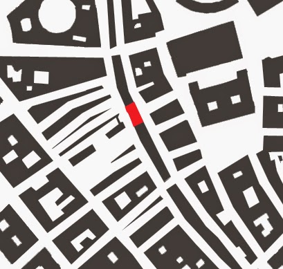
Palmstedt’s House is a good example of a building whose emphasis is exclusively on the ground level.  Because the street is so narrow, it is impossible to get far enough away from the building to get a good look at the upper stories.  
The upper stories are therefore plain and simple with a smooth plaster surface and extremely few details while the street level is relatively detailed with heavy rustication in the plaster and an expressive Roman-arched entryway.  In the dense urban environment of Gamla Stan, it is impossible to emphasize the central part of the facade by stepping it out very much, and the narrow lot discourages any inward jogs.  Pamlstedt combined both of these typical moves in order to save space—the middle part of the facade juts slightly outward into the sidewalk while the entry portal is deeply recessed into the facade.

Sources
Stormaktstidens privatpalats i Stockholm by Martin Arvid Ohlsson (1951).
Carl Fredrik Adelcrantz Arkitekt by Stig Fogelmarck (1957).
C.  F. Adelcrantz Ett gustavianskt konstnärsöde by Stig Fogelmarck (1994).

All of the images are my own except for:
Adelcrantz Palace image left: http://commons.wikimedia.org/wiki/Category:Adelcrantzska_palatset#mediaviewer/File:Adelcrantzka_palatset2009.JPG
Adelcrantz Palace image right: http://sv.wikipedia.org/wiki/Adelcrantzska_palatset#mediaviewer/File:Adelkrantzka.V_fasaden.jpg
Drawings of Fredrikshov: Carl Fredrik Adelcrantz Arkitekt by Stig Fogelmarck (1957).
Lithography of the Westman Palace by Ferdinand Tollin: http://caw.litografiskamuseet.se/index.php/Detail/Object/Show/object_id/1690
Drawing of Palmstedt Hus: http://sv.wikipedia.org/wiki/Palmstedts_hus#/media/File:Palmstedts_hus_1810_ritning.jpg

Sunday, February 22, 2015

Churches of the 1700's

In my study of Stockholm maps and in my study of Stockholm’s tollhouses and toll boundaries, I found that the city didn’t grow much throughout the entire 18th century.  This is also reflected in the fact that only two churches were added to the city during the 1700’s.   

Adolf Fredriks Kyrka (finished 1787)
Adolf Fredriks Kyrka was the only significant addition to Stockholm’s churches throughout the entire 18th century.  The church was literally built around a smaller wooden chapel that had been on the site since the mid 1600’s.  St. Olaf’s Chapel was part of the Klara parish (see #1, Churches of the 1600's), but by the mid 1700’s, the parish had grown enough to split into two separate and self-supporting entities.  The existing wooden chapel was deemed too small and too modest to be the seat of the new Adolf Fredrik parish; a call for design proposals for a new church attracted several entries.  The winning entry by City Architect Adelcrantz was the only one to adhere to the competition’s requirement that the existing chapel could be in use until the day that the new church opened its doors.
Adelcrantz's drawings for the new church.  Note that the original plan was a Greek cross like St. Olaf's Chapel.

Adelcrantz’s proposal was to build the new stone church around the existing chapel.  The new church thus inherited the original chapel’s location, its orientation, and its Greek cross floorplan.  The wooden chapel was located in the middle of a block (although not precisely in the center), and a map from 1663 shows that one street to the south of the church dead-ended into the church block.  By 1702, the northern block was also split by a new street which dead-ended at the church.
The church seen from the south (Olafsgatan) and from the north (Saltmätargatan).
Part of Adelcrantz’s proposal was to divide the block to the west of the church with an extra-wide street.  This created a view from Drottninggatan, one of Stockholm’s busiest thoroughfares at the time, to the church’s front door.
View to the church down Wallingatan from Drottninggatan.
These direct views from the south, north, and west were possible because the church, like all of Stockholm’s churches built after Örnehufvud’s city plan, is oriented according to the street grid and not strictly on an east-west axis (see my post Churches of the 1600's). 

It wasn’t until 100 years after the church was built that Sveavägen, the street to the east of the church, was widened to become such a major thoroughfare.  Today, the church’s site is experienced in passing, but historically, the church’s site would have been experienced more as a destination and as a focal point in the city’s fabric.

Although Adelcrantz inherited the Greek-cross floor plan of the existing chapel, he elongated the east-west axis to create an axial plan.  Was Sweden moving away from the more inward, human-focused central plan toward a more traditional liturgy with processionals?  It is impossible to confirm with a sample size of only one church, but it does seem possible and in keeping with Stockholm’s other central churches which moved the alter from the center of the church to the end of a wing, creating an axis within a symmetrical space.     

In style, Adolf Fredriks kyrka is a Swedish interpretation of French Rococo.  While French Rococo was exuberant and decorative in the extreme, the Swedish interpretation is quite staid and modest with few exterior details and a simple, white, bright interior.  Exterior details include pilasters which interrupt the roofline, window niches, and a relatively detail-rich central tower.
The interior is slightly more exuberant with plaster details and pilasters which “arc” across the ceiling.


Sabbatsberg Kyrka (converted 1761)
While Adolf Fredriks kyrka is situated amidst the tight urban fabric, Sabbatsberg Kyrka was in a rural setting, and that rural setting is still apparent today despite the fact that the Sabbatsberg area is now part of central Stockholm.

Sabbatsberg Kyrka was not built as a church.  Instead, it was originally the main house of Sabbatsberg Malmgård (suburban farm), built in 1717.  Being on the main road between central Stockholm and Karlberg Palace, a subsequent owner used the building as a pub and inn.  The adjacent mineral spring had been a health spa of varying popularity since the 1680’s, and in 1751, the Stockholm Parish bought both the spa and the entire farm.  While the spa was seen as a money-making venture for the parish, the farm became a parish-sponsored poor house and hospital. 

Being a religious institution, it was only natural that a church was needed on the premises; the inn was converted to a church in 1761 by master mason Georg Förman.  The adjacent farm building was renovated to be the church’s sacristy.
The church is the yellow building, and the sacristy is the red building.
As the building was not originally intended as a church, its layout and orientation are not at all traditional.  The main entry is from the south, and one enters at the middle of the space instead of at the back as is usual.
The church's main entry
Both the church and the sacristy are of log-cabin timber construction, but the church's timbers are protected by outer paneling.  The sacristy's timber structure remains visible. 

Sabbatsberg has always been on the periphery of Stockholm, and even today, when central Stockholm has enveloped the area on all sides, Sabbatsberg remains rural in character and the church is infrequently used.  Unlike Adolf Fredrick, a larger, more grandiose church was never needed.

Sources:
Stig Fogelmarck, Carl Fredrik Adelcrantz Arkitekt (1957) (Adelcrantz's drawings came from this book)
Stig Fogelmarck, C.  F. Adelcrantz Ett gustavianskt konstnärsöde (1994)
http://www.norrmalm.myor.se/studier/sabbatsberg.html
http://www.gustafvasa.nu/?page_id=27


Monday, November 17, 2014

Långholmen: From Prisoners to Park

It is ironic that Långholmen, one of Stockholm’s largest and most central green areas, was never heavily developed due to the prison that occupied the island for 250 years.  Today, the island is a leisure-time oasis, but for much of Stockholm’s history, the island was a much feared destination. 

A Short History
Långholmen, or “Long Island,” is just to the north of Södermalm in Riddarfjärden, the bay leading to Stockholm from the extensive inland Lake Mälaren.  For centuries, it was the last uninhabited stop on the way into the city, and was thus used as a strategic layover point for several important battles in the 1400’s and 1500’s. 

In modern history, the undertakings on Långholmen have always had a civic focus.  With time, Långholmen’s strategic location was no longer used by armies and navies but was instead utilized as a toll station where all of the boats on their way into Stockholm from the countryside were stopped and charged tolls for their cargoes  (see Stockholm’s Tollhouses, #12 Långholmen Sjötull).  
The old and "new" tollhouses from the 16- and 1700's .

After the island was donated from the crown to the city of Stockholm in 1647, the central part of the island was leased as a Malmgård (suburban farm) to Jochum Ahlstedt.  The eastern end of the island was leased (without cost) for the foundation of Mälarvarvet, a ship-building yard.  The shipyard was founded in 1685 and is still in use as a shipyard today!  Eventually, the city bought back Jochum Ahlstedt’s farm and converted it into a prison.  The prison was expanded several times during its 250 year history, but already in the 1870’s, the city slowly began converting the island to a public park.  After the prison closed in 1975, the island’s future was uncertain—would it be developed or would it be preserved as a park? 

Today, Långholmen is mostly a park, although it is sprinkled with private buildings including several residences, artists’ workshops, a hotel, a couple of restaurants, and a school.  The giant Västerbron (West Bridge) divides the island into two, further disintegrating the island’s park-like atmosphere.  While parts of the island are beautiful and nearly wild, I get a sense that there is an uneasy balance between public and private functions on the island.  While I am not aware of any further discussion about what to do with the island, I would not be surprised if a debate sprang up in the near future.

Alstavik Malmgård
Alstavik is much like any of Stockholm’s other Malmgårds from the 1600’s (see Malmgårdar).  Its owner, Jochum Ahlstedt, was a successful brewer who rented the land from the city starting in 1657.  Over twenty years, he built a farm from scratch, including a palace-like main house which was finished in 1670, a mill, a brew house, a horse barn, a livestock barn, and a smithy.  Supporting the buildings were a farm, a kitchen garden, a fish farm, and a cherry orchard.

We do not know who the architect was for the main house, but it was large and stately enough to attract a lot of attention.  It was even included in Gripenhielm’s Mälarkarta, a map of Lake Mälaren with accompanying illustrations of important landmarks that Gripenhielm created for the king.  In keeping with the stately nature of the house, a linden allé led from the bridge toward Södermalm to the house. 
Alstavik as shown on Gripenhielm’s Mälarkarta, 1688.

After Jochum’s death, Alstavik Malmgård was passed down through the family until the city bought the entire complex and converted it into a prison in 1724.
Alstavik's facade from a 1681 drawing.  Today, the house is hard to distinguish from the surrounding prison buildings which were added over time.

Mälarvarvet—Mälar Shipyard (map 1)
Stockholm was expanding so quickly in the 1600’s that the shipping industry couldn’t keep up.  Quite simply, there just weren’t enough cargo ships to bring in all the goods that the city desired, and there wasn’t enough seaside land to store all the ships in the winter.  The city rented out the eastern end of the island, without cost, to a new ship-building enterprise, Mälarvarvet.  Over time, workshops, storage sheds, workers’ housing, a smithy, an office, and various other buildings were built around the shipyard.  At one time, the area around the shipyard was much more densely developed, but many of the buildings were demolished over time.  Today, some of the historical buildings are still standing:
Fördärvet (The Ruin--named after the pub, 1762): workers’ housing, then pub, now apartments
Gula Raden (The Yellow Row, which is now red, 1834): workers’ housing, now apartments
Stenhuset (The Stone House, 1856): workers’ housing, now apartments
Nybygget (The New Building, 1876): – workers’ apartments, now apartments

Today, Mälarvarvet is Stockholm’s oldest shipyard and it maintains, repairs, and rebuilds ships.  While not technically part of the shipyard, the narrow canal between Långholmen and Södermalm is lined by historic wooden motorboats and sailboats during the summer, reminding visitors of Långholmen’s long nautical history.

Spinhuset—The Spin House (map 2)
The first thing to pop into a Swede’s mind upon hearing the name Långholmen is not the suburban farm Alstavik, or the shipyard, or today’s park.  Instead, most will think of the prison.  This is understandable considering the prison’s long history from 1724 until 1975, and that the prison buildings dominate the middle section of the island. 

The prison was established in 1724 when the city bought Alstavik Malmgård.  During the famine years in the 1680’s and 1690’s, thousands of starving peasants migrated to Stockholm in hopes of finding work and a better life.  Sadly, a better life was not to be found for most of them, and the numbers of beggars on Stockholm’s streets only increased.  

At the time, begging was a crime, as was being a vagrant, or a woman without the protection of a husband or organized work.  By these standards, Stockholm’s streets were lined with “criminals,” and something needed to be done about the worsening situation.  Finally, in 1724, the city found the money to found a Spin House where vagrant women could spin wool into yarn and weave garments, partly covering their own costs while serving their sentences. 

One hundred and twenty vagrant women were imprisoned in the Spin House, but the capacity wasn’t nearly big enough to meet the demand.  Already in 1728, City Architect J. E. Carlberg designed a prison expansion around the original Alstavik house, but it wasn’t built until 1746. 
Carlberg's drawing for the prison expansion.

Carlberg's Spinnhus has been modified and expanded over the centuries.
After the expansion, the prison could accommodate 250 female inmates.  The prison was meant to be self-sustaining and in addition to spinning and weaving, inmates also worked the Alstavik farm. Several new buildings were added to the complex throughout the 18th century, and these housed auxiliary functions which supported the prison and farm such as a baking kitchen, a laundry house, a brewery, a wagon house, a horse barn, a livestock barn, a firewood shed, and housing for guards and prison functionaries. 
Some of the auxiliary buildings from the 1700's.

By the 1780’s, it wasn’t just vagrant women who were imprisoned at the Spin House: the commonest crime was theft, which could be punished with a lifetime sentence.  The next commonest prisoners were “child murderers” who helped other women commit abortion, as well as the women who committed abortion or who smothered or abandoned their infants after birth.  These crimes often earned a lifetime sentence at the Spin House.  It was also a crime to run away from grueling factory work, and in 1780, 21 of the Spin House prisoners had been caught after lawlessly leaving their employment.  The next most common sentence was due to begging on the streets and to “bad behavior” in public.  Insubordination, impropriety, and laziness were also verdicts that could land a women at the Spin House.  Lechery and prostitution were not uncommon, and these women were caught by uniformed men who patrolled the streets, arresting any and all who seemed suspicious.  Drunkenness, poisoning, fraud, incest, religious fanaticism, and forgery were all crimes which had at least one representative in the Spin House in 1780.  

In the 1820’s, the female prisoners were moved to a different prison and male prisoners were moved to Långholmen.  Instead of spinning, the men worked as shoemakers, sock weavers, carpenters, blacksmiths, stone cutters, and, strangely, cork cutters.  Especially demanding tasks included working the pedal-driven grain mill and the pedal-driven sawmill.  The prison was expanded several times in the first half of the 1800’s by adding levels and wings to existing buildings, creating a capacity of 950 prisoners. 
The Kronohäktet was added to Carlberg's buildings in the 1860's.
Even more axillary buildings were also added to the complex throughout the 1800's, including housing for prison guards.
Centralvakten from 1859.

The Philadelphia System made its way to Sweden during this time period, changing how Sweden dealt with prisoners.  Instead of sleeping in dorms with 16 beds, inmates now had separate tiny cells.  The goal of imprisonment was no longer just to “clean up” the streets, but to reform criminals and to rehabilitate them into normal society through a program of isolation, hard work, and abstinence from alcohol.  There was a simultaneous focus on education of both inmates and of the working classes in an effort to keep them employed and out of prison.    

In 1874, an entirely new prison complex called Centralfängelset or The Central Prison was designed by prison architect V. T. Anckarsvärd to increase the capacity by 300 prisoners.  In addition to the tasks listed above, prisoners were now also involved in basket weaving, printing, book binding, the fabrication of parts for baby strollers, and the fabrication of cartons for various industries. 
This plan shows the entire prison complex, with the new Central Prison at the top (windmill shaped).

Throughout the early 1900’s many smaller additions were made to the prison complex.  In 1912, the prison director received a new house designed by architect Gustaf Lindgren, who also designed additional housing for prison workers in 1924.  
Director's Villa
Housing for prison workers

Yet another building (Fasta paviljongen) was added to the complex in 1914 (probably by Lindgren), this one with cells large enough to encompass a carpentry workbench.  
A new facility for mentally ill prisoners was added in 1931 despite the fact that the city had begun to strategize on moving the prison off the island due to its antiquated facilities.  It was difficult to incorporate modern laws on how prisoners should be treated and on how their sentences were to be served in such old-fashioned buildings.   

Eventually, in 1975, all of the prisoners were moved off the island and into more modern facilities.  Stockholm’s first impulse was to demolish the entire prison complex and to erase that darker side of its history.  However, Sweden’s department of antiquities and the Stockholm City Museum argued that it was important to keep the prison as a record of more than 250 years of penal history.  A compromise was reached and the Centralfängelse and the Mental Institution were demolished while the oldest buildings including the Alstavik house and Carlberg’s additions were to be renovated into a hotel, a hostel, a restaurant, a pub, a café, a prison museum, ateliers for 30 artists, and a conference center.  The Fasta Pavilion was converted into a trade school and many of the smaller axillary buildings were converted into highly coveted rental apartments.  

Even today, the penal nature of the buildings is still distinct.  A high stone wall separates the island into two halves to the north of the Spin House, and a stuccoed wall to the south of the Spin House encloses a large yard which is used today for parking and winter boat storage.  Many of the buildings’ windows are small and the thick, dark mullions look like jail grilles in front of the windows.  The contrast between the park-like nature of other parts of the island and the prison area in the middle of the island is stark.
  
Knaperstad (map 3)
This little complex in the Spin House gardens wouldn’t be so remarkable except for the fact that Immanuel Nobel, Alfred’s father, built the larger of the two buildings in the 1830’s.  (The smaller building is from the 1700’s.) After Nobel was forced to leave Knaperstad for economic reasons, the complex became a school and barracks for prison officers.  It is now divided into several apartments.
   
Karlshäll Malmgård (map 4)
In 1836, the prison’s site manager Modéer asked permission to built a residence for himself on some of the rocky land that the prison rented from the city.  Modéer claimed that the site was too rocky for productive farming and that the new, stately residence would be an adornment to Lake Mälaren’s shores.  He was granted permission and began construction of his malmgård (suburban farm) on the cliff’s edge above the water.  The main residence consists of a main building and two wings in a U-shape around a central courtyard.  A bit apart from the main house were farming sheds, a small cow barn, a wash house, and a workshop.

Interestingly, Modéer built the main house using the “Rydin Method” which was a sort of proto-concrete patented by Rydin who was a factory owner, newspaper editor, and parliament representative contemporary with Modéer.  The Rydin Method was also known as “poured limestone” and was a blend of limestone, water, and sand which was mixed to a mortar-like consistency.  When the mixture was half dry, it could be poured into forms.  After only a day, the forms could be taken away and the limestone mixture would continue to slowly harden.  The limestone mixture was poured around timber columns which supported the building until the limestone mixture cured; afterwards the columns served as a type of reinforcement in the concrete-like mixture.  Rydin claimed that this construction was just as “fireproof” as stone or brick construction because the wood columns were encased.  The Stockholm building authority did not agree and buildings built with the Rydin method were charged the same fire insurance premium as regular timber structures.  

A later tenant was the “Schnapps King” Olsson.  Olsson’s schnapps distillery was on Reimersholm, an island very near Långholmen, and Olsson used the Karlshäll Malmgård as a summer residence.  He hired architect Magnus Isaeus in 1876 to design a horse barn, servants quarters, a greenhouse, a garden master’s house, a gatehouse, and a billiard hall.
The Billiard Hall and Gate House
Olsson was very interested in gardens and on the terraces surrounding the main house, he planted an extensive garden that was reputed to be Stockholm’s finest.
Today, the gardens are gone and the terraces are open lawns.  They must have been magnificent, however, given their waterside locations.  To the right: The garden master's house is perched between the garden terrace and the water's edge.

After Olsson, Karlshäll Malmgård was used a mental hospital for nearly 70 years.  With the 1974 plan for Långholmen, it was decided that the Malmgård should be accessible by the public.  The mental institution moved out and the buildings served headquarters and meeting spaces for various non-profit organizations.  Today, Karlshäll is a conference center and is available for parties, and the farm hosts occasional jazz festivals. 

Sofieberg (map 5)
Sofieberg, the entire western end of the island, is one of the few areas of Långholmen that isn’t connected in some way to the Spin House.  Because the land has been rented from the city by private parties for centuries and because the area was so far outside of the central city, no one has really kept track of the various summer cottages that have been built and demolished there.  Today there are only two jealousy-inspiring “cottages” with park-like grounds and amazing water views remaining.  Until the 1970’s when the city built a waterside path around the entire island, Sofieberg was gated off from the rest of the island and closed to the public. 

Västerbron—The Western Bridge (map 6)
Långholmen is physically split into two halves by the gigantic Västerbro that spans from Södermalm, across Långholmen, over Riddarfjärden and to Kungsholmen.  A temporary, seasonal floating bridge spanned between Långholmen and Kungsholmen as early the mid-1500’s, but by the 1800’s, the city desired a permanent bridge that could handle train traffic.  It wasn’t until the 1930’s, however, that the city got serious about funding and building the bridge.  At that time, there was great debate about how the bridge would be divided between pedestrian, train, tram, and car traffic.  There was also some back-and-forth discussion about exactly where on Kungsholmen the bridge would land.  However, there doesn’t seem to have been any discussion at all about if a bridge should even be built across the island of Långholmen, splitting it into two.

I am guessing that due to the large and brooding presence of the prison, Långholmen seemed like a natural landing spot as the bridge spanned between the larger, more populated islands of Södermalm and Kungsholmen.  No one cared if the prisoners were disturbed by traffic noise or by the bridge’s looming shadows.  If the bridge were proposed today, however, I would think such a disruptive design would never be approved.  City residents would never consent to splitting one of Stockholm’s largest and most central urban parks into two.

While the bridge does provide some interesting framed views of Kungsholmen, it is a very unfortunate presence on the island, disrupting the oasis that is Långholmen.  Despite paths leading under the bridge which connect both sides of the island, and despite the fact that pedestrians can access the island from the bridge, Västerbro most decidedly reinforces the prison’s 250-year-old pattern of splitting the island into two separate pieces.
The bridge towers above the water's edge, but it is about equal in height to Långholmen's rocky summit.  The bridge forms an uncrossable barrier at the island's high point, dividing the island into two distinct areas.

Park
Today, large portions of the park are manicured with lawns and paths, but there are also several "wild" patches, especially up on the rocky heights.
Today, nearly all of Stockholm’s craggy high points are green, covered in mature hardwoods, and surrounded by verdant parkland.  However, these green oases are a modern fabrication.  Historically, these high points were too rocky and windy to allow for dirt accumulation, and until the late 1800’s they were barren, wind-swept places.  An asserted effort on Stockholm’s parks department transformed these areas (including Vita bergen, Högalid, Tanto, Observatorielunden, Vanadislunden, and Kronobergsparken) into leafy parks amidst Stockholm’s urbanizing environs.  This was also the case on Långholmen, although the main purpose in this case was “beautify” the island for passing boat passengers rather than to create a park right next to the prison.

City Garden Master Alfred Medin used mud that was dug out of the canal between Kungsholmen and the mainland to cover large tracts of rocky Långholmen.  Between 1872 and 1884, he planted 2900 hardwoods including maples, elms, ashes, mountain ashes, cottonwoods, and cherries.  During this time, Medin also leveled out tricky parts of the topography using trash and covering it with mud, covered additional areas of the island with mud dredged out from the canal between Långholmen and Södermalm, and planted grass and bushes amongst the trees.       

A small peninsula on the northern side of the island has been used as an unofficial swimming and sunbathing spot since the early 1900’s.  In 1916, the police became involved due to reports of naked bathing, and they tried to forbid bathing at this location.  Much of the city protested and a compromise was reached: the city built two separate, official bathing spots on the island, one for men and one for women.
A popular swimming spot today.
A network of paths, an amphitheater, and several pavilions and kiosks were also built.  A steamboat dock was even built so that city-dwellers could quickly and easily reach the new bathing complex and “folk park.”  Sadly, ferries no longer service the island.
Further park development plans were interrupted by the world wars, and the bridge as well as worsening water quality dampened Stockholm’s enthusiasm for the park.

After the prison closed and the buildings were converted into restaurants, hotels, and conference facilities, interest in the park began to warm up again.  The lake's water quality improved throughout the 60's and 70's.  In the 1990’s, a waterfront promenade was built around the entire island, and the amphitheater is now used throughout the summer for theater performances and rock concerts.  The prison’s kitchen gardens were converted into popular “colony” gardens, or garden lots which are owned by and taken care of by urban dwellers (map 7).  
Despite the walking trails, swimming beaches, and garden lots, however, I would guess that the park is used by far fewer Stockholmers than other inner-city parks such as Djurgården, Haga Park, and Norra Djurgården. Every time I have walked on the island, there have been others walking and families swimming at the beach, but there has never been an overwhelming number of visitors. 

I think that there are several reasons for this:  Ironically, while the Västerbro bridge connects Långholmen to the city, it also cleaves the island into two parts and lends the island a negative impression.  Also, Långholmen’s park hasn’t been a part of the collective consciousness for generations as other parks have; a long-standing tradition to picnic on the island just doesn’t exist.  Additionally, the beaches and swimming spots are all north-facing—good for avoiding sunburns but Stockholm summers are rarely warm enough to seek out shade.  Another factor is probably the absence of a large, sunny lawn.  There are a few beautiful lawns on the island, but views of parking lots or the trafficked bridge as well as a lack of direct sunlight hamper summer picnics.

Sources:
Most the names, dates, and historical info came from: Långholmen Den Gröna Ö edited by Carl-Johan Kleberg (1998) 
All of the images are mine except for: 
The two Alstavik drawings came from: http://sv.wikipedia.org/wiki/Alstavik
The Carlberg drawing came from: Johan Eberhard Carlberg: Stockholms stads arkitekt 1727-1773 by Henrik Ahnlund (1984)
The Centralfängelset plan drawing came from: http://sv.wikipedia.org/wiki/L%C3%A5ngholmens_centralf%C3%A4ngelse