THURSDAY, JUNE 15, 2023
Exploring the Island of Ingmarsö, its Inland Lakes, and its Island Neighbors 
 |
| Lots of people sitting outside in the sun on the ferry. |

We
chose Ingmarsö because it is actually a series of islands (Brottö,
Ingmarsö, and Kålgårdsö) which are linked by a rowboat to Idholmen and
Finhamn. Together, there’s quite a lot of hiking and exploring to do on
this chain of islands. Ingmarsö is so large that it even features
several inland lakes. We took a hammock with us but there was just too
much to explore, and we didn’t end up leaving time for hanging out in
the hammock. We did, however, snooze on the sunny, smooth rocks by the
water’s edge one afternoon.

We set up camp on the top of a ridge between one of Ingmarsö’s freshwater lakes and the Baltic Sea. We didn’t have much of a water view from our tent site, but we ate our meals down by the water—morning sun by the inland lake and evening sun by the Baltic.
 |
| Apple turnovers for breakfast by the lake |

The
islands have a series of “official,” marked trails, but there are also
miles and miles of unofficial but well-worn trails to explore.


 |
| vitsippor (wood anenomes) and Adam och Eva (elder orchid) |
Brottö was once its own island but is now connected to Ingmarsö thanks to the constant rising of the land after the last ice age. Brottö is Stockholm County’s first Cultural Reserve—like a nature reserve is meant to preserve and make accessible a natural area, a cultural reserve is meant to preserve and make accessible an area that is unchanged since historical times. Brottö is relatively undeveloped and large parts of its historic farming structure remains visible in the landscape. The island’s pastures, farm fields, meadows and forests have been used and maintained for hundreds of years by the island’s farmers, and the land is still farmed by traditional methods today. It is a very picturesque landscape.

Large tracts of Ingmarsö are also still farmed today. The main “road” from Ingmarsö to Kålgårdsö goes through the middle of several beautiful, sunny pastures (close gates behind you!). We were chased by curious cows in one pasture and nearly overrun by cuddly sheep in another. The lambs were especially cute but I was surprised by how soft even the adult sheep’s coats were.

These
islands are car-free and the roads have been the same intimate scale
for hundreds of years. The roads are utterly charming, and while we
were occasionally passed by all-terrain golf carts, the pace of the
island is very much a slower, pedestrian or bicycle pace. A human pace.

No trip to the archipelago would be complete without a few moments of jealousy over uber cute historic summer cottages. Brottö especially has a number of jealousy-inducing cottages.

After three days and two nights on the island, it was time to hop on the ferry home. We rowed ourselves over to Finnhamn and caught the ferry from there. This ended up being a very strategic move, because Finnhamn is an earlier stop than Ingmarsö, and the ferry was quite full by the time it got to Ingmarsö. A number of people on the Ingmarsö dock had to wait for the next boat!

TUESDAY, JUNE 13, 2023
Lapplandsleden: 10 days and 143 km / 89 miles in the Wilderness with Skis, a Sled, and a Tent on the Lappland Trail 
Carl
and I were nervous that any future ski touring trip would never be able
to live up to the perfect Easter adventure in Skäckerfjällen last year,
but luckily this year’s adventure on the Lappland Trail was amazing,
too. It was a completely different kind of trip, though. Our trip
through Skäckerfjällen ("Besk Ski Touring Ever")
was a lazy one with relatively short days and lots of lounging in the
sun, but the Lappland Trail was much more demanding than any of the
previous trails we have done and we skied each day from around 9am to 4
or 5 pm.

Part of the reason that this trip was so much tougher was that we started with 10 days of food and supplies which weighs a lot, especially in the winter. Our previous 10 day winter trips have been punctuated with enough cabins selling food that we have never had to carry more than 5 days of food at any one time. Five days of food is the absolute max limit that we can carry in our winter backpacks, so on this trip with twice the amount of food, fuel, etc, we had to use an expedition sled. We were really nervous about the sled as they’ve seemed so awkward when we’ve watched other people with them, but the sled actually worked out surprisingly well.
 |
| Carl pulling the sled |
Carl pulled the sled for most of the trip. I did pull it whenever the trail was out on lake ice for extended periods and I was able to pull it quite well on that flat terrain.
 |
| Me pulling the sled on lakes |
 |
| Loving the relatively light backpack |
There
were a number of extremely steep uphills on the Lappland Trail. Think
red ski slopes. These slopes were too steep even for Carl to pull the
heavy sled up alone, so we roped me in, as well. With both of us
pulling the sled up, we were able to slowly scissor our way up the steep
slopes.
Besides being able to tote enough food and supplies for ten days, the sled also made a perfect back rest and windbreak for fika and lunch stops. With the sled, we didn’t have to dig wind-protected benches as often, saving us time and effort.

Traveling
with the large and uber heavy sled was a bit of a challenge but we
managed. We pre-booked a minivan taxi to the train station and then
managed to get the sled into our sleeping compartment without toooo much
ado. Getting the sled on and off the bus to our destination in Hemavan
was also not too too difficult, but after a couple of days I did wake
up with an extremely swollen and very sore right wrist.
 |
| The sled had its own bunk on the night train. There was plenty of room for the sled under the bus. |
On
previous ski touring adventures, we’ve climbed high and then stayed
high. Of course the trails yo-yo up and down over passes, but they’ve
all stayed high after the initial climb to treeline because our previous
trips have all stayed within one single mountain range. The Lappland
Trail, however, crosses over a number of ranges, dipping well below
treeline between each range. Almost every day found us climbing and
descending from low valley to high pass to low valley again. Because of
this, the terrain was very varied, but all of that climbing was
exhausting and really took a toll on our energy levels.
 |
| up.... |
 |
| and down... |
We generally plan in at least one reserve day each trip. If the weather’s extremely bad one day, the extra day gives us flexibility to wait out the bad weather. We’ve never needed to use the reserve day for bad weather and instead have used it to rest or to go telemarking up and down nearby slopes toward the end of our trip. This reserve day makes the trip a little less stressful and also gives a physical break toward the end of the trip when the body needs it the most. On this trip, however, we didn’t have a reserve day. With all of the up and down, our bodies were quite exhausted, and we could really, really have used a break. But we had to keep on keeping on.
 |
| We didn't have a ton of extra time or energy for side adventures, but we did manage to get some telemark turns in! |
On
the first half of the trip, the trail was overrun by snowmobile tracks,
and we were passed by a number of snowmobiles every day. It didn’t
feel like we were in the wilderness when we were skiing on snowmobile
highways.
 |
| snowmobile highway |
But
as always, the snowmobiles are a blessing and a curse. The blessing of
snowmobiles is that they pack down the snow making for much easier
skiing, and we almost missed them on the second half of the trip where
snowmobiles were forbidden. Luckily, there had been one other skier
before us and they had packed down the snow for us. Their track was
easy to follow except for one snowy pass when we couldn’t distinguish
anything in front of us. You could feel the track, however—as soon as
we veered off the track, our skis sank into the snow, so it was easy to
step right back onto the track.
 |
| one ski track |
We
only saw two other skiers during the entire 10 days. Once we left the
area where snowmobiles were allowed, we were quite alone out in the
wilderness.
Wilderness and wilderness. Several of the deep valleys between mountain ranges had a small communities and a road. We bypassed the developed areas trying to keep our sense of wilderness intact, but we did end up talking with one elderly man who was out on his antique snowmobile outside of the small village of Gränssjö. (If we ever get a snowmobile, it has to be one like his!) He told us that he had grown up in the village, but back then, there was no electricity, road, nor school. Kids walked out to school in Tärnaby in the fall and walked back in time to help with summer farming chores, with only a visit at Christmas in between. It really wasn’t that long ago that some of these remote mountain communities became physically connected to the rest of Sweden.
We also came across traces of historical Sami settlements that are still inaccessible by road. We passed by a few traditional kåtas


There are also a couple of emergency shelters (relatively new structures)


 |
| tent night 1 and 2 |
 |
| tent night 4 and 5 |
 |
| tent night 6 and 7 |
 |
| tent night 8 and 9 |
 |
| tent views |
We
were very lucky with both the weather and the snow. It was very cold
when we started out with temperatures around -20C or -4F. It warmed up a
bit after a couple of days but it wasn’t until the last two days or so
that the temperature rose above freezing. We had great snow until the
last couple of days when it got very crusty and icy from the warm
daytime and below freezing nighttime temperatures. There was quite a
lot of snow, too, even high up in the windy passes, and we never had to
worry about scraping our skis on the rocks just under the snow’s
surface. Also, the temperatures were still cold enough that we didn’t
have any worries about the streams or lakes opening up, which was a huge
relief.
 |
| Lots of big lakes to cross |
 |
| Left:
We were amused by the signs stuck into the ice in the middle of
lakes...it's a lot of work to dig them and take them out every year!
Right: "Weak ice" and "Do not leave the trail!" Despite the good ice and
cold conditions, lakes can have bad ice due to currents. Here, poles
stuck into the snow on top of the ice show where the safe ice is. |
We
had quite a lot of sun and despite lots of sunscreen came home with sun
and wind-burned, peeling faces. There were cloudy days, too, and even a
bit of new snow, though not much. Many days were breezy, but only one
day was downright windy. We never had weather that felt overly
threatening, though I was admittedly a little worried ascending up to
one windy pass.
 |
| new mountains appear over the pass |
Because
the trail yo-yoed up and down below and over treeline, we were able to
avoid the worst of the wind while tenting. Most nights we camped right
at treeline—just enough into the trees that the trees blocked the worst
of the wind, but just high enough that we still had wide views of the
mountains above us, the valley below, and to the mountains beyond.
These thinly spaced birch orchards are just gorgeous.
 |
| birch "orchards" |
I
think this was our first ski touring adventure ever that we haven’t
seen herds of reindeer. At first we thought it was because of all of
the snowmobile traffic and noise, but we didn’t even see any during the
second half of the trip where snowmobiles were forbidden.
Besides the sled, this trip featured two new pieces of gear. First, I’ve always had a problem with my hips and bottom being icy cold. Even in my crazy warm winter sleeping bag, I’ve often had a hard time getting and staying warm because of the cold radiating out from my hips. I finally invested in a pair of insulated shorts which I wore over my long johns and under my pants. I used them day and night and didn’t suffer at all from the cold on this trip—they made all the difference in the world and made the trip SO much more comfortable.
The other piece of new-to-us gear that we tried were short skins. We’ve had long skins that we use for getting up steeper slopes and for slowing down our descents on steeper downhills, but long skins are a terrible waste of energy on all other terrain so we end up taking them off and putting them back on again several times throughout the day. It’s a fairly time-consuming process and can be challenging and cold if it’s really windy. But this year, Carl bought us short skins for my birthday and I’m a total convert. The short skins are a bit inefficient on flat or downhill terrain, but compared to long skins, they are magic. They make it easy to get up shallower slopes that are too slight to bother with long skins but too steep to comfortably ski up with bare skis. The short skins limit the amount of scissoring I have to do to get uphill as well as the amount of switch-backing I have to do to get downhill. The short skins even make it a bit easier to ski on flat terrain because your skis don’t have as much of a tendency to glide apart. They are also really helpful when pulling the sled, so that they sled doesn’t pull you backwards. I love them and we used our short skins for the majority of the trip, only changing into long skins for the steepest of ascents.
 |
| Left: taking off long skins. Right: for the most part, we skied with short skins on our skis. |
I
wasn’t expecting overly dramatic scenery on this trip. But while the
scenery was less dramatic than Kungsleden, I was pleasantly surprised.
Even “small” mountains are actually quite large and impressive in the
vast snowy landscape!


On the second-to-last day, we re-entered snowmobile land.
 |
| back to more snowmobile highways |
 |
| last pass |
Alas,
all good trips come to an end including this one. We took off our
short skins and speedily skated the icy trail down into the bustling
town of Klimpfjäll where we enjoyed a lazy lunch with wine in the sun
before getting on the bus which took us out of the mountains to our
night train back to Stockholm. We arrived in the city at about 6am on
Monday morning, lugged our gear home, took a shower, and then headed to
our offices and resumed life in front of our computers. Culture shock!
 |
| Thank you touring skis! |
Our adventure on Lapplandsleden was a really good experience. We now know that we can maneuver and pull a fully-laden sled. We know that we can keep skiing and skiing up and down really tough trails, even though we were reminded of the importance of a rest day. We now know that while 15 kilometers per day is totally doable on a relatively easy trail, 10-12 kilometers per day is a better distance for us on a more challenging trail. It was SO lovely to be outside for an extended period of time, and we were so lucky to have such good weather allowing us to actually see and enjoy the beautiful scenery surrounding us. It was a bit sad to say goodbye to winter for the year...but summery adventures await and winter will come again all too soon...

SUNDAY, MARCH 26, 2023
Downhill in Vemdalen 

The weather in February up in the mountains had been abysmal with lots of days above freezing and a good deal of rain, so I wasn’t actually expecting great downhill skiing. But wow, what a lovely surprise! We totally lucked out with great sunny weather, great snow, uncrowded slopes, and practically no lift lines.
 |
| I LOVE being in the mountains! |
We left work at lunch on Wednesday and hopped on the Härjedalingen, a bus from Stockholm Central direct to the ski resorts of Härjedalen. The bus was cheap, convenient, and pretty comfy as far as buses go; waaay better than driving all that way in the snow. We arrived in the village of Vemdalen in time for a late dinner. We dragged our suitcases the ten minute walk to our lodging, let ourselves in, installed ourselves in our room, and warmed up our dinner in the common kitchen.
Thursday dawned bright, clear, and sunny. It was below freezing despite the sun and perfect conditions for skiing. We took the ski bus to Vemdalsskalet, the largest of the district’s three ski areas (all three of these ski areas are on the same ski pass). Unlike our first day of downhill skiing last year (see “White Christmas, White New Year's, and White Epiphany”), we were able to slip right back into the swing of skiing without aching legs and feet and hesitant psyches. After a couple of easier runs, we were warmed up and ready for more challenging slopes.
 |
| Map for Vemdalsskalet |
Vemdalen has a few black slopes, but honestly, they’re not terribly
steep and sometimes the line between a “medium” red slope and a
“difficult” black slope seems random at Vemdalen. Nonetheless it felt
amazing to zip down the steeper slopes without greater difficulty.
 |
| Carl and I on the slopes |
We enjoyed fireside goulash at the little cozy restaurant at the top of the mountain

before
rounding out the afternoon with as much skiing as possible. Toward the
end of the day, we were sitting in a lift with some random people and
one of the voices sounded exactly like one of my co-worker’s. I looked
over and the person was looking the other direction—with ski gear and
helmet and goggles on, it’s pretty difficult to recognize people in all
their ski gear. But as their conversation continued, I was more and
more certain that I was sitting next to my colleague. Finally I turned
to her and said her name. She looked at me and with all of my
ski gear, it took her a second to recognize me, but finally she did.
Such a small world, I had no idea that we’d be vacationing in Vemdalen
at the same time!
 |
| cool little "secret" canyon to ski through at Vemdalsskalet |
After maximizing the day of skiing until the lifts closed, we took the bus back to the village, went to the grocery store, and made ourselves local renskav which literally translates to reindeer shavings, a traditional way to eat reindeer that is a lot like kebab shavings in concept. Yum! After a long, exhausting day of skiing, we were glad to take it easy in the evening and spent much of the evening reading in our room.
We stayed at a very picturesque historic farm turned pension just on the edge of the village. The rooms were adequate and we had our own bathroom, and it was nice to be able to cook in the common kitchen.
 |
| Our pension and view from our room. |
It snowed a lot during the night and the snow continued during most of the next day. When we arrived at Klövsjö, another of the area’s ski resorts, there was about a foot of powder to swish through. So much fun! A couple of Klövsjö’s black runs were actually relatively steep, and I had a lot of fun skiing the powder on those slopes, too. But toward the end of the day, the black slopes got too moguly for my taste—I could still get down them fairly well, but they just weren’t fun any longer.
 |
| Klövsjö ski map |
We had chili for lunch in one of the mountains cabin restaurants and an afternoon fika in another cabin café. It was nice to get out of the wind and the snow and to warm up our frozen toes for a while, but we were excited to get back out on the slopes to maximize our skiing, too.
That evening, we tried one of Vemdalen village’s restaurants. The food was ok but uninspired. Culinarily, it sounds like Klövsjö village is the place to be—there are apparently a number of well-known culinary establishments there. If we ski Vemdalen again, I might lobby to stay in Klövsjö despite it being a bit more of a trek on the ski bus to the ski areas.
Saturday was clear and sunny again, but the temperatures started to warm up. The snow got slightly slushy before the afternoon cooled off again, but the slush was relatively minor. This time we skied the third and final resort in the area, Björnrike.
 |
| Björnrike ski map |
Björnrike
features surprisingly long slopes. I’ve now done some research and
Björnrike’s vertical drop is actually among the highest in Sweden.

Sweden's ski resorts are generally heavy on tow and anchor lifts and light on chairlifts. Björnrike is no exception; here there's only one chair lift! It was lovely to be able to sit down when we were in that area of the resort.

We’ve
previously stopped at the very charming Vemdalen Church (built in 1763)
in the summer; it’s even more picturesque with winter snow.

It was another quiet evening with reindeer shavings for dinner and lots of reading. Perfect after a lovely but exhausting day out skiing.
Sunday was our last day in Vemdalen and we returned to Vemdalsskalet, both because it’s a slightly larger area than Klövsjö and Björnrike but also because we needed to return our rental skis.
 |
| Architecture inspired by "the 'olden days" at Vemdalsskalet |
Despite
a cloudy forecast, the day dawned sunny and we enjoyed mostly sunny
skies until it clouded over and started snowing in the afternoon.
Because Sunday is the typical rental change-over day, the slopes were
almost devoid of other skiers and the lift lines were non-existent (the
longest line we had to wait in during the entire trip was only about 4
or 5 minutes, we timed the trip to avoid the spring break weeks).

We skied and skied and skied, trying to get as much skiing in before we had to leave the mountains and get on the bus and head back to Stockholm. It was sad to do a last run for the season, but I am so glad that we were able to get to Vemdalen for a long weekend. The skiing was really great and some skiing is better than none! After a full day of skiing and a long bus ride, we got home at midnight with sore knees and good memories.
 |
| We
had clear views to Sonfjället, a national park and mountain massif that
I've never given much thought to before, but now I'm intrigued! |
MONDAY, MARCH 20, 2023
Cross-Country Weekend in Leksand

The cottage was an older farmhouse, one of two on the farm. The current farmers live in the other, bigger house and rent out the smaller house to guests.
 |
| the main farmhouse and barn |
 |
| our cottage and frozen lake view |

We had incredible luck with the weather. First of all, there was actually snow, which is not a given. (We had actually booked a cabin in Värmland but cancelled when it was apparent that there wouldn’t be any snow.) Another stroke of luck was that the snow wasn’t even icy. And, to top it all off, we had sunny skies on both days!
On Saturday we skied at Granberget which is a small mountain just outside of Leksand.


At the top, a few cross-country loops swing through more mature forest. By this point I was pretty tired and more than ready for our lunch stop at the Granberg fäbodar or Granberg Shielings,a community of cabins at a high, summer pasture. Today, the fäbodar are used as summer cabins. They were charming as always, I seem to have developed quite a love for fäbodar.

After lunch, skiing back down the mountain was quite quick and easy, which was good because my legs were feeling quite done after all that climbing. Luckily, though, the downhill sections weren’t too steep and the tracks were well made, helping us to keep control and steer in the right direction. All told we skied about 24 kilometers or 15 miles.
Sunday we headed in the other direction and skied a trail outside of Rättvik called Kopparrännspåret. We chose this trail because it had recent reviews (meaning that it had recently been groomed) but mostly because it is almost entirely flat. After all the uphill the day before, we needed to give our legs a break. The other plus to this trail is that it is groomed by a snowmobile instead of with a large snow cat. This means that there’s no flat bed for skate skiing (which we’re not into anyway) and that the trails are much narrower, more intimate, and impart more of a feeling of wilderness. It’s like driving a country road instead of the interstate highway.
The Kopparrännspåret trail is a 9 kilometer out-and-back trail, so we skied a total of 18 kilometers (11 miles). We stopped for a fika break at the edge of a bog and enjoyed the sun on our faces. For lunch, we stopped at the edge of another bog and enjoyed the wide-open views, but the sun was swallowed by clouds right after we sat down so the break wasn’t quite as warm and sunny as we had hoped.

Back at the car, we drove the 3.5 hours back to Stockholm and were home and unpacked in time for dinner. It was pretty nice to get home early and have time to get organized and to relax before hopping back into the hamster wheel again on Monday. I am so glad that we were able to find some good snow for such a great cross-country weekend!

THURSDAY, MARCH 09, 2023
Visiting Friends and the Snow
A
few weekends ago, Carl and I rented a car and drove through six and a
half hours of snow to visit our friends Patrik and Ulrika in Sysslebäck,
a village in the province of Värmland. We had visited them in
Sysslebäck last new year’s and we’ve seen each other a couple of times
in Stockholm over the year, but since P&U more-or-less moved to
Sysslebäck, we haven’t had a ton of contact. It was time for a visit!
After a long drive, it was lovely to pull up to P&U’s house, hug our
friends hello, and chat over some port before heading to bed.

Unfortunately, Patrik was really not feeling very well during our visit. He was not up to any cross-country skiing so Carl and I went skiing on our own while Ulrika skied a shorter trail with their new dog Kurt and Patrik rested at the house. We had skied the local (quite large and quite well known) cross-country park Långberget when we visited last time, but at that point there wasn’t much snow and only a couple of trails were open. This time, almost the entire park was open so Carl and I took advantage and skied the longest loop, Vasabanan (18 km or 11 miles). This loop starts out hilly and then descends onto a series of flat bogs. You then ascend back up to the start. With so much climbing in the last few kilometers, the trail was fairly tough, especially considering it was our first day on skis for the season.

We lucked out with a gorgeous, wind-still, sunny morning and took advantage with a fairly long fika sitting on our skis in the sun when we arrived down at the bogs. The weather had clouded over by the time we stopped for lunch, but we enjoyed the break and the view and the food none-the-less.

Back at the house, we spent a cozy afternoon lounged in front of the fire with P&U. We celebrated our reunion with a bottle of bubbly before making dinner—P&U totally spoiled us with a local moose steak, roasted root fruits, and a to-die-for sauce made from local chanterelle mushrooms. It was such an incredibly tasty meal, and paired with delicious wine and good friends, it was quite a meal to remember.
Patrik was feeling even worse on Sunday, so we parted ways in the morning—P&U drove to the medical clinic a few towns over and Carl and I returned to Långberget for more cross-country skiing. Our legs weren’t as energetic as the first day so we did a couple of easier loops, though we did still manage to ski 16 km (10 miles).

We finished skiing around lunchtime and had hoped to catch up with P&U for a last meal together before we had to start driving back to Stockholm, but Patrik was in such bad shape that the clinic checked him into the hospital! Patrik stayed in the hospital for a few days and is now back at home recovering. We knew that Patrik was not at the top of his game during our visit, but he never let on to us just how miserable he was feeling—he even sat up with us fairly late into the night on both Friday and Saturday!
Instead of stopping for lunch with P&U, Carl and I stopped at Ekshärad Church which has been on our Sweden-to-do map for a long while now. The church with its thick, wood shingles is picturesque in of itself, but it is best known for its graveyard where about half of the grave markers are not stones but are traditional wrought-iron crosses (Värmland has a long history of iron mines and forges). The oldest iron grave marker in the churchyard is from the 1700’s, and the tradition continues today with new iron markers being added every year.

The wrought-iron markers are sort-of cross-shaped, but many of them balance on the line between Christian and Viking symbolism—if you add a few more horizontals to the Christian cross, you end up with the symbol for the Viking tree of life. Roosters, flowers, curlicues, dangling leaves, drapes, Viking ships/dragon heads, and stars were among the secondary forms that we saw on the grave markers.

The roads were much clearer on the way home which made for much easier and faster driving, and soon enough we were home and greeted by our purry cat Gordon. As always, the weekend was much too short. But we did have a lot of fun swishing through the snow and visiting our dear friends. Thank you Patrik and Ulrika for your warm hospitality!
 |
| Sunrise from the bedroom window at P&U's house. |
MONDAY, MARCH 06, 2023
A Farewell to Mexico
When
we moved my mom from Mexico back to the US, we left most of her
belongings behind in a storage unit. We knew we’d have to get back to
Mexico to sort, but we didn’t know when. Two years later, it was time
for a last trip to Mexico. Being such a long and expensive journey from
Sweden, we didn’t want to fly all that way just to empty a storage
unit; while we were there, we also wanted to see something new. So
before tackling the boxes, we met up with Carl’s sister Emma and her
family in Chiapas where we explored Mayan ruins, hiked in the jungle,
drove a long circuit, and tried, in vain, to order a margarita.
Unfortunately both Carl and I had colds at the beginning of the trip. Both parties flew into Tuxtla, Chiapas’s capitol, but didn’t stay long. Instead, we journeyed across the mountains on a four-hour drive to Ocosingo. The first hour of the journey was on the “motorway.” Despite being a toll road, the “motorway” was still only a two lane road, one lane in each direction. But in true Mexican style, despite the mountainous, curvy roads, passing was still possible—slower trucks and busses drove mostly on the shoulder, speeding cars drove in the middle of the road, and oncoming traffic just calmly shifted onto their shoulder when meeting a passing car, all while driving 70+ mph (115+ km/hr). Carl and I have experienced this kind of crazy driving in Mexico before, but it was still a shock to the system, especially driving in that chaos while sick and jet lagged.
After the “motorway,” we had three more hours of one-and-a-half lane winding, mountainous roads before finally descending into Ocosingo. The drive was gorgeous, but we were jet lagged and sick and absolutely exhausted and were more in a just-want-to-crawl-into-bed mindset than a sightseeing state of mind. After passing about 5000 unmarked speedbumps, a number of slow-moving vehicles, a couple of mountain passes, lots of locals in their traditional Mayan Sunday best, hundreds of small farms, and every manner of livestock on the road, we finally got to Ocosingo and to our hotel with a pretty balcony overlooking the main plaza.

Ocosingo is one of the least touristy places I’ve visited in Mexico. There were a few other gringos in town, I’m pretty sure that all ten of them were all staying at our hotel, but Ocosingo is a town that still very much belongs to the locals. We stopped in Ocosingo in order to visit Toniná, an archeological site about 10 miles outside of town. The archeological site is impressive, but it’s definitely not on the main tourist radar—the other 10 or so visitors while we were there were Mexican.
There must have been a lot more to Toniná in the Mayan days (about 300-900 A.D) but today the archeological site consists of one massive seven-leveled pyramid built into the side of a hill. A number of structures were built on the pyramid’s platforms.

Today,
there are several areas where the pyramid’s original stucco reliefs are
visible, and there are a couple of well-carved stelae.


The archeological site was impressive, but my strongest memory was the incredible setting and view. I was expecting the highlands of Chiapas to be similar to the highlands of Oaxaca right next door, but the scenery is totally different. Ireland is to Chiapas as Spain is to Oaxaca. Oaxaca’s highlands are dry and withered while the highlands of Chiapas are green and verdant. The view from the top of the pyramid is of green, rolling ranchland studded with trees ringed by forest-covered mountains. The verdant ranchland is absolutely stunning.

From Toniná, we had another long three-hour drive to Palenque on narrow, winding roads over hundreds more speed bumps, passing dozens more slow-moving vehicles, crossing several mountain passes, and avoiding still more livestock. At first glance, Google Maps’ driving time estimate seemed ridiculously long considering the distance, but it turned out that yes, it is impossible to average more than 25 mph (40 km/hr). We arrived at our hotel in Palenque just as dusk was bleeding into dark, which was a relief, because while it is relatively safe to drive around Chiapas during daylight, it is not at all safe after dark.

Another
aspect of the adventure that is driving in Chiapas is that brake lights
seem to be optional. Hheadlights were not always a popular saftey
feature, even after dark.
There are two choices of hotels in Palenque—either you can stay at a cheap or boutique hotel in town or you can stay at a cheesy resort out in the jungle on the road to the archeological site. The resorts range from backpacker’s dorm huts to luxurious cabañas. Given the presence of howler monkeys at the resorts along the road to the archeological site, we opted for a middle-of-the-road resort and ended up really liking our cabaña which had two spacious rooms under the same thatched roof and a shared porch with hammocks
There are two choices of hotels in Palenque—either you can stay at a cheap or boutique hotel in town or you can stay at a cheesy resort out in the jungle on the road to the archeological site. The resorts range from backpacker’s dorm huts to luxurious cabañas. Given the presence of howler monkeys at the resorts along the road to the archeological site, we opted for a middle-of-the-road resort and ended up really liking our cabaña which had two spacious rooms under the same thatched roof and a shared porch with hammocks


The resort restaurant was pretty terrible—excruciating service, no margaritas, and mediocre food at best—but the next evening we tried the restaurant next door which turned out to be one of the most memorable experiences of the whole trip. The restaurant is owned and run by a family who is passionate about pre-Columbian Mayan food. They, together with several anthropologists and archeologists, have done years of research to figure out what Mayans ate before the arrival of the Spanish. Based on their research, the restaurateurs have then crafted a menu of local, foraged, pre-Columbian ingredients. The menu was simple but offered an almost endless variety as you picked one of seven meats and pared it with one of seven sauces. The meats were deer, wild turkey, wild boar, peccary, a local freshwater fish, local freshwater crawfish, and wild duck while the sauces were based on forest herbs, dried chilies, peanut and chilies, native orange, chaya, wild tomato, and cocoa. We were served an appetizer of a jungle mushroom spread and corn and yucca tortillas, and then Carl and I shared the boar with the forest herb sauce and the duck with the native orange sauce. Desert didn’t really exist in pre-Columbian times but the chefs have created a flan that is so “native” as possible using yucca flour, honey, maize milk, and quail eggs instead of the more European ingredients. Everything was SO incredibly tasty! A truly memorable culinary experience.
The restaurant owner spent a lot of time at our table telling us about the research and the process of testing their way to the perfect menu. One thing that has really stuck with me was how he talked about the Mayan relationship to maize. Corn was not merely a food. Not even a way of life. Corn was life to the ancient Mayans. This is exactly what was expressed in a book about the Sami culture of northern Sweden that I read recently. To the Sami, the reindeer are not a food, or a way of life. Like corn for the Maya, reindeer are life to the Sami.
We were of course in Palenque to see the famous archeological site and spent two days there (Emma and fam went to see a nearby waterfall instead of hanging out at the ruins on the second day). The archeological site is relatively extensive with several complexes of pyramids


It took most of the first day to wander the archeological site, read all the signs, and climb the various pyramids. We had a picnic lunch in the shade of some giant trees and sat on miscellaneous leftover stones that had never been fitted back into the palace complex after it was stabilized. While eating, we had “story time” and took turns reading about the site from an archeological guidebook to Mexico that Carl and I have used through the years. It felt like heaven every time a breeze stirred against my sweating skin.
 |
| Mayans didn't have the arch and corbelled their stone architecture instead. |
We visited the site’s archeological museum which was just chock full of amazing artifacts. The signage was quite informative and interesting but I think we were all suffering from information and impression overload by the time we left the museum.

Walking back through the site to our cars, we finally saw some of the howler monkeys that the area is so famous for! We first watched a group high, high up in the trees but then came across a group of howlers playing, napping, and grazing in the lower branches of a tree in the middle of the archeological site. Our necks were soon tired so Carl and I lay on our backs in the grass and gazed up at the monkeys, passing the binoculars back and forth. Lying there in the grass watching the snoozing howlers soon made me sleepy, too!
 |
| We didn't get great photos of Palenque's monkeys, but we did manage to decently capture some of the other wildlife. |
Carl and I started our second day at Palenque with a guided jungle hike. There are some marked trails through the jungle that you can walk without a guide, but we wanted to learn more about the flora and fauna. It turned out that with the guide, we spent more time bushwhacking and rock-hopping over streams than walking on the official paths which we never would have done alone.

Also,
the guide showed us some ruins that we wouldn’t have otherwise seen,
and we even got to crawl into one! The jungle around Palenque is
absolutely peppered with small ruins buried under the jungle
vegetation. Once you know what to look for, you realize that every
little mound is a collapsed structure. And every once in a while, you
catch glimpses of intact walls peeking out of the earth. We even saw a
small, ancient Mayan dam along one of the creeks!
After our hike, we were sticky with sweat and dirt and were more in the mood to chill out than actively tourist so we sat atop a couple of different pyramids in the shade enjoying every slight breeze and the view while sketching and journaling. It was a lovely, relaxing afternoon.

The relaxing afternoon was punctuated by a constant drum beat and we eventually walked over to another pyramid complex to see what the noise was all about and found a group of locals (mostly but not all Mayans) dressed up in different interpretations of traditional Mayan dress, dancing and drumming in front of a large pyramid. They were clearly dancing for themselves and not as a tourist attraction, and it took me a while to realize that it was the winter solstice. Like Lutheran Swedes dressing up in traditional garb and dancing around the Midsummer pole, the Catholic Mayans were participating in their own traditional pagan solstice celebration.

After three nights in Palenque, it was time to drive southward. We decided to make the next leg of our Chiapas circuit extra long and visited a very remote Mayan community hours off the paved road. The drive was long but it was super interesting to pass through the small villages along the way. We had previously become accustomed to dodging dogs, pigs, chickens, and turkeys in the road, but in these parts the emaciated dogs didn’t even bother to raise their heads when we passed by, much less move out of the way.

The purpose for our detour way out into the campo was to see ancient pictographs at Metzabok, an area with a number of archeological sites that have only just begun to be excavated. Being so far off the beaten tourist trail it was hard to find much information on the area, so we just winged it. The pictographs are on a cliff above a lake and the only way to see them is by boat, so we hired a guide and his son to paddle us there.


The pictographs range in age from 1500 to 300 years old. It is interesting that people returned time and again to the same place and kept painting new images, sometimes obscuring the old images. The figures were of humans, animals, blown handprints, a face, and a couple of abstract symbols, one of which was perhaps a sun symbol. Even though the tradition continued into relatively recent times, the symbolic meaning of the images and of the act of painting them has sadly been lost.

Back
at the cars a few hours later, we retraced our drive back to the main,
paved road and then proceeded southward. This part of Chiapas is
scarcely populated resulting in fewer villages and speed bumps to slow
down for as well as fewer slow-moving trucks and busses to pass.
Additionally, this jungle road was much straighter and flatter than the
mountainous roads, so we were even able to drive in fifth gear for some
stretches!
We arrived in the small, dusty town of Frontera Corozal at dusk and checked into our hotel. There are only two lodging options in Frontera Corozal and one of them never answered their phone or their email, so we didn’t have much choice about where we stayed. Our hotel in Frontera Corozal was aspiring to be a fancy resort with thatched-roof bungalows and a pool, but the griminess of the buildings and pool was really detrimental to that goal. Carl and I had brought a mosquito net for just such an eventuality and were very thankful to be able to sleep bug-free. These bungalows were not air conditioned and it was very sticky going to bed, but by the morning the temperatures cooled down enough to pull up the sheet.
We arrived in the small, dusty town of Frontera Corozal at dusk and checked into our hotel. There are only two lodging options in Frontera Corozal and one of them never answered their phone or their email, so we didn’t have much choice about where we stayed. Our hotel in Frontera Corozal was aspiring to be a fancy resort with thatched-roof bungalows and a pool, but the griminess of the buildings and pool was really detrimental to that goal. Carl and I had brought a mosquito net for just such an eventuality and were very thankful to be able to sleep bug-free. These bungalows were not air conditioned and it was very sticky going to bed, but by the morning the temperatures cooled down enough to pull up the sheet.

The “resort” had a passable but not gourmet restaurant where we ate dinner one night and both breakfasts. Yet again, it proved impossible to order a margarita. The bar doesn’t even stock tequila or mescal! We were slowly getting the picture that Chiapas just doesn’t do margaritas. But for some reason, piña coladas are popular. We tried them at Frontera Corozal and they were impressively delicious, which isn’t too big of a surprise since both coconut and pineapple were in season and the drinks were made with fresh ingredients.
One of our favorite things about visiting Mexico at Christmastime is the fruit. Papaya, star fruit, mango, pineapple, banana. All fresh, all locally grown, all so, so delicious! Not to mention the avocados! We ate many meals in restaurants but we did do a few picnic breakfasts and all of our lunches were picnics, many of them at scenic archeological sites. Our picnics consisted basically of fruit, avocado, fresh local cheese, and tortillas. Even meals in restaurants were al fresco since the restaurants consist only of a thatched roof and no walls. I was expecting to be eaten alive by mosquitos, but the mosquitos were luckily relatively few.
One of our Frontera Corozal breakfasts was capped off by a family of spider monkeys that climbed into an orange tree just below our table. The monkeys proceeded to pick oranges, peel them, and eat them, casting the peels and leaves onto the ground. It was a truly amazing experience to watch the monkeys that close.

The reason for driving to Frontera Corozal was to visit Yaxchilán, yet another ancient Mayan city. Yaxchilán is situated on a prominent peninsula where the Usamacinta River does an oxbow turn, and even today, the river is the only means of transportation to the archeological site. We hired a boat to motor us to there. The Usamacinta River is the border between Mexico and Guatemala, so we had Mexico on one side and Guatemala on the other. The boat ride was very relaxing and quite pretty.

We knew that Yaxchilán would be interesting, but it was unexpectedly large and more beautiful than we had anticipated. We had negotiated with the boat driver to have an extra two hours at the archeological site, and I am so glad we did—even with the extra time had to rush at the end. There are several temple excavated complexes at Yaxchilán, but the areas between them are not excavated, so to get from one complex to the next, you have to hike through the jungle for a few minutes. After training our eyes on the jungle hike in Palenque, Carl and I were able to spot and point out several ruined structures, and we even saw a couple of fragments of intact walls under all the tree roots.

Yaxchilán claim to fame is its extraordinary carved lintels which document specific people and events through images and hieroglyphs. Not only are many of the lintels in excellent condition, but they are exquisitely detailed. You could even make out the figures’ fingernails.
 |
| Interestingly,
the lintel carvings face sideways. While walking through the doorway,
you never get a right-side-up view of the panel. On the other hand, the
panels are never totally upside-down, either. |
We weren’t prepared for how grand or how high Yaxchiláns largest pyramid was. The staircase leading up to it passed several other structures and just kept climbing and climbing up and up and up. The pyramid even had a comb more impressive than those at Palenque.

Today,
there is a lot of jungle vegetation between the river and the pyramid,
but during the Mayan era, this temple would have been visible from the
river. What an impressive sight it must have been, towering over the
city’s other structures and over the river!
 |
| This is all that you can see of Yaxchilán from the river today. |
The
howler monkeys were very vocally settling territorial or mating
disputes during our visit at Yaxchilán. There were several 20 minute
sessions of howling and screaming matches up in the trees. The monkeys
were so close and the volume so loud that it was hard to have a
conversation on the ground.
In addition to being unprepared for the size and grandness of Yaxchilán’s pyramid, we were also unprepared for the size and grandness of Yaxchilán’s main plaza which is lined by temples, tombs, stelae, a ball court, and other various important structures.
In addition to being unprepared for the size and grandness of Yaxchilán’s pyramid, we were also unprepared for the size and grandness of Yaxchilán’s main plaza which is lined by temples, tombs, stelae, a ball court, and other various important structures.


Our next stop was Bonampak,

another
Mayan center quite close to Yaxchilán. Bonampak’s draw is its
incredible, well-preserved murals. If you’re looking closely, you can
often see small patches of color in many Mayan archeological sites. But
only Bonampak has intact stucco murals. And wow. These murals are
incredibly detailed, incredibly colorful, and tell the story of a royal
visit. I was totally blown away.

It was a twist of fate that preserved Bonampak’s murals. Most Mayan murals have long-since faded and flaked away. But at Bonampak, a tree falling on top of a temple ironically saved the murals. The felled tree opened up the roof in just such a manner that calcium-enriched rainwater was able to seep into the rooms, coating the ceilings and walls with a thick layer of calcium. The stucco murals were preserved behind the calcium and when archeologists began to chip away at the calcium, they found the intact murals.

From Bonampak, we continued around our circuit and eventually turned off the main road and headed into the interior of Chiapas again. This road had once been the main highway through this corner of Chiapas, but government money abandoned this road when the new circuit road was built (the circuit road follows the Guatemalan border and our guess is that it was built in order to be able to more easily monitor the border) and this interior road has not been maintained for many years. Sections of the road have reverted to gravel and other sections have completely caved in while the segments in between are drivable in fourth gear. It was a little bit of an adventure to get there, but we eventually reached our ecolodge Guacamayas.

Guacamaya is the local word for scarlet macaw. These birds are native to the area but are desperately endangered. The community that owns and runs the ecolodge uses some of the profits to fund a sanctuary for injured scarlet macaws. (Many rural communities in this area of Mexico are co-ops, a modern version of the traditional tribal way of life where no one owned the land and everyone was expected to contribute to the group’s livlihood.) Their goal is to rehabilitate and re-release the gorgeous birds into the wild. There were only a few birds in residence while we were there but it was cool to see them so close.

After a week of intense touristing, it was lovely to slow down into a more relaxed pace at the ecolodge. The two families shared a two-room cabaña with a common front porch with comfy chairs and hammocks overlooking a swiftly moving river, and we spent a lot of time (but never enough!) reading and snoozing on the porch.
As apposed to our previous lodging, this cabaña succeeded in feeling luxurious with its clean and well-maintained structures, fresh paint, good linens, and huge windows opening onto the garden and out to the river. The entire ecolodge including a number of walkways was raised up on stilts because the river floods during the rainy season. Being disconnected from the ground as well as the lighter wooden structures instead of the heavy Mexican concrete made for a much loftier, more tropical/exotic vibe. I admired the extremely shocking pink that the cabañas are painted—the color felt perfect in Chiapas but it’s hard to imagine what the neighbors would say in Stockholm...

While we did spend quite a lot of time relaxing, we did manage to fit in a couple of activities. We got up early on Christmas day for a 7 a.m. boat ride along the river and up a side creek into the jungle nature reserve on the other side of the river. The guide pointed out all kinds of birds and we saw a couple of groups of monkeys in the trees.

We
slept in the next day but went on an afternoon hike through the jungle
and the guide told us all about the many plants we walked by. More
monkeys!


 |
| Some of the amazing plantlife we observed in Chiapas. |
We
had both howler and spider monkeys passing over our cabaña. The howler
monkeys started howling each morning at about 5:30 or 6:00 a.m., acting
as the best kind of jungle alarm clock. We fell asleep each night to
the music of a hard, tropical rain beating on the thatch and on all the
millions of leaves overhead. Even when the rains eventually tapered
off, there was a syncopated music of drops falling from the thatch to
the leaves in the garden below.
The weather turned grey and rainy while we were at the ecolodge which provided a welcome relief to the hot, sticky weather before. It was even chilly enough to need light jackets at dinner and blankets at night! The grey weather did mean that the batteries from the lodge’s solar panels eventually ran out, suddenly blacking out the whole lodge at around 9 p.m. one night. There was no power until about 24 hours later, but the kitchen did have a generator that they ran intermittently to keep the refrigerators cold. However, the kitchen didn’t have power for the blender to mix drinks for us. No margaritas as usual and no piña coladas without the blender. We made do with micheladas and cheladas as usual. I’ve never drunk as much beer as I did in Chiapas!
Guacamayas is located in the center of the area that saw the most intense guerrilla warfare of the Zapatista uprising in the 1990’s. It’s interesting how cyclical the world is. When I was a teenager, Chiapas in southern Mexico was in no uncertain terms off-limits to tourists, but northern Mexico was completely fine. In the early 2000’s I even waded across the Rio Grande to have dinner in a tiny village on the Mexican side of the border. Today, southern Mexico is relatively safe and touristed but Northern Mexico is totally off-limits unless you have a death wish.
Interestingly, the residents of the village co-op that runs the ecolodge are not native Chiapians. They are originally from Oaxaca and were moved by the Mexican government, receiving the land in the process. Reading between the lines, it seems that the Mexican government seized Zapatista land, did away with the rebels in one manner or another, and moved stable, loyal Mexicans in to try to neutralize the area.
After three nights at the ecolodge, we had one last leg of the driving circuit to finish. It was a long, full day of driving but scenic as always in Chiapas. Yet another aspect to the adventure that is driving in Chiapas is that there are relatively few gas stations. They are only located in larger towns, and there just aren't that many big townd in the state of Chiapas. In true Mexican entrepreneurial ingenuity, the locals have solved the problem in their own way, selling jugs of gasoline from their front doors or front yards. Note that you don't get to keep the jug--the gas gets funneled directly into your tank.

We
broke up the driving with a picnic lunch at a lake and an afternoon
stroll at Chinkultik, another Mayan archeological site. This city site
was not one of the major power centers of the ancient Mayan world, but
its strategic, high location overlooking a river valley and plain is
gave it enough power, influence and wealth to build and re-build a large
pyramid and several complexes of smaller palaces and temples.
By nightfall we had arrived in San Cristobal de las Casas, a colonial city high up in the highlands of Chiapas. San Cristobal is a relatively modern city, but it is surrounded by villages where the inhabitants lead an incredibly traditional way of life.
By nightfall we had arrived in San Cristobal de las Casas, a colonial city high up in the highlands of Chiapas. San Cristobal is a relatively modern city, but it is surrounded by villages where the inhabitants lead an incredibly traditional way of life.

They
seem to make their living by producing traditional handicrafts which
then get sold to tourists. There was of course a good bit of junk in
San Cristobal’s market, too, but the general level of the handicrafts
was at a much higher level than we’re used to seeing in Mexico.
In San Cristobal, we stayed at an 18th century hacienda which has been converted into a hotel. The hacienda’s courtyards were beautiful and provided a relaxing and authentic setting to linger over breakfast and for quiet afternoons spent sketching, journaling, and reading. The hotel rooms were fairly basic, but they did have working fireplaces and came with firewood which was replenished each day! The fireplaces were the only source of heat in the rooms and it was incredibly cozy to fall asleep to the crackling of the fire.
In San Cristobal, we stayed at an 18th century hacienda which has been converted into a hotel. The hacienda’s courtyards were beautiful and provided a relaxing and authentic setting to linger over breakfast and for quiet afternoons spent sketching, journaling, and reading. The hotel rooms were fairly basic, but they did have working fireplaces and came with firewood which was replenished each day! The fireplaces were the only source of heat in the rooms and it was incredibly cozy to fall asleep to the crackling of the fire.

Emma and family only spent one night in Chiapas before heading back to the airport and home. We had one last dinner out on the town and finally, Chiapas was touristy enough for margaritas!
We had so much fun sharing Chiapas with Emma and her family. As her kids get older, we’re getting to know them better and better and it’s really fun to see them develop into lovely, responsible almost-adults. Sharing so many amazing memories was a perfect bonding experience and I also really enjoyed chatting and playing games over sipping tequila on cabaña porches and over long dinners in outdoor dining rooms.

After Emma and family left, Carl and I had two days to explore San Cristobal and its environs before we flew northward ourselves. San Cristobal has a few churches, a cathedral, an archeological museum, and a textile museum that are worth perusing, but the city is otherwise short on tourist sites.


We also took a side trip from San Cristobal to see the nearby Cañon de Sumidero. This was not a wilderness experience—we were jammed into a speed boat with about 40 other tourists—but we did see a number of giant crocodiles


There’s a tiny archeological site at the mouth of the canyon in the town of Chiapa de Corzo. The modern town is built atop the ancient town, so most of the ancient town has been subsumed into the modern landscape; for example, the high-sitting church is probably built on top of a large, ancient pyramid. In any case, there’s not a lot to see at the archeological site but we of course had to stop for a quick look anyway. It was a bittersweet moment—as much as we love Mexico and its ancient monuments, this insignificant little archeological site might well be the last Mexican pyramid we ever climb. There’s so much else of the world to explore now that we don’t have any familial connections to Mexico!

After an amazing two weeks in Chiapas, it was time to head northward and finally tackle Mom’s storage unit. We flew into Mexico City where we met Mom and her friend/caretaker Carol. They had flown in the night before and spent the night at the airport hotel. We shared a shuttle to San Miguel de Allende. The ride is usually about four hours, but we hit traffic and it ended up taking us closer to five and a half hours to arrive in San Miguel.
 |
| Flight from Chiapas to Mexico City--lots of volcanoes, then the neverending city. |
We stayed at a perfect apartment that we rented on AirBnb. The apartment was clean and spacious (which was perfect for all the boxes and sorting) and it was located on what just might be the most charming street in San Miguel with all of its plants and its small, intimate scale.

The
apartment was just two blocks from the main square but it was on a side
of town that Carl and I had never explored, so it was fun to see some
new, pretty areas while running errands to the grocery store, the dry
cleaner’s, and the like.

Carl and I got up early on the morning after we arrived in town and took a taxi out to the storage unit where we met up with the moving truck we had booked in advance. The movers loaded up the truck in no time and soon we had towering piles of boxes in the apartment. It was time to start sorting.

The sorting process went relatively smoothly. Mom was able to let a lot of the less nostalgic stuff go and she and I split the treasures. After a few days of sorting, Carl and I spent the next few days running around town giving assorted items to assorted friends and donating the rest to charity organizations and the library. We also took advantage of the relative low cost of services in Mexico and had a lot of the textiles dry cleaned and the carpets cleaned. It was then time to pack the treasures into our suitcases. We all paid for extra suitcases on the plane and we shipped a large box to Mom in Rochester. Despite our apprehensions, the box actually made it to Rochester about two weeks after we shipped it!
We spent most of the week working, but we did have a couple of breaks to enjoy meals with Mom’s dear friends. It was lovely to see them one last time, but sad to say goodbye.
Unfortunately, Mom, Carol and I all got sick in Mexico. It started out as a cold but just got worse and worse. We all managed to fly home, luckily, but once back in Rochester, Mom was so sick with pneumonia that she ended up in the hospital for over a week. I had deadlines at work and had to work despite being really sick, which was extra trying given that I was also terribly jet lagged. My immune system was so compromised that right as I was starting to get over the flu from Mexico, I caught a stomach bug and proceeded to spend the next three days in the bathroom. But we all eventually recovered, though it has taken a month for all of us to feel almost back to normal. (This is a partial explanation for why this blog post has taken so long to write...)
Being so sick was a totally bum way to say farewell to Mexico as none of us had the energy to see much of San Miguel while we were there. But I am glad that Carl and I at least had a lovely time and experienced a lot in Chiapas! Who knows when or if we’ll ever return to Mexico. There’s certainly a lot left to see, and I’m particularly intrigued by some of the archeological sites in the north. Maybe in another twenty years the north will be safe again, one can only hope!
MONDAY, NOVEMBER 28, 2022
Another Svartlöga Weekend
For
the long weekend at All Soul’s, we took the ferry back out to Carl’s
aunt Eva’s cabin on the island of Svartlöga. Carl and I took the boat
out on Friday morning, but Eva couldn’t join us until Saturday. It was
the first time that Carl and I have been to the cabin without Eva. It
was a bit odd without her but cozy and beautiful as always
none-the-less. Our August Svartlöga tradition with Eva is to have a
crawfish feast; crawfish isn’t in season right now, but crab is, so Carl
and I shared a delicious crab for dinner on Friday evening.

Eva brought a goose feast with her for Saturday evening’s dinner in celebration of Martensgås, which is a traditional goose dinner celebration in honor of St. Martin. It was my first time celebrating Martensgås, fun with a new experience and always lovely with yummy food!
We spent a lot of time on both Friday and Saturday out in the forest trying to find mushrooms, and while we did find some, we didn’t come home with huge quantities. We gave up the mushroom hunting by Sunday and spent the morning’s hike checking in on some of our favorite spots on the island. By this point, we’ve visited the island so many times that we’ve hiked just about everywhere and have run out of new places to check out. But visiting old favorites is always fun, too.

November days are pretty short in this part of the world, and we spent just as much time inside the cozy cabin reading by candlelight and headlamps as we did out hiking or sitting by the water. It’s definitely a slow, contemplative time of year.
The November weather was a mix of some blue and a lot of grey skies, but the island is beautiful even under cloudy skies. It was yet another beautiful and lovely weekend on Svartlöga. Thank you Eva!

WEDNESDAY, NOVEMBER 23, 2022
Grand Canyon Part II: The River
Rafting
the Colorado River in the Grand Canyon might have been the inaugural
trip om my bucket list; it has been on my list so long that I don’t
remember when the idea first surfaced, but it was probably in
conjunction with my obsessive reading of Outside Magazine as a
teenager. To do a river trip, you either need a lot of expertise and a
lot of patience for the permit lottery system or you need a big chunk of
savings to pay for a spot on an outfitter’s trip, so it has taken a
while to fulfill this very early dream of mine.
But four years ago, in anticipation of our 40th birthdays and 10th anniversary, Carl and I decided it was time to make this dream reality. We started talking with friends and a group of four of us including my dear dear friend Chad and his partner Tom started doing research. We had thought that you needed to sign up a year in advance, but it turns out that you actually need to sign up two years in advance! There are a number of outfitters that work in the park, and we quickly narrowed it down to Azra, an outfitter with an informative website, non-motor trips (I can’t imagine being in the canyon on a motorized boat?!), and even a trip with an extra focus on hiking which is of course right up our alley. The Hiker’s Special trip is a little longer than most non-motorized trips to allow for extra hiking, and it is even in the spring or fall which coincides with more humane temperatures in the canyon, a ban of motors on the river, and an allowance for campfires. We were 100% sold that the fall Hiker’s Special was the trip for us, but the real challenge was getting a spot on the trip.
But four years ago, in anticipation of our 40th birthdays and 10th anniversary, Carl and I decided it was time to make this dream reality. We started talking with friends and a group of four of us including my dear dear friend Chad and his partner Tom started doing research. We had thought that you needed to sign up a year in advance, but it turns out that you actually need to sign up two years in advance! There are a number of outfitters that work in the park, and we quickly narrowed it down to Azra, an outfitter with an informative website, non-motor trips (I can’t imagine being in the canyon on a motorized boat?!), and even a trip with an extra focus on hiking which is of course right up our alley. The Hiker’s Special trip is a little longer than most non-motorized trips to allow for extra hiking, and it is even in the spring or fall which coincides with more humane temperatures in the canyon, a ban of motors on the river, and an allowance for campfires. We were 100% sold that the fall Hiker’s Special was the trip for us, but the real challenge was getting a spot on the trip.

Azra releases all their trips for one season at the same time two years before the season begins. We were ready and waiting to call and email exactly at opening time. One of us was able to get spots on the phone, and one of us was able to get spots over email, but not for the hiker’s special trip we were hoping for. Luckily, within a few hours, the chaos of Opening Day sorted itself out and we were able to trade our non-hiking spots for a place on the Hiker’s Special trip we had been dreaming about. We would be rafting the river in September/October 2020.
But then, of course, a pandemic broke out. At first it was uncertain if the park would close the river entirely. When it became apparent that our trip was going to happen but under very different circumstances than usual (masks, eating in separated groups, etc), we elected to move our reservation forward and canceled our plane tickets. The next year’s trips were of course already fully booked, so we were given spots more than two years out on a trip that hadn’t even opened up for reservations yet. We were so, so bummed, but looking back I think it was definitely the right decision to make, especially considering the uncertainty of flying from Europe.
Sadly, when it was time to make our final payment a few months before the trip was finally going to happen, Tom had to drop out of our group. He had recently switched jobs and just didn’t feel like he could ask for three weeks of vacation. So our group of 4 dwindled down to 3. Luckily, none of the remaining three of us got sick, or broke a leg, or had any other disaster that prevented us from making the trip. All three of us were terrified for months that something would happen at the last minute, but we all arrived in Arizona half a week in advance, just in case, and we were fortunate to have no problems making the start of the trip. It wasn’t until we were on the boats and a couple miles down the river that we could finally collectively relax.
 |
| Azra
transported the group from Flagstaff to the start at Lees Ferry on a
bus. At Lees Ferry, smoke from a nearby forest fire blurred the view of
the famous Vermilion Cliffs. |
While I do a good bit of research when planning a trip, I’ve never done a ton of trip-themed reading leading up to an adventure. But something about this classic adventure enticed me to voraciously read about the canyon and its history, exploration, geology, ecology, archeology, anthropology, river, dams, and outrageous characters. A number of related books touched on the Canyon but were more focused on the Southwest-at-large including water rights, the desert, the native cultures, the monsoons, the landscape, and the environmental movement. I even read a number of fiction classics set in the Four Corners area. I’ve never been so literarily prepared for an adventure before! Even so, while on the trip, the guides introduced me to a number of must-reads that I am now, after the fact, working my way through. I’m not sure that I’ll ever be satiated with Grand Canyon and Southwest lore.
Needless to say, this river adventure has been a long time in coming. Not only have I been dreaming about the trip since I was 15 or so, but we booked it four years in advance! After four years of waiting, our expectations and anticipations had built up to sky-high levels, and I was beginning to get nervous that the trip could never live up to such extreme expectations. Additionally, none of us are really group-travel kinds of people. Carl and I have been on shorter guided adventures where we really didn’t enjoy the company of our groupmates (a jungle trek in Guatemala comes to mind). What if there were really, really annoying people in our Grand Canyon group? Or what if there were outspoken Trump followers in the group?
I needn’t have feared. Everything about the trip totally and completely exceeded my expectations, including the other guests on the trip. I was of course expecting mind-blowing scenery, but even the scenery was above and beyond my expectations. I’ve never eaten better food while camping. I was expecting competent, experienced guides, but our guides were among the most experienced in the business as well as being down-to-earth, easy to talk to, and extremely knowledgeable on a range of subjects from Grand Canyon history to geology to archeology to flora.
 |
| Megan's photo of our guides |
And the group was absolutely lovely. Each person was warm, caring, and open with their own interesting quirky twist. Some were fantastic artists while another wrote and recited hilarious poems about camp life (such as a line of squirming paddlers waiting for the toilet the morning after chili night) and yet another sang and played the guitar beautifully. Everyone helped out, the boats were loaded and unloaded in record time, and doing dishes after dinner became a social event of its own. On challenging hikes, the group stayed together, cheering and clapping as we made it up or down especially tricky sections, lending hands and knees and spots and passing backpacks up and down. Some people were adventuring alone, some had come in groups of 3-6 family members or friends, and there was a larger contingent of 9 that had met on a previous river trip. Some were more social than others, but I do think that everyone felt included and cared for, and the group always kept a collective eye out for each other.
I’ve filled more than two pages already and I haven’t even started writing about the trip. This adventure was so monumental, so amazing, that I’m rendered speechless. I could never do the experience justice with words, or in photos. It’s not just the scenery. Or being completely unplugged and disconnected from the world for 16 days. Or sleeping under the stars. Or watching the moonrise light up the canyon walls. Or the Dutch-oven cooking of pineapple upside-down cakes in the wilderness. Or the feeling of accomplishment after a tough hike. Or the sense of discovery upon finding shards of ancient pottery strewn about the ground. Or the exhilaration of running America’s biggest commercially-run rapids. Or coming to understand the force of nature that the river still is despite its dams. Or the refreshment of sinking into a cold stream after a hot desert hike. Or the melding of the group. The Colorado River Grand Canyon experience is all of this and more, combining to create a unique experience like no other. It’s a fabled place and a fabled experience, and in this one case even the fables don’t seem to do the actual experience justice.
I
think that a big part of what is so intriguing about the canyon is how
varied it is and how, if you’re paying attention, you can observe your
progress “downhill” by watching the flora change. Parts of the canyon
are surprisingly open

while other parts are very closed in by the looming canyon walls.

Some plants phase out as you lose elevation and others, like the ocatillo, get phased in.

Our flotilla
 |
| Thank you Chad for the photo on the right. |
consisted of four oar boats that took four passengers plus a limited amount of baggage and supplies,
 |
| Thank you Megan for the photo on the right! |

one paddle boat with six paddling passengers and a limited amount of baggage and supplies,

and one dory, the traditional Grand Canyon hard-hulled row boat, with three passengers and basically no supplies.
 |
| Thank you Megan for this fantastic dory portrait on the the right! |
Carl, however, wasn’t as content to just sit and look; he wanted to learn how to row the oar boats. In the rapids. On day 2, our guide let Carl take the oars for a while, and Carl did really well. On each proceeding oar boat day, Carl asked the guides to let him row when appropriate and he accumulated a good bit of experience. By the end of the trip, the guides let him row some big but less complicated rapids, and Carl did really well, never losing control or losing his line.

We didn’t have an assigned boat, instead everyone rotated around between boats and guides, meaning that we were in a different constellation almost every day. One of my favorite aspects of the trip was talking to the guides and getting a little glimpse into their exotic lives. Also, each guide had their own special interest—one was an expert in geology,

another in flora,

another in prehistoric cultures and ruins,
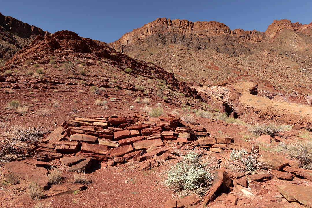
The daily routine varied by how far we paddled and where and when we stopped to hike, but the days none-the-less followed a similar routine. The guides rose early to prepare coffee and tea which were ready by 6 a.m.
 |
| Morning in the canyon before the sun reaches into the canyon depths. |
The
guests generally got up at 6, got some coffee, and sipped while packing
up camp. The guides cooked while we were packing, and breakfast was
served between 6:30 and 7 a.m. Breakfast was always an amazingly
luxurious affair—walnut pancakes, French toast, eggs to order, fresh
fruit, bagels with lax and cream cheese and capers and onions, migas,
breakfast tacos, toasted English muffins, etc. After breakfast, we
started loading the boats, forming fire brigades to pass gear into the
boats as the guides hollered after “3 sleeping pads” or “6 gear bags.”
Each guide had their own system for how they lashed the gear onto their
boats and by the end of the trip we knew to where to pass which gear.
 |
| Each guest had two blue dry bags: one for the sleeping kit and one for clothes and other personal gear. |
We then hopped into the boats and started downriver, generally passing through a number of miles and a number of rapids, sometimes stopping for a hike or a short look-see,
 |
| Chad's photo of Redwall Cavern |
 |
| Left: Ultimate Frisbee game while waiting for lunch. Right: Lunch is served. |
After lunch we got back into the boats and paddled for another couple of hours until we arrived at camp. Sometimes the boats were close together on the river, sometimes we were fairly spread out and in our own little worlds, alone in the canyon. One of my favorite moments was a quiet stretch of river when my boat agreed to 10 minutes of quiet and contemplation. No talking, no moving around and rustling. Just looking, taking in, enjoying the amazing canyon we found ourselves in.
The head guide had a Plan A and a Plan B and sometimes even and Plan C for every day. We didn’t always stop exactly where she had originally planned for hikes or lunch, but I think that we managed to snag every Plan A campsite. Each campsite was more magical than the last. Except for our first campsite which was on ledges of rock, the campsites were sandy beaches. Some were more vegetated than others. Some were dunes, some were flat. Each of course featured incredible views of the canyon and the river.

Once at camp, each group claimed a camping spot and then returned to the boats to help unload the gear, forming long fire brigade lines to pass the gear from the boats and the muddy beach up onto the dry banks. We then returned to our individual campsites to set up camp, though after a few days of trial and error, Carl and I stopped setting up our camp before bedtime because everything just gets sandy when it’s out in the open. We did, however, wash our feet with soap every day and bathe in the river with camp suds every other day ish. The water was so muddy and silty that we were just as filthy after our baths as before but the soap did somehow make us feel a little less grimy. We hung everything to dry in trees, and the air was so dry that most everything dried within an hour.
(The water leaving Glen Canyon Dam just upstream from the Grand canyon is not terribly silty—the silt falls out while the water sits behind the dam. But a few days down the Grand Canyon, the Little Colorado River joins the main Colorado River. The Little Colorado drains a huge desert watershed and if it has rained anywhere upstream, the Little Colorado is more mudslide than river and it clouds the entire main Colorado River for the rest of its journey downstream. The Colorado carries many times more silt than the Mississippi given its size. Before filtering the water, the guides let buckets of river water sit over night. By the morning, much of the silt has fallen to the bottom of the bucket, and the bottom fifth of every water bucket is solid silt.)
 |
| The Little Colorado joins the Colorado River. Chad's photo. |
At
that point in the evening, we generally served ourselves a margarita or
a glass of wine and chatted with folks about the day, about our lives,
and about the canyon. Every day was the most scenic happy hour ever!
 |
| The photo on the right is Megan's |
All
food and drinking water was provided by Azra, but other beverages were
not included. Each guest has quite a large beverage allowance—like a
bottle of wine per person per day. You could spend the trip in quite a
haze if you wanted to, although it would definitely be a shame not to
clearly remember this incredible experience. Our group never got too
rowdy except for the last evening when most of the group crowded into
one boat and passed around endless bottles of bourbon, tequila, and
gin. There were definitely a few people feeling a little green on the
rocky bus ride out of the canyon.
Dinner was generally served at dusk, and wow! The dinners totally blew my mind. I have never eaten like this while camping before. We had grilled steaks, shrimp tacos, Mexican bean soup, spaghetti with home-made sauce and grilled garlic bread, salmon . . . . And as impressive as the dinners were, deserts were even more amazing. The guides baked Dutch-oven cakes almost every night—pineapple upside-down cake, pound cake with icing, deep dish chocolate cookies, carrot cake. We were totally and utterly spoiled. Amazingly, despite all of the rich food and huge portions, Carl and I came home weighing the same as when we left.
Dinner was generally served at dusk, and wow! The dinners totally blew my mind. I have never eaten like this while camping before. We had grilled steaks, shrimp tacos, Mexican bean soup, spaghetti with home-made sauce and grilled garlic bread, salmon . . . . And as impressive as the dinners were, deserts were even more amazing. The guides baked Dutch-oven cakes almost every night—pineapple upside-down cake, pound cake with icing, deep dish chocolate cookies, carrot cake. We were totally and utterly spoiled. Amazingly, despite all of the rich food and huge portions, Carl and I came home weighing the same as when we left.
 |
| Double dutch oven and birthday cake |
We did sleep in our tent a few nights when it sprinkled or when it was windy, causing sand to fly around,

but mostly we slept out under the stars.

Our
starry sky was limited to a thin strip above the dark, towering canyon
walls, but the stars were so numerous and so bright that it was quite a
show. Our trip started at the new moon so it wasn’t until a few days
into the trip that the moon started to drown out the stars. Watching
the moon rise up and over the canyon walls as well as the moonshine on
the opposite wall was breathtakingly magical.
 |
| Left: Stars! Right: Moonrise. |
I generally don’t sleep great while camping. At the Grand Canyon, I still woke up every time I needed to turn over, but I did actually sleep better than I usually do while camping. I also generally woke up just as the night sky first started to brighten. Sometimes I tried to snooze for another half an hour, but sometimes I just watched the canyon walls wake up from their black slumber to their daytime ocher glow.
I'm going to pause my explanations and just show, day by day, the amazing scenery we floated through:
 |
| Day 1. A couple of miles from Lees Ferry you pass under Navajo Bridge, the last sign of civilization for days. |
 |
| Day 2 |
 |
| Day 3 |
 |
| Day 4 |
 |
| Day 5 |
 |
| Day 6 |
 |
| Day 7 |
 |
| Day 8 |
 |
| Day 9 |
 |
| Day 11 (we didn't move far on Day 10) |
 |
| Day 12 |
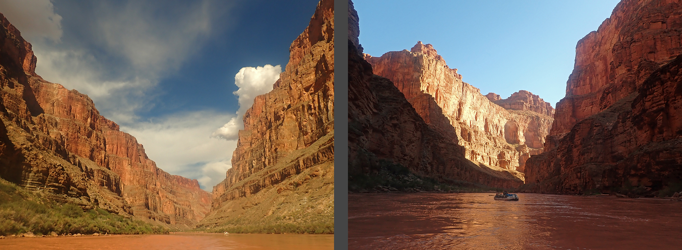 |
| Day 13 |
 |
| Day 14 |
 |
| Day 15 |
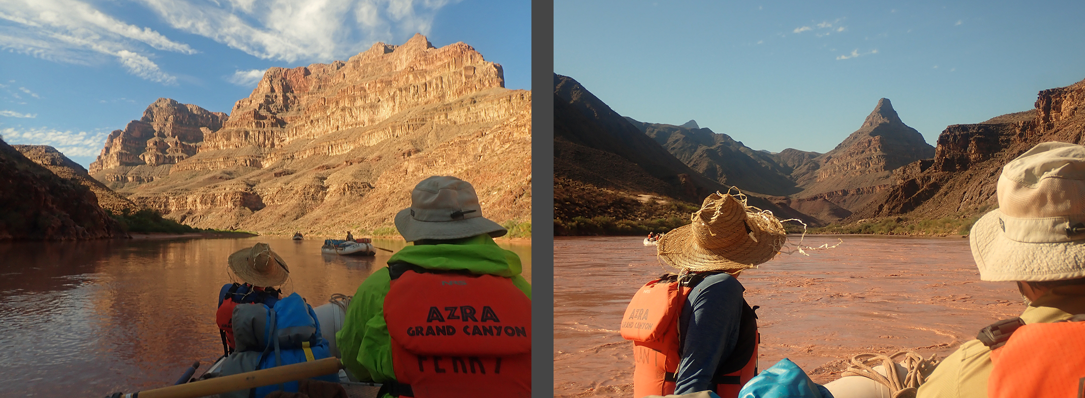 |
| Day
16. Diamond Peak is in the photo on the right. The top of Diamond
Peak is the same elevation as Lees Ferry where we started the river
trip. |
I’ve
gotten a lot of questions about how going to the bathroom works while
rafting the river, so here goes: Azra follows established protocols
that are required by the National Park Service, so even though parts of
the bathroom routine are unusual, they are sanctioned and even
necessary. First of all, you’re not supposed to urinate on land at
camp. Given the dry, desert climate, if everyone peed at the limited
number of campsites, the entire river would stink of urine. Instead,
you’re supposed to pee directly into the river as much as possible.
After a lifetime of training to not pee in the water, it felt incredibly
strange to just let it go in the river. Not only that, but to walk
into the river and dunk down to my waist for the express purpose of
peeing. Men have it a lot easier since they can stand on the bank and
pee into the water, but the women spent a lot of time getting in and out
of the river. We were all a bit shy about peeing in front of each
other at the beginning of the trip, but it’s really hard to find a
secluded spot on the river, so by the end of the trip, everyone was
peeing right and left with no semblance of privacy.
 |
| Emerging from the river after a pee |
Getting into the river to pee after you’ve changed into dry evening attire isn’t so appealing, so there was a yellow pee bucket beside every solid waste toilet. The yellow pee buckets get emptied into the river every morning. Additionally, because the majority of injuries on the river occur while trying to pee in the middle of the night, Azra equipped each of us with a smaller plastic pee bucket known as a groovette so that we could pee at our camps. In the morning, you dumped the contents of your groovette into the river and rinsed it out before packing it with the rest of your belongings.
Solid waste does not get dumped into the river; instead, all poo and used toilet paper gets transported down the river on the baggage boat. The “toilets” are rectangular metal containers with a convenient sitting height with a sealing lid called groovers. Two groovers were “open” at a time, and we used a total of six groovers over the course of the trip. “Fresh groover day” was a big event.
The guides generally set up the two “open” groovers on opposite sides of the camp in secluded spots with an amazing view. Sometimes there wasn’t enough foliage to provide cover, so the guides set up a huge parasol over the groover to block the view. Sometimes the groovers were so well hidden that the path in to the groover was a little hard to find, but they were generally marked with a handwashing station. The handwashing stations consisted of two buckets with an ingenious little foot-pumped faucet. One bucket was full of water, and you pumped the water up into the faucet, washed your hands with soap, and the grey water fell into the second, empty bucket. The grey water was tossed into the river every morning.
 |
| Bathroom with a view |
After hearing that all urine and grey water (and dish washing water) was dumped directly into the river, the next question is . . . where did the drinking water come from? Yes, we drank from the same source that we peed in, which is the same source that every other person on the river pees in. Gross, yes, but. The volume of the river is so incomprehensively large that the ratio of urine to water is very low. Also, the water is filtered to city-drinking-water standards before going into the food or drinking water jugs.
If you’ve ever filtered water with a hand pump while camping, you know that it is actually an extraordinary amount of work to filter just a few liters of water. Imagine filtering water for 30 people for 16 active days of desert sun! The guides luckily do not filter the water by hand; they hook up a car battery to the filter. The battery is heavy, but that’s one of the main advantages of boating over backpacking—you can take so much stuff and weight is seldom an issue.
The variation in our daily routine came from our various stops and hikes during the day. Sometimes we got to camp at lunchtime and then went for a hike after lunch. Sometimes we hiked a side canyon that was only a mile or two downstream from the previous night’s camp. There are hundreds of side canyons in the Grand Canyon making for a lifetime of hiking possibilities.

And
from what we’ve experienced, each side canyon is completely different:
some are open with generous views while others are slots and no view of
the sky;

some are dry while others gush water and feature hanging gardens of greenery;

some have established trails and in others the stream is the trail;

many have visible prehistoric relics while others feature vestiges of more modern inhabitants;

some feature fossils,

some are shady and cool while others are hot and dry.

I really enjoyed all of our hikes but I think that my favorites offered views of the river from above.


I also really loved seeing remnants of the prehistoric cultures that have passed through the canyon. There are hundreds of known archeological sites in the canyon, but many of them are off-limits to visitors, either to keep them intact or because they are still sacred sites to the tribes still living in the area. The small sample of prehistoric sites that we did see really whet my appetite for more! One hike led high up above the river to a natural overhang where ancient people have built small rooms for food storage.

Not only was there a fabulous view, but there were even a couple of cobs of ancient corn remaining!

On another hike, we passed by three free-standing structures on three different ridges with wide-open views.

Scattered
around the structures were an astounding number of pottery shards, so
much that you couldn’t help but step on the ancient artifacts, and we
could clearly make out several different styles of pottery as well as
pieces of rounded pot rims and handles.

A couple of hikes featured petroglyphs which were pecked into the rock

as
well as pictographs which were painted onto the rock; on one hike we
saw prehistoric handprints. We also came across a number of grinding
stones and manos.

There’s a surprising amount of water gushing into the river from various side canyons, and several of our hikes featured waterfalls, one of which spurts directly out of a cliff face.

Another waterfall was jumpable and many members of our group plunged into the pool below.

On several hikes, we followed creeks up into side canyons.

On
one particular hike, we followed a stream up a twisting side canyon
which was about 10 feet wide. The various members of our group stopped
at various points along the canyon as the wading conditions got harder
and harder and waited for the return on little sandbars or boulders on
the side of the canyon. I waded with the group until the water reached
my waist; I stopped there but Carl and Chad and a few others continued
farther up until there were sections where they were in up to their
chests!

Some
of the hikes were only possible with ropes to assist us up and down
tricky passages, and it was at these sections where our group felt
especially bonded as we cheered each other on and helped each other
overcome gravity.
 |
| Thank you for the photo on the right, Megan! |
Other “hikes” were actually scrambles closer to “climbs” and involved not only ropes but also harnesses and rappel devices.
 |
| Thank you for the photo on the right, Dave! |
Unfortunately,
I ended up hurting myself on one of the rappels, falling about a meter
and landing on rock directly on my tailbone. The fall was extremely
painful, but I was able to get up and to finish the hike out of the side
canyon, albeit slowly and painfully. There were a couple of sections
of rappels left, and I was terrified, almost panicking. But I managed
to get down to the bottom without completely losing it, though I was
definitely in shock for the rest of the evening and couldn’t stop the
tears from constantly leaking down my face. It was unfortunate timing
because it was the first of only three evenings when we had a campfire,
and I do love a campfire, especially when someone is singing and playing
the guitar. But I just couldn’t enjoy it and ended up going to bed
early.

I had hoped that the pain would fade away after a day or two but my tailbone was extremely sore for the rest of the trip (I hurt myself on day 6 of 16). I couldn’t sit comfortably and spent most of the remaining days standing up in the back of the oar boats, bracing when I had to sit down for the rapids. One of our groupmates very generously offered up his travel neck pillow for me to sit on, but it sadly started to leak air after a couple of days. Luckily, my injury didn’t stop me from hiking—actually, moving around seemed to make it hurt less, though I was definitely less spritely and wasn’t moving as quickly as usual. Unusually large steps up or down hurt, as did any hopping, and Carl had to help me with any trickier sections.
On our hikes and from the river we saw a number of bighorn sheep,


We
saw and heard innumerable bats, mostly flying in the air but also
sleeping and hanging in the bushes. An amazing abundance of birdlife
from ducks to herons inhabit the river, and there were so many
butterflies, especially monarchs, making a stop on their way to Mexico.
We saw a couple of snakes including one Grand Canyon rattler as well as
several scorpions and a tarantula, but had no bites or stings in the
group.

We spent much of every day soaking wet. Sometimes voluntarily—when it got too hot, we hopped off the boats into the river. Mostly in calmer sections, but once or twice we swam through smaller rapids.
 |
| Chad's photo on the right |
Also,
many of the hikes featured crystal clear water which was hard to
resist, both because of the soaring temperatures but also because the
river water was so silty and it was lovely to occasionally rinse the
silt out of our hair.
 |
| Thank you Megan for the photo on the left! |
But
most of the time we were wet because of the rapids. The people in the
front of the boats were soaked in just about every rapid, but even the
back of the boat was completely submerged in the larger rapids. And
even when we weren’t going through a rapid, our feet were always wet
since water constantly fills the bottom of the boats.
We were wearing sandals and water shoes in the boats and had dry, sturdy hiking shoes in our day bags for the side hikes. We found ourselves constantly scrambling to change shoes back and forth. I think that if we ever do a similar trip I will try a different method and invest in lightweight cross country running shoes that grip while hiking but that dry quickly and wear them all day every day, both in the boats and on the hikes. Assuming that my feet don’t get blisters, this would save a lot time and stress.
The Colorado River in the Grand Canyon is completely unlike any whitewater I have rafted before in the Southeast. The Colorado’s rapids are formed by flash-flood events coming down the side canyons when boulders and debris wash from the side canyon into the main river. In between the rapids, the river is very calm and is almost lake-like. But then suddenly, just downstream from a side canyon, the river will just drop off the edge and plunge down a rapid. I don’t have exact numbers but in many sections there is a rapid every mile, meaning that you barely have time to recover from one rapid before plunging into the next. Many of the rapids are named (often the name relates to its side canyon) but a surprising number are just called “Mile 101 rapid” and the like. Many of the smaller rapids and riffles aren’t even named at all.
 |
| Smaller rapids and riffles |
Of course, the biggest rapids are named and after reading a bit of Grand Canyon lore, you start to recognize the names of the most forbidding rapids like Crystal and Lava. I was generally not very nervous about the rapids as I have enough whitewater experience to keep me calm and because I had utter faith in our guides, but I was nervous about these infamous monsters that have flipped many boats and claimed numerous lives.
 |
| Thank you for these amazing photos of Lava Falls Megan! |
(There
is a reason why Lava Falls is called LAVA falls...several sections of
the the canyon was filled with lava at various points of the canyon’s
history. Each time, the river was blocked behind lava dams.
Eventually, the river cut through the obstacle. Lava Falls is at one of
these faults where lava once filled the canyon.)
 |
| Frozen lava is still visible in the canyon even though the lava dams have long since vanished. |
While
we did stop to scout Crystal and Lava, it wasn’t always the biggest and
most infamous rapids that seemed to make the guides nervous. We
stopped to scout a few rapids that don’t make it into the history books,
including one named Bedrock where the water parts around a gigantic
boulder in the middle of the river. The right run is the recommended
run, but the current tries to push you into the left channel on the
other side of the boulder. With the river being at low water, there
were several “extra” rocks making the passage into the right channel
even more challenging than usual. Here, the guides scouted for a long
while, pointing at various landmarks and discussing the best run. Even
so, things did not go as planned and two of our boats ended up in the
“wrong” left-hand channel where my guide even lost control of the oars.
We were completely at the mercy of the river and ping-ponged off the
canyon walls and the boulder in the middle of the river, but lucky for
us, the river decided to spit us out of the channel unharmed and without
too much drama.
 |
| Left: The guides scouting above Bedrock rapid. Right: Chad's photo of Carl and I taking in the next rapid. |
On our trip, the most dramatic rapid ended up being a no-name tiny thing. But on the Colorado River, there is so much water flowing that even a small, no-name rapid can be dangerous if approached the wrong way. Carl, Chad and I were in the paddle boat and on the approach to this little rapid, the guide directed us to back paddle. As we got closer, the instruction to back paddle got louder and louder and more and more urgent. We were back paddling furiously, but we didn’t manage to clear the obstacle and we ended up plunging into a hole behind a barely submerged boulder. Water filled in behind the boulder, forcing the boat upstream into the boulder. The water pouring off the boulder submerged the nearest side of the boat, causing the opposite side to rise up, flinging us around. Three of us, including Chad and the guide, bounced out of the boat while the rest of us got banged up inside the boat. Instead of flipping, the boat whipped around so that the opposite side was now submerged, causing the other side to rise up. This pattern repeated itself several times in a whirl of chaos and confusion until one of the paddlers realized that we didn’t have a guide any longer and took over the command of the boat. On his command, we remaining paddlers were able to finally get us out of the hole and back into the regular current of the river. The other boats around us picked up our floating passengers and brought them to our boat. Even though we had lost people and paddles and hats during the chaos, we managed to recover everything and everyone and before long, we were all back in the boat and paddling along, though we continued to recount the story and laugh uproariously for the rest of the day.
We had incredible luck with the weather during our trip, but Chad, Lena and the guide “joined the Colorado River Swim Team” on the one chilly, rainy day of our trip. Otherwise, most days were clear and sunny with some afternoons culminating in huge, puffy cumulous clouds and rumbles of thunder and small, unsustained sprinkles of rain. Afternoon temperatures were generally in the low 100’s and the lows were in the low 70’s. Some nights it was comfortable going to bed, but many nights were too hot and sticky for even a sheet until the early morning hours. But the day of the no-name rapid drama was cloudy and cool. We were also passing through a series of drenching rapids that got us completely soaked every mile or so. Carl and I had resisted putting on our splash gear, but as the day wore on and we got colder and colder, both our splash jackets and our splash pants became necessary.
The morning of our last day on the river dawned perceptibly cooler, and it was the first time I needed a fleece while packing up my gear. It was blazing hot by lunchtime, but fall was clearly making its first inroads into the canyon by our take-out in mid-October.
Transportation by Azra bus on paved roads to the trip’s start at Lee’s Ferry had been relatively uneventful despite a wildfire that clouded over our view of the fabled Vermilion Cliffs. But once we were a couple of miles downriver, the smoke cleared and we were blessed with full canyon views for the rest of our trip. Leaving the canyon was a bit more of an adventure, however. Our takeout was at Diamond Creek on the Hualapai Reservation. There is no road leading down the side canyon; instead, the “road” is the creek. It is a very bumpy ride.
 |
| After 226 miles (364km) on the river, 1800’ (550m) of elevation loss, 80 major rapids and countless minor rapids and riffles, we arrived at Diamond Creek. |
But
eventually we made it up out of the side canyon and back onto paved
roads, following historic route 66 back to Flagstaff where we took a
much needed shower and had one last slightly teary and slightly awkward
goodbye dinner with our group and guides.
I flew home the day after our trip, which given my bruised tailbone was insanely painful, but Carl stopped in Austin on his way to visit friends. I had one day at home to recover from jetlag before starting work again. Going back to work after such an amazing adventure has been pretty tough to say the least. Both Carl and I are feeling deflated after such an spectacular adventure; after so long a wait and so much anticipation, I am even feeling sad that the we have already been on the adventure. I’m missing Mia and Chad and our group and the guides, all of the amazing people we hung out with on the trip. This is PVD post-vacation depression on a massive, unprecedented level. We’re not the only ones from our group that are feeling this way; folks are already starting to email about meeting up on the river again!
I flew home the day after our trip, which given my bruised tailbone was insanely painful, but Carl stopped in Austin on his way to visit friends. I had one day at home to recover from jetlag before starting work again. Going back to work after such an amazing adventure has been pretty tough to say the least. Both Carl and I are feeling deflated after such an spectacular adventure; after so long a wait and so much anticipation, I am even feeling sad that the we have already been on the adventure. I’m missing Mia and Chad and our group and the guides, all of the amazing people we hung out with on the trip. This is PVD post-vacation depression on a massive, unprecedented level. We’re not the only ones from our group that are feeling this way; folks are already starting to email about meeting up on the river again!
It
doesn't help my mood that my tailbone is still painful. It's getting
better, but the doctor said that it would take 6-12 weeks until I could
sit without a donut cushion.
We do have another fun adventure on the not-too distant horizon, which does help the PVD a bit. But nothing can ever compare to the experience of rafting down the Colorado River in the GRAND Canyon for 16 days. It was glorious. It was indescribable. It was the unparalleled bucket-list trip and adventure of a lifetime.
We do have another fun adventure on the not-too distant horizon, which does help the PVD a bit. But nothing can ever compare to the experience of rafting down the Colorado River in the GRAND Canyon for 16 days. It was glorious. It was indescribable. It was the unparalleled bucket-list trip and adventure of a lifetime.

No comments:
Post a Comment