Svartlöga


We left work early on Friday and spent the four hour long ferry ride with books, a glass of wine, and beautiful views. Eva met us on the island and provided a traditional crawfish feast for dinner—it was such a treat, especially in such authentic surroundings! As usual, we dined and chatted by candlelight until we were all too sleepy to keep our eyes open, and I slept unusually deeply that night.
 |
| Ferry from Stockholm to Svartlöga |
We all enjoyed a lazy morning and then Carl and I set out for a couple of walks. First, we returned to the mushroom-covered area that we had discovered last year (see “Island Weekend”), but found nothing. We then set out to the end of a peninsula that we hadn’t explored before. Despite the Stockholm region’s severe drought, the island was surprisingly green and verdant and summery. We found a secluded area where the bedrock dips into the sea and went for a lovely swim.
 |
| What drought? |
On our return to the cabin, the light was right and we spotted several mushrooms that we had missed on the way out. We picked a modest number of björksopp, or birch boletes, and fried them up as an appetizer before dinner.
 |
| Two varieties of birch boletes |
On Sunday we had another slow morning before setting out to pick some berries that we had noted the day before. First, we picked a few black currants,


We also walked through the island’s super cute village down to the super cute harbor. Despite the fact that I’ve photographed the harbor several times before and have probably taken more than a hundred shots, I just couldn’t resist this time, either. After the harbor photo shoot, Carl and I sat on a dock and enjoyed the sun on our backs and the sound of the waves lapping against the rock. We’ve never visited during the summer high season, but on the off-season, Svartlöga’s harbor is a particularly scenic and peaceful place. Like many other beautiful places in Sweden, the harbor blends culture and history with natural landscapes into a lovely and unique scene that’s seemingly straight out of a travel magazine.
 |
| Every family on the island has their own cart for wheeling groceries from their boats to their cabins. |
After returning to the cabin for lunch with Eva, Carl and I spent an hour or two snoozing and reading in our hammock.

 |
| Views from the ferry back to Stockholm |
At home, we ate the black currants with our breakfasts and turned the gooseberries into a delicious jam.
 |
| Gooseberry jam! |
Svartlöga and its deciduous forests are truly beautiful, but one of the things that I love most about the island is how time slows down when you’re there. The weekends still feel short from ferry ride to ferry ride, but the time in between seems to lengthen just a little. Actually, it’s not that time seems to move more slowly, but that the pace of life slows down a bit. Svartlöga is a place to slow down and enjoy.
 |
| The simple life: The cabin's dishwashing station uses water carried from a well, and the greywater is poured over the blackberry bushes along the fence line for a little extra nourishment. A washbasin and water jug for handwashing after visiting the outhouse. |
Thank you for a lovely weekend, Eva!
 |
| A few of the island's other cute cottages. |
SUNDAY, SEPTEMBER 16, 2018
Summer Vacation 2018 Part III: Outer Hebrides and the Isle of Harris and Lewis

 |
| Approaching Harris on the ferry |
 |
| Isle of Harris's turquoise beaches |
We “wild” camped by a couple of deep, white sand bays, and while we didn’t get to fully experience the turquoise water, we did get to see the bays both at high and low tides.


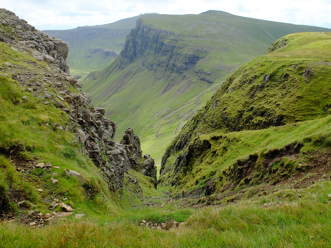
The landscape is far too green to be considered lunar, if you ask me, but it was beautiful, rocky and desolate scenery even if I don’t quite agree with the guidebook author’s choice of description. Villages consist only of a few houses, and there really aren’t that many villages on the island. The windy one-lane roads make the relatively short distances between villages feel like real journeys.
 |
| Isle of Harris |
We did get a few moments of sunshine, such as when we stopped at St. Cements Church.
 |
| St. Cements Church |
 |
| Instead of the usual demon or ogre, this church has a naked lady baring it all to scare away the evil spirits. |

The Isle of Lewis is actually attached to Harris even though they have two separate names and identities. The names come from old Norse and Harris means “High Land” while Lewis means “Low Land.” Lewis’s landscape is much flatter and much less dramatic than Harris’s, and much of Lewis’s interior is dominated by a seemingly infinite moor. Being a bit flatter and less rocky, Lewis was more cultivated and there are still clear signs of how crofters once tried to make a living from the land. Raised beds of kelp-enriched soil were created to aid productivity, and slivers of land divided by stone walls show how the fields were divided up and rotated among the villagers so that no one was stuck with the less-fruitful fields for more than a year.
 |
| Signs of ancient agriculture on Isle of Lewis |
We visited a couple of different blackhouses or traditional crofting cottages. They had thick, double-stone walls and thatched roofs. The hearth was in the center of the main room, and there was no chimney. Instead, the smoke eventually drifted out through the thatch. Apparently the smoky houses had their advantages since the smoke preserved the thatch, it was easy to smoke meat and fish, and the smoke kept bedbugs and lice away.

The highlight of Lewis was definitely its Neolithic stone circles, the most impressive of which is on top of a ridge at Callanish. Built about 5000 years ago, before Egypt’s pyramids, the stone circle consists of thirteen standing stones around a central stone.
 |
| Callanish Standing Stones |
The circle’s stones are in the range of ten feet tall while the central standing stone is sixteen feet tall and five feet wide. The stones are cut from a nearby quarry and the texture of their visible grain makes them even more visually interesting and mysterious. Transporting and erecting the stones was truly an impressive feat.

Later, over the span of several millennia, the stone circle was added on to. First was a line of stones leading further up the ridge to the south. A bit later, a chambered cairn was built off-center inside of the circle. It was a communal burial chamber used over several centuries. An avenue defined by a double line of standing stones was built down the ridge to the south, and shorter arms of standing stones radiating to the east and west of the stone circle were added by 3500 years ago. But about 500 years later, the chambered cairn was destroyed and the remains were scattered about the site. The site’s museum interprets this desecration as evidence of changing views of the standing stones, but my personal theory is more along the lines of the site being desecrated as an act of aggression or war. Perhaps the conquerors brought a new religion with them.

The stone circle does not sit on the ridge’s highest point. The circle is not perfectly round, the central stone is not perfectly centered, and the arms are not perfectly straight or aligned to the cardinal directions. The site has no known astrological coupling. It’s hard to surmise if geological perfection was an unachieved goal or if the site held some other meaning, but the processional nature of the avenue leading up the ridge seems evident, at least in my church-influenced eyes.

The Callanish Standing Stones are mysterious, impressive, and interesting on their own, but I find them even more intriguing because it is just one of several stone circles within easy walking distance. Callanish is definitely the most impressive circle—the other sites have smaller stones and lack the radiating arms. I started to ponder how the various circles related to each other. Was it a case of many small, local or even private circles and a big, regional circle? Or were all of the circles part of a larger complex, much like the various temples at the Acropolis in Athens? Was Callanish dedicated to the area’s most important god while the smaller circles were dedicated to more minor deities? Or were the various circles stops on some sort of pilgrimage eventually leading up the processional avenue and culminating at the stone circle at Callanish?
 |
| A nearby circle called Callanish II |
Any why were the circles placed just below the ridges’ highest point? Was the highest point left clear for occupation by the gods? Or if the circles were connected on a pilgrimage, and if they were approached from beyond the high point, the circles would be hidden from view until they suddenly appeared, magically, below you.
 |
| Another nearby stone circle, this one isn't even signed from the road much less in the guidebooks. |
Lewis and Harris are so out of the way that there are relatively few tourists and most everything is free. Even the Callanish standing stones, the biggest tourist site on the island, had no entry fee. We were si fascinated by the stones that we visited the site three times, once just to sketch and write.
 |
| Plan of the Callanish Standing Stones from http://home.clara.net/gponting/page47a.html |
Another pre-historic highlight was stopping the Dun Carloway broch. The double, dry-stacked stone walls of this Bronze Age defensive manor house were still clearly visible.
 |
| Dun Carloway Broch |

We also spent a day hiking across the heath to a couple of Stone Age shielings. A shieling is like a Swedish fäbod, a simple hut up at summer pastures. These shielings were built of double stone walls and a corbelled stone roof into beehive shapes beside a burbling creek. Inside, there’s enough room to stand up and small storage niches were built into the walls. The beehive shielings were in use all they way into the beginning of the 19th century, which explains why they survived intact for 5000 years.
 |
| Stone Age beehive shielings |
Our last night on Harris and Lewis, we were having trouble finding a place to wild camp that wasn't visible from the road and that was also close enough to town for an easy drive for our 6 a.m. ferry. We ended up spending the night inside of one of the island's many "fixer uppers."


After spending four full days on Harris and Lewis, we took the ferry back to the mainland and drove across the country, scouting out Cairngorms National Park for future ski touring adventures. We stopped at scenic Braemar Castle before staying the night at a lovely lodge tucked way into a scenic, fecund glen.
 |
| Braemar Castle |
On the way back to the Edinburgh airport, we made a couple of sightseeing stops. Our first stop was to see several Pictish stones at Aberlemno. The stones are roughly the same age as early Viking rune stones. The Picts were Christians, and a couple of the stones clearly depicted crosses. The stones also clearly depicted horses and soldiers at battle.
 |
| Two sides of the same stone. It was moved from a field to the churchyard during the middle ages. |

We also spent a few hours at Stirling Castle, one of Scotland’s largest and most important castles that was developed over many centuries and occupied by most of Scotland’s (and many of England’s) regents. The castle is strategically and scenically located on a lofty height, and the several of the buildings were exquisitely built. We didn’t have a lot of time to explore, but the town of Stirling is a lovely scale and is very charming.
 |
| Stirling Castle |
Although we spent three weeks in Scotland , our summer vacation was over before we knew it, and as always, there was a lot that we didn’t get to see. We loved having time on Skye and on Harris/Lewis to hike into the mountains and across the moors, to delve more deeply than the traditional tourist track, and to have the time to sit and enjoy the mountain and standing stone views when the weather allowed. While Scotland is of course very European with its prehistoric monuments, its lengthy and complicated history, its lovely cities, its deep tradition of food and drink, and its abundance of palaces and castles, the natural side of Scotland is much wilder and rawer that most of Europe. In a way, Scotland’s wilderness is very civilized with its aristocratic hunting grounds and great estates, but that historic layer doesn’t lessen the wild impact of Scotland’s “hills.” Carl and I were definitely disappointed by all the rain during our trip, but our appetite for Scotland’s scenery and history is still strong; we’ll definitely be back on several more trips to explore the Orkneys, St. Hilda, more of the Highlands, still more castles, more whiskey tastings, and more dramatic beaches.
TUESDAY, SEPTEMBER 11, 2018
Summer Vacation 2018 Part II: Isle of Skye

 |
| Eilean Donan Castle |
We camped at the head of the very midge-y Sligachan Valley then walked through the U-shaped glacial valley,
 |
| Sligachan Valley |
 |
| Climbing up to the pass between Sligachan Valley and Loch Coruisk. |
From the pass, the view was extremely dramatic with serrated ridges all around us and layer after layer of lakes all the way to sea. The scenery was not unlike dramatic Norwegian fjords.
 |
| View fromt the pass down to Loch Coruisk. |
From the pass, we also scouted the next pass to the west as a possible off-trail loop for our hike out. There’s no official trail going over that other pass, but it looked crossable on our map. We of course couldn’t see if there were steep cliffs dropping away from the other side of the pass, but the close side looked very hikable.
 |
| Scouting out an off-trail route... |
We descended down to Loch Coruisk

 |
| Crossing over Loch Coruisk's outlet which tumbles directly into the Atlantic. |
 |
| Camping at Loch Coruisk. |
The next day, we took a daypack and circumnavigated the lake. The air was warm and humid, and we were soon sticky and sweaty from crossing a tricky boulder field, so we went skinny dipping at a particularly scenic and shielded cove. The turquoise water was refreshing without being cold, and we lingered in the water for a while. We didn’t have towels with us, so we stood on the beach, rotating our stomachs and backs to the sun to dry off. Just as we were getting dressed, we heard some hikers well behind us in the boulder field. Good timing!

On our hike to the lake, we had passed by a good number of other hikers, though not all of them were heading to or coming from our destination. It is possible to reach the lake by boat, either private or on a small tour boat, so there are a good number of day trippers at the lake, too. But relatively few hiked the loop around the lake, and in the evenings, we had the entire valley practically to ourselves.
 |
| Around Loch Coruisk. |
We continued around the lake and crossed the feeder river at the head of the valley. We stopped often for lunch and snacks and many photos and generally reveled in the views which just got more and more dramatic as the day became clearer and clearer. The hike around the lake was only about 10 kilometers, so we were able to take our time and really enjoy the scenery.
 |
| Left: The river at the top of Loch Coruisk. Right: The stream draining the Loch. |
The next morning, we packed up camp and hiked back up toward the pass we had crossed to get to the lake. But instead of following the trail all the way up to the pass, we decided to turn off and head up a side valley to the pass that we had tried to reconnoiter on our way in. Before hiking in Sarek last year, I would have found the trail-less walking difficult and disconcerting, but after trekking across Sarek for three weeks last year, this little off-trail hike seemed easy as pie. We reached the nameless but very windy pass and ate lunch while enjoying the breathtaking views of the jagged mountains encircling the valley of Harta Corrie. Carl and I started calling it the Enchanted Valley.
 |
| View from our off-trail, unnamed pass. |
From the pass, we dropped without difficulty down into the valley, but we then we climbed up a steep face into a hanging valley. From the hanging valley, the view out from the valley is cut off, so we felt like we were in our own secret world. According to our guidebook, there is supposed to be an “easy,” cairned trail up beside a huge waterfall into the next hanging valley above, but the author must be crazy—the only access up into the next hanging valley is up a vertical cliff face and is utterly impossible without ropes. The author must have confused this valley with a different one.
 |
| Harta Corrie Valley. |
We camped up in our secret, enchanted hanging valley and then hiked out the next day. Again, the weather was warm and muggy, so we jumped into the river at the bottom of the valley. It was blissfully cool but not cold and I stayed in for quite a while. The coolness remained in my body for a good while, but I was definitely hot and sweaty again by the time we got back to the car.
It had been a while since our last shower, so we drove to a car camping ground along the beach at Glen Brittle. The showers were lukewarm but delightful none-the-less, and camping along the beach was quite scenic. Unfortunately, however, the midges (larger no-see-ums) descended in the evening so we couldn’t sit outside for long. Doubly unfortunate was the weather, which had turned for the worse, socking in the mountains in clouds—despite there being a dramatic backdrop of Cuillins behind the beach, we never got to experience that view.
 |
| Car camping at Glen Brittle. |
The next morning, there was a break in the rain so we went on a very rewarding day hike out to the end of the peninsula at Rubha an Dunain. The hike would have been even more dramatic with mountain views, but we had a lovely day enjoying the closer-range sea-cliff views, seals, and prehistoric sites instead.
 |
| Peninsula at Rubha an Dunain |
 |
| Dun! |
Right below the dun, a herd of at least 20 seals were playing in the water. We watched them arc, swim, and pop up in small groups or alone for quite a while. Sometimes a pair of seals seemed to be wrestling or possibly mating. We saw two different baby seals riding on the back of its mother, and two other young seals playing in the vicinity of an adult. A few of the seals barked and grunted while swimming toward us, probably to intimidate us, the intruders. The seals were so fascinating, and so cute!
A bit farther around the peninsula, right beside a small lake, we climbed into a giant Neolithic chambered burial cairn. The top had long-since caved in but we could still clearly see how the entry and sides were constructed with some upright stones, some spanning stones, and a lot of dry-stacked stones. The cairn and the setting and the drizzly weather were very atmospheric and oh-so-Scotland, we were almost convinced that by climbing into the cairn we were going to get transported back to the Stone Age á la Outlander.
 |
| Chambered burial cairn! |
The peninsula was also littered with historical relics. Several beautiful stone walls crossing the peninsula, a ruined manor house, and an abundance of ruined croft cottages are all that is left of a once-bustling farming village.

The only distillery on Isle of Skye is Talisker, so of course we had to go on a tour and bring home a souvenir bottle. We also enjoyed testing different whiskies in the evenings while reading in our tent—in Scotland, it’s possible to buy half bottles of good brands so we were able to test a few different varieties over our three weeks. It was fun sitting by our tent and enjoying our whisky with a view in the evenings (or all too often we were forced to sip our whisky in our tent and without a view due to the rain).
 |
| Left: Walking to Talisker Bay. In the rain. Right: Trying whiskey in our tent. |
It looked like there was going to be another break in the clouds and fog and rain, so we headed up to the Trotternish Ridge for our next backpacking adventure. This time, we left the car at the end of the trail and took the bus to the beginning of our hike. The bus ride was very long, and it started to feel impossible to retrace all of that distance, on foot, in just three day’s time. The weather was promising while we were on the bus, but as we got off the bus, it started to sprinkle. We headed up anyway.
 |
| The Trotternish Ridge from below |
The hike began with a very steep climb from nearly sea level up to the ridge. Without studying it, you’d think that it was impossible to climb up the ridge’s cliff face, but there was actually a perfect, upwardly sloping cut in the cliff face that provides the perfect “roadbed” for the trail.
 |
| Climbing up to the Trotternish Ridge. |
 |
| Up on Trotternish Ridge. |
 |
| Camping below The Storr, waiting for the fog to disappate. |
The next peak over was still fogged in when we woke up, but by the time we had eaten breakfast and packed up camp, the entire ridge seemed to be clear of clouds and fog. We decided to risk it and to charge along the ridge and hope that we could make it out to the road on the other side before the clouds descended again.
 |
| Trotternish Ridge |
We had several beautiful, rain-free hours with dramatic light playing across the folds and fissures of the ridge. The views both forward and back along the ridge were just gorgeously dramatic with the ridge’s sheer cliff face dropping into the green valley below. Between the treelessness and the mesa-like nature of the ridge, the scenery felt like a very, very green West Texas.
 |
| Trotternish Ridge |
There was no trail per se, but with clear weather, it was easy to follow the edge of the ridge as it ascended and descended peak after peak after peak. Many of the climbs were brutally steep, and the descents were ruthless on the knees. We weren’t at altitude, and the peaks weren’t really all that high, but the steepness was just barely at a walking angle (as opposed to a climbing angle) and the sheer number of steep peaks across the long ridge made the hike challenging and tough. The guidebook was right when it warned that the ridge hike is tougher than it looks on paper.
 |
| Trotternish Ridge |
We generally walked several feet from the ridge face, and since the ridge tilts upward, we only rarely saw the bottom of the ridge’s cliff face. At times, small ravines cut into the ridge. Skirting them, you get a clear view about 700 meters or 2300 feet straight down into the valley. Vertiginous, to say the least.
 |
| Trotternish Ridge |
While we were crossing the valley before the last major ascent, it started to rain again. We could see low, dark clouds moving in toward the ridge, so we decided that it was better to continue up in order to be able to get down—the peak wasn’t fogged in yet and waiting in the valley was likely to mean that we’d be waiting for days and days before the weather cleared up again. The last climb, however, was the steepest and the most dramatic. The only feasible route was extremely steep and extremely close to the cliff’s edge; I was a bit nervous during the ascent but our path was luckily in the lee of the wind so it wasn’t nearly as scary as I had expected.
 |
| Approaching The Quiraing. |
We made it over the last peak and descended to The Quiraing. The Quiraing is just below the ridge at the bottom of the cliff face where giant chunks of cliff have fallen down or been separated from the ridge over geological eons. The resulting landscape is a twisted, bumpy maze of hills and stone pillars and hidden valleys and surprise lakes. Apparently, islanders hid their cattle in the Quiraing when Viking raiders descended upon the area, and I can now see why that was a successful tactic. Just when you think that you’ve meandered out of the maze, another hill or cliff suddenly appears to block your path.
 |
| Stone walls to keep livestock in The Quiraing. |
We camped in the Quiraing, but unfortunately we were too exhausted to hide ourselves as well as the medieval cattle and there was a steady stream of hikers passing within hailing distance of our tent site. We spent the next morning exploring the maze and hiking back up onto the ridge in order to look down on the geological mess.
 |
| The Quiraing |
That night, we luxuriated in a warm bath, a gourmet dinner, and a soft, dry bed at Sconser Lodge, a Victorian-era hunting lodge that’s now a bed and breakfast. Carl’s parents had stayed there on their Scotland trip 25-ish years ago, and they loved the experience so much that they gave Carl a birthday gift certificate for dinner during our trip. Our meal of hand-dived sea scallops, stuffed pheasant, and sticky toffee pudding was truly a memorable meal.
 |
| Sconser Lodge |
The next day dawned clear and sunny, the one truly beautiful, clear day of our entire two-week stay on Isle of Skye. After a full Scottish breakfast at the lodge, it was too late to attempt a summit in the Cuillins, so we decided to hike around the base of the mountains and gaze upward at the jagged peaks instead. We followed a delightful river uphill as it tumbled down a long series of small waterfalls.

We reached a low pass and continued on the other side into the valley of Coire na Creiche, which is ringed by yet more saw-toothed peaks. We spent a couple of hours eating lunch, gazing at the view, and following rock climbers through our binoculars.

We then decided to “summit” an “unnamed” peak, really a rounded foothill with a gorgeous, panoramic view of the Cuillin mountains. As a reward for our climbing effort, we treated ourselves to a bar of chocolate, a delicious accompaniment to a jaw-dropping view. On the way back to our car, we stopped at the foot of one of the river’s many waterfalls for a swim. We sat in the river while the waterfall pounded down on our backs and shoulders, giving us a massage.

The next two nights, we camped at a campground with hot showers on the shore of Loch Greshornish while we spent the days looking at prehistoric and historic sites.

 |
| Broch! |
Next, we hiked over a cow pasture to a souterrain, an unbelievably long and narrow man-made tunnel constructed of stone slabs spanning over stacked stone walls and then covered over with dirt to look like a natural hill. Archeologists aren’t quite sure what the souterrains were used for, but the main theory is that they were used to secretly store goods. This theory doesn’t quite seem right to me, because eel-ing one’s way through a long, damp tunnel to retrieve one’s butter doesn’t seem very convenient to me. I’d be more inclined to guess that they had something to do with burial rites, but who knows.
 |
| Souterrain! |
After visiting the medieval Dunvegan Castle and its beautiful, extensive gardens,
 |
| Dunvegan Castle |
 |
| St. Columba’s Isle |
The next day, we continued our prehistoric streak and stopped at another Iron Age souterrain; this one has been excavated and I was interested to learn that they are crooked in plan.

Perhaps it was due to the excavation, but this souterrain was slightly roomier and lent a bit more credence to the idea the tunnels were used for storage. We also stopped at a site with the imprints of three round stone huts. I thought these were interesting because it wasn’t until the Vikings arrived that the Celts built buildings with right angles. Before that, everything was round. The habit of rounded corners seems to have lasted well past the Viking era as we found that even some medieval crofts and manor houses had rounded corners.
 |
| This ruined manor house from the historic era has right angles at one gable end and a rounded wall at the other end. |
Our last day on Skye, we drove out to the ruins of Trumpan Church where an entire clan was burned alive in one act of a centuries-long inter-clan war.
 |
| Trumpan Church |
Skye is just beautiful. Unfortunately, the rainy, cloudy weather hides the beauty much of the time. We did have the one gorgeous day, but we battled rain on and off every other day of our two-week stay on Skye. We did get lucky enough to see most of the scenery along our two backpacking hikes, but much of the rest of the island was hidden from us. Sadly, one of my main impressions from this trip was from rain....And from midges, tiny biting insects that are a bit bigger than no-see-ums. As soon as the wind dies down, they come out in full force. Between the rain and the midges, we weren’t able to sit outside all that much this trip, and we spent quite a lot of time in the evenings reading in our tent instead of gazing at the view as we had hoped.
 |
| Random photo: The Fairy Glen |
Another background worry was Carl’s boots, both of which decided to fall apart at the beginning of the trip. He was able to hold them together first by cutting up our drying line piece by piece and tying the sole onto the boot, and later by using duct tape. The boots held long enough to just barely get him through the trip, but Carl did leave them behind in Scotland at the end of our trip.

From Skye, we took the car ferry out to the Outer Hebrides to the Isle of Lewis and Harris. More soon...
 |
| View to the Outer Hebrides from Skye |
THURSDAY, AUGUST 30, 2018
Summer Vacation 2018 Part I: Edinburgh

I had been in Edinburgh before, when my dear friend Chad and I took a train up from London in 2006 (he was working for a year in the Big Smoke and I spent the summer couch surfing amongst my many friends that happened to be working in London that year). Sadly, my memories of Edinburgh are a bit clouded by a terrible cold and bronchitis that I was suffering that weekend. So between the time lapse since 2006 and my memory lapse due to being ill, it was high time to get back to Edinburgh.
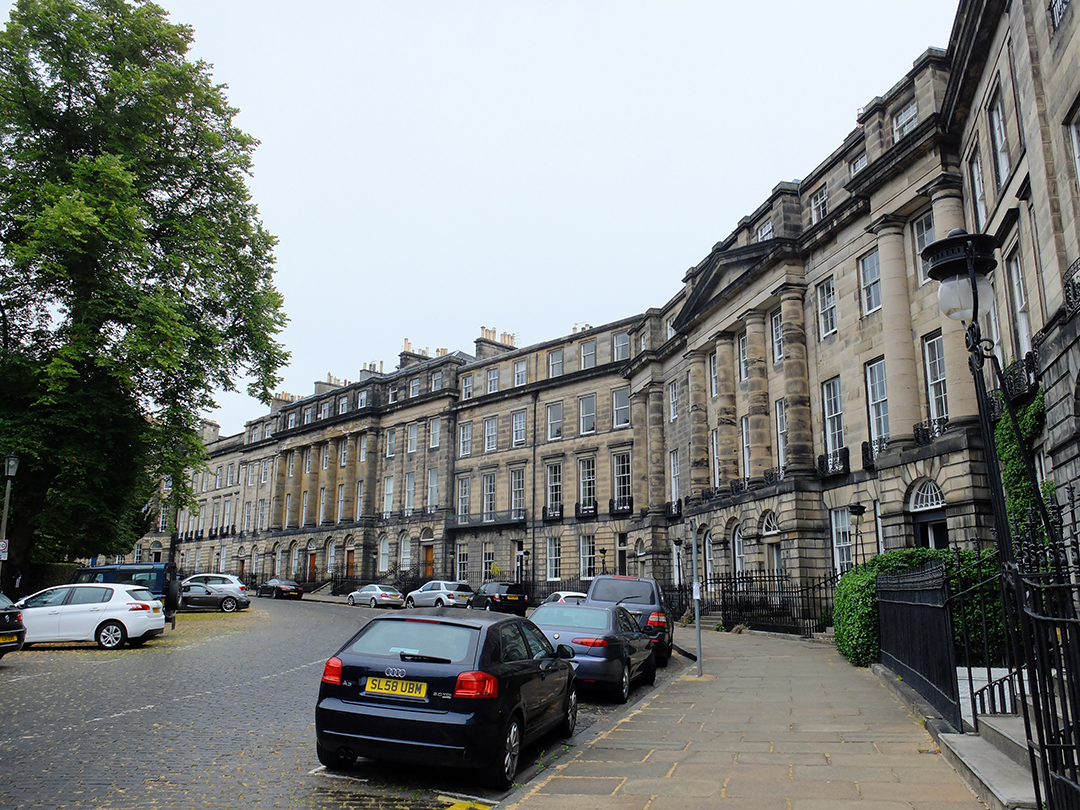
I was especially excited about Edinburgh after my interest was piqued from reading about it in an urban planning book. The Georgian “New” Town was planned in the mid-1700’s and the original city plan as well as a heavy majority of the original buildings are still intact.
 |
| James Craig's original New Town plan from 1766 |
I don’t remember the New Town at all from my first visit, but this time, I completely fell head-over-heels in love with the city. First of all, the city is a wonderful scale—just big enough to have culture, distinctive neighborhoods, a variety of shopping and restaurants, and a lot of diverse sites explore while still being small enough to be easily navigated. Very few of the buildings diverge from the Georgian four or five story maximum. Grey stone unites a large majority of the facades. Major, middle, and minor streets still fit their original pattern. Many of the original visual axes and termini still function in their original roles.

The New Town was designed by James Craig in 1766, and it runs parallel to the Old Town’s ridge.

 |
| Left: Main commercial street. Right: Small residential street. |
 |
| Mews behind the residental streets |
Today, these New Town appears remarkably homogeneous, but the city council was apparently disappointed at the mish-mash nature of the buildings that were springing up. They hired Robert Adam, the Georgian architect, to design the buildings around Charlotte Square in 1791.


 |
| Left: The three columns of windows in the middle of the image belong to one townhouse. Right: The end pavilion appears to be one residence, but the left-hand column of windows actually belongs to the townhouse next door. |
It seems that the art of the townhouse was mastered in Edinburgh. Even neighborhoods that were clearly designed and built in the Victorian era still follow the Georgian pattern of crescents and circuses of townhouses enclosing a private, green park.
 |
| Georgian patterns were repeated in various forms for at least 150 years after the original New Town was designed. |


The private parks in the middle of the crescents and circuses caught my interest, too. In this day and age—especially after living in Sweden for seven years, a country where no land is really ever off-limits to the public, even when privately owned—it is hard for me to comprehend that such a HUGE percentage of Edinburgh’s green space (70%? 90%?) is completely fenced off from the public. Unless a child is born into a wealthy, town-house owning family, it seems that there is a very limited choice of parks or playgrounds available to that child, and many open spaces throughout the city have large signs specifically stating that games involving balls are not allowed. Even more astounding was that the private parks seem to be very sporadically used. Even though we walked around in the evenings, in fine weather, we saw a total of two people inside the private parks. While I really feel strongly that the parks would be a better use of space if they were available to the general public, I did still really appreciate how the sheer number of green crescents and circuses make Edinburgh perhaps the greenest city I have ever experienced. Just about every block has its own park, and the parks are not small.

Edinburgh really stands out because of it’s Georgian “New” Town, but we also enjoyed wandering around the alleys and courtyards of the Old Town. The courtyards seem extraordinarily underutilized—despite being the high season and summer there were very few cafés, restaurants, or bars taking advantage of them.


We also toured through Holyrood Palace, the Queen’s summer home for a week or two every year. The original wings are much older and started as a medieval monastery, but the palace got a big make-over in the Georgian era, giving it symmetrical facades that fit in with the New Town.


From the palace’s lovely garden, there are good views of Arthur’s Seat, a peak above the city. The parkland around Arthur’s Seat is part of the palace grounds, but is open to the public and is an amazing urban amenity—you can start your day hike from your font door! We spend a lovely couple of hours hiking up and along the dramatic bluff, looking down on the old town and the castle.

 |
| Dean Village and a very lived-in mews. |
There’s a lot to see in Edinburgh, but there’s also a lot to eat and drink! We tried one restaurant that specializes in turning seldom used parts of livestock into gourmet meals, and it was quite good. We also spent a couple of hours in a couple of different pubs. In one pub, three older-middle aged men came to our table and struck up a conversation about soccer, Italy, and Edinburgh. In general, I was really impressed with Scottish pubs because they really do function as the city’s living room. People of all ages and different socio-economic backgrounds share a pint together, with their children and their dogs, sometimes with a game on or sometimes with a live band. Edinburgh’s parks may be segregated between rich and poor, but the city’s pubs are a common ground for all.
 |
| This crescent isn't actually rounded. |
After a jam-packed weekend in Edinburgh, we rented a car and drove across the country to Isle of Skye....


 |
| Townhouse doors through three distinct eras |
FRIDAY, JULY 13, 2018
Brännö


Since both Johannes and I were going to be in Göteborg for our office’s annual summer party anyway, we all decided to make a weekend of it. After the party, we took a ferry out to Brännö, an island just off the coast right outside of Göteborg. Brännö is within commuting reach of Göteborg, but it has retained a village-like charm and scale. Outside of the main village, the island is mostly undeveloped and there is a large nature reserve at the far end.
 |
| our hotel |
After a beautiful but surprisingly short ferry ride, we dropped our bags off at our cute if overpriced pension then headed to the island’s official swimming area for a picnic and a dip. After a long, relaxing afternoon at the beach, we went for a beautiful walk through the island’s wooded center to the far beach. The island feels so remote and pastoral that it was a bit of a chock to be able to see the giant cranes of Göteborg’s harbor in the distance.

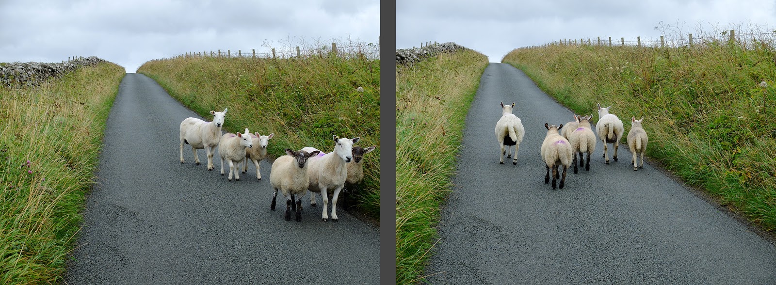
The next morning, we had a leisurely breakfast before heading across the island to Galterö Nature Reserve for a hike. The Nature Reserve is on another small island, just across a narrow canal from Brännö. Galterö is still used as pasture, and we saw a number of grazing sheep, but it is mostly undeveloped. The landscape of green pastures nestled between bulbous rock outcroppings was just beautiful.


The Göteborg Archipelago isn’t really all that different than the Stockholm archipelago, but somehow it is. The rock is rounder, redder, and bulbier. The beaches are sandier. There are no pine trees. The water is bluer in comparison to Stockholm’s nearly black sea. There’s a lot more wave action. The villages are larger and more concentrated. Fishing dominates over farming.

All too soon, it was time to hike back to Brännö and to the ferry back to Göteborg. Meeting “in the middle” for a little adventure was a wonderful way to see Susanna, Johannes, and Agnes; I’m so glad it worked out to see Brännö together!

TUESDAY, JULY 10, 2018
Midsummer's on Gotland


We celebrated the holiday first with a visit to the picturesque Nyhamn fishing camp,


The next day, we explored a few nearby prehistoric sites including an intricate early Iron Age grave that was discovered during road work in the 70’s at Stenkyrka. The grave is a giant stone-lined “wheel” with two stone boxes asymmetrically placed at the center. The boxes had already been plundered when the grave was discovered.


We also visited a prehistoric fort atop a waterside cliff at Bygdeborg. From the cliff, you get a clear view of several small fishing harbors and a long stretch of coastline, so it is easy to understand the location’s strategic importance. The cliff served as the defensive barrier on one side, but on the other side, a large wall of stacked limestone was meant to keep out the enemy. Inside the fort, we had a lovely picnic fika while looking out over all that beautiful water.

While the whole family was assembled, Carl’s dad took us to Visby’s cemetery to see the graves of several ancestors that died in the 1800’s. Afterwards, we wandered through Visby—always charming, the town was especially beautiful with an abundance of roses blooming along the town’s lanes.

It was a short and intense visit to Gotland, but we still managed to see and do a lot on the always lovely island. Thank you everybody!

THURSDAY, JUNE 14, 2018
Läckö Castle +

Stockholm’s
gorgeous spring/early summer continued without a break for weeks after
our camping trip in Riddersholm’s Nature Reserve (see below). Weeks
upon weeks of uninterrupted sunshine and warm temperatures is, to say
the least, unusual in Sweden, so we decided to take advantage of the
guaranteed beautiful weekend and take a little road trip to visit Läckö
Castle which has been on our list since we moved here.

We
rented a car in Stockholm early on Friday afternoon and in our usual
fashion, we stopped at a couple of other, smaller sites on our Sweden
to-see map. First on the list was a very special rune carving carved
directly onto the face of the bedrock. The rune carving does have a
rune-filled snake with text and a message like the average rune stone,
but inside of and interacting with the snake is a complex carving
depicting the ancient Sigurd saga. The average passer-by at the time
(about 1000 A.D.) would have understood the reference to the story as
well as the significance of why that story was depicted in that specific
place. Today, the association is lost and we don’t really know why the
patron would have requested that particular story, but the best guess
is that since the patron’s name was similar to the hero of the saga,
perhaps she was trying to establish a connection between the hero and
herself.
The
lighting wasn’t that great when we were there, so our photos don’t at
all show how impressive the carving really is. I’ve included an image
from Wikipedia. On the left, a man has been beheaded. In the middle,
there’s a horse and birds in a tree. On the right, a man stabs the
snake (dragon) with his sword and kills it.
 |
https://sv.wikipedia.org/wiki/Sigurdsristningen |
It
wasn’t a planned stop, but the countryside Jäders Church was so
unusually ornamental for a small, rural parish church that we had to
screech to a stop. It turns out that the existing church from the
1100's and 1400’s was renovated in the 1600’s, Sweden’s wealthiest
period, by one of Sweden’s wealthiest nobles to serve as a burial church
for his family. Naturally, the architect was the period’s starchitect,
Nicodemus Tessin, none other than the king’s court architect.

Like
many of the churches in the area, fragments of rune stones were used as
building material. They were once covered over by plaster but are now
visible. Another rune stone was found under the church floor during a
renovation and was moved to the church yard. This stone is unusual
because part of the text is on the stone’s side. After traveling
through Central and South America, I’m used to the idea that the
Catholic Church used the building materials and sites of pagan temples
for both practical and symbolic reasons, but I am curious about why
early church builders used rune stones as building material when many of
the rune stones are clearly Christian with their carved crosses and
were even erected specifically to advertise the patron’s Christian
belief to the world. Despite the crosses, was the non-Latin rune
alphabet considered pagan?

And
since we were right down the road, we made a super quick stop at a
Sundbyholm Palace, originally a medieval convent which was confiscated
by the Crown during the Reformation. It has been rented out to various
nobles for the last 500 years and is most famous because Sweden’s
beloved artist Prince Eugene once painted the building.

Eventually
we had to stop making stops in order to make progress south toward
Läckö Castle. We arrived late and quickly set up our tent in the
castle’s campground, made a quick dinner, and went to bed.
Läckö Castle was also property of the Church before the Reformation. As the area’s many pre-historic finds demonstrate, the area was certainly of strategic importance well before being first named in written sources. The Castle is located on a narrow, high peninsula jutting into the enormous Lake Vänern (Sweden’s largest lake) which was almost certainly a pre-historic hilltop fortress before entering the written record when it was built into a medieval castle by the local bishop in 1298. This particular bishop was one of Sweden’s wealthiest individuals, and at the time, Vänern’s shoreline was the much disputed border between Sweden, Denmark, and Norway. The castle’s location was unquestionably strategic in defending the riches of the Skara diocese and of the bishop himself.
Läckö Castle was also property of the Church before the Reformation. As the area’s many pre-historic finds demonstrate, the area was certainly of strategic importance well before being first named in written sources. The Castle is located on a narrow, high peninsula jutting into the enormous Lake Vänern (Sweden’s largest lake) which was almost certainly a pre-historic hilltop fortress before entering the written record when it was built into a medieval castle by the local bishop in 1298. This particular bishop was one of Sweden’s wealthiest individuals, and at the time, Vänern’s shoreline was the much disputed border between Sweden, Denmark, and Norway. The castle’s location was unquestionably strategic in defending the riches of the Skara diocese and of the bishop himself.
 |
| Lake Vänern |
In
addition to defense, the castle also served a political purpose. Much
like the King, the Bishop owned a number of grand residences (supported
by enormous farm estates) around his territory.
 |
| One of the barns on the Läckö estate, and the road leading to the castle through the farmland. |
The
only way to keep control over the power-hungry priests was to travel
around and stay for a time at the various residences. The area’s
important nobles could also be entertained and perhaps persuaded to
donate to the church while the bishop was in residence.

 |
| Courtyard inside the wall, then interior courtyard inside the main body of the castle. |
The
castle was confiscated by the Crown in conjunction with the Reformation
when it and its supporting farms were granted as a fiefdom to the
powerful De la Gardie family. After securing unimaginable wealth during
the Thirty Year’s War, The De la Gardie family updated the castle’s
interiors in the 1600’s. Today, the castle is known for these
well-preserved Baroque interiors.

Actually,
none of the furniture survived, but the walls and ceilings still retain
their Baroque decoration and painting, most of which celebrate the
family’s military successes in the Thirty Year’s War. While the rooms
for entertaining are opulently painted and decorated (by Swedish
standards, the French monarchy would have scoffed!), the chapel is
visibly post-Reformation with its relatively sparse ornamentation.

Läckö Castle’s peninsula location is makes its walls and towers extra picturesque, and Carl and I spent a good bit of time gazing at the castle while lounging in the shade, picnicking, reading and sketching, and night swimming.

Evening temperatures in Sweden are never warm enough to allow for night
swimming, but this spring’s unusually warm weather was perfect for an 11
p.m. dip to cool us off before crawling into our tent.
 |
| Night swimming. Sunset colors at 11pm. |
While we were in the area, we also spent some time exploring the area’s prehistoric sites including Viking rune stones,

Bronze Age rock carvings,

a large ceremonial burial mound from the 700’s, iron age burial mounds,

and a Stone Age chamber grave. We stopped at some more “modern” sites including churches, windmills,

and
Stola manner house. While the churches themselves weren’t overly
impressive, they all had an impressive array of early-medieval
gravestones that are now almost 1000 years old.

Gösslunda
church had an interesting carving of a centaur with sword and dagger at
its front door; the mythological figure was supposed to keep the evil
spirits away.

Despite
this spring’s lack of rain, the agricultural area was vibrantly green
and stunningly beautiful. This area of Sweden is much flatter and much
more fertile than Stockholm, which means that the farm fields stretch
much farther and encompass much larger areas of the landscape.
Västergötland’s landscape is not a wild beauty, but a cultural beauty
with a visible agricultural history stretching back for millennia.

On the way home, we stopped at a site that we had never heard of before, Källby Hallar. The site consists of two unusually tall rune stones standing on either side of a historic road. The stones create a passage or mark a boundary of some sort. One of the stones is unusual in that a human or mythological creature is carved on the middle of the stone. Possibly the figure is the Nordic god Thor.

We also stopped at yet another church, Husaby. This church has been on our list because of its unusual tower which is dimensioned more for a cathedral than for a parish church in the countryside.

It’s
unknown today who had the tower built or why, but it was built around
1100. The name of the village points to the area being one of the early
monarchy’s many properties through which the king constantly rotated in
order to keep an eye on the locals, and the area also hosts the ruin of
an early bishop’s castle (a smaller version of Läckö), but the church
tower could just as well have been built by a local clan chief or to
celebrate the baptism of Sweden’s first Christian king who was baptized
in a spring just below the church.
 |
| Left: ruin of the Bishop's Castle at Husaby. Right: Spring where Sweden's first Christian king was baptised. |
Husaby also had a number of nearly millenia-old gravestones.

Not
even a kilometer from Husaby Church is a large area of Bronze Age rock
carvings at Flyhov. The scope of these carvings reminded us of our
visit to the World Unesco Site at Tanum (see my post “3000 Year-Old Rock Carvings in Tanum).
Many of the themes at Flyhov were similar to Tanum including ships,
footprints, dots, sun wheels, warriors, and animals, but this area
included large net-like images that were intriguingly different.

We took a break from the sightseeing and enjoyed a fika of coffee, tea, and cake in the luxuriant gardens at Hällekis Manner. After a quick last stop at Forshem Church to see its Romanesque carvings, we headed to the highway for our four hour drive back to Stockholm.

Long
drives in this sunny dry weather and at this time of year when it never
gets dark are so much easier than drives on the dark, snowy roads of
wintry Sweden. Even so, the drive was slow at times as even this main
highway between Sweden’s two largest cities is often only one lane in
each direction. Sometimes, the highway is even interrupted by traffic
circles! These “highways” are quite the testament to how well Sweden’s
train system functions!


Riddersholm's Nature Reserve

Two days after my tiring long weekend in San Diego, houseguests arrived. They stayed with us for over a week and we had a fantastic time showing them our beautiful city and catching up on life, but the timing and intensity of their visit left me pretty well exhausted. Two days after our houseguests left, Carl and I had a four day long weekend. We were too tired to do anything major with the weekend, but the weather was too beautiful to just recuperate at home. And besides, four-day long weekends don’t come around so often, so we decided to take a little trip, but a very calm and restful trip.

We settled on Riddershom’s Nature Reserve, not too far outside of Stockholm. The area used to be an island, but it is now attached to the mainland on a peninsula that juts far out into the archipelago. Instead of the faster and cheaper bus, we decided to take the ferry from downtown Stockholm, a much more scenic way to travel when time allows.

We
enjoyed our morning sipping coffee and watching the scenery and cute,
cute cottages go by. While Stockholm was fully green and spring was in
full swing, the greenery became more and more sparse the farther out in
the archipelago we travelled. By the time we got out to Riddersholm,
spring was only just beginning.

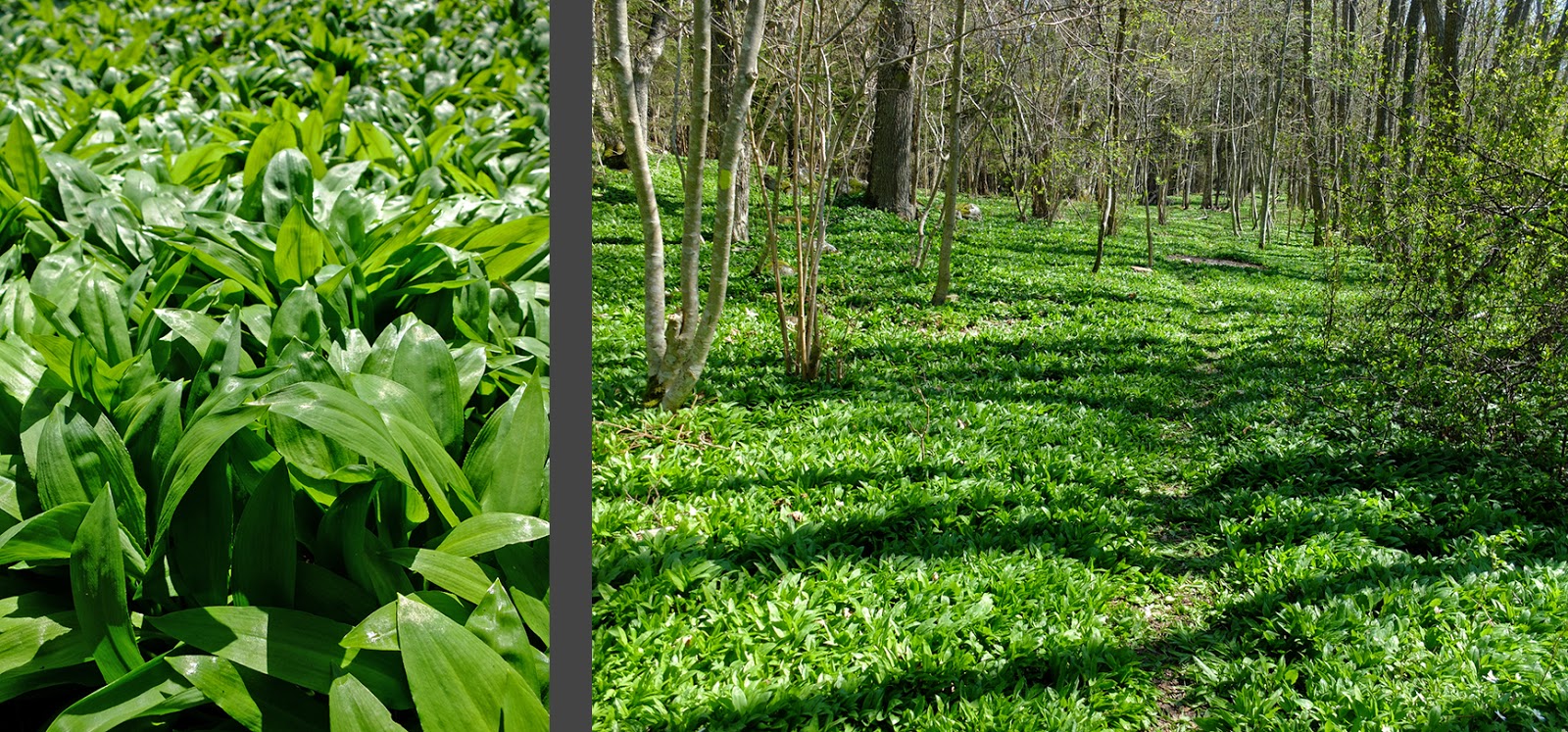
Riddersholm’s Nature Reserve isn’t huge, but considering our exhausted state, it was the perfect size to keep us occupied for three days. After getting off the ferry, we hiked a few miles through the most beautiful wildflower-strewn forest. In places, the wood anemones carpeted the forest floor, creating a very magical setting.

We
hiked past a couple of lakes, some boggy areas, through some pastures,
and through forest until we found a small peninsula jutting out into the
water where we could set up our tent in a small wildflower-covered
clearing.

We
spent the evening sitting at the water’s edge in the sun, reading and
watching the giant cruise ships and ferries to Finland motor past.

Often I don’t sleep very well in a tent, but this time I slept soundly and solidly and long. We didn’t wake up until around 10 a.m. when a dog on the nearby hiking trail barked at us. We had a leisurely breakfast at the beach then went for a hike around parts of the nature reserve that we hadn’t explored yet.

The destination for the day was a windmill from the 1700’s which proved to be a very scenic lunch spot.

Today’s nature reserve is made up of what was once Riddersholm Manor’s estate. The agricultural nature of the area is still much in evidence with hazelnut groves,

oak-studded pastures, small croft houses,

and even “leaf-gathering meadows” or lövängar where leaves were gathered for winter fodder for the livestock.

We took a break in one of these leaf-gathering meadows and read while overlooking a small lake and the Riddersholm Manor.

Back at our campsite, we lounged in our hammock for a couple of hours before the sun set and we got chilly; at that point we got out our big fluffy down jackets and started our waterside dinner.

The exceptionally gorgeous weather continued, and we woke up to yet another warm, sunny day. After lingering over breakfast with our books and sketch pads for a couple of hours,

we
broke camp and made our way slowly to the main road and the bus. On
the way, we foraged for a few new-to-us plants. Most notably, several
of the nature reserve’s forest floors were seas of ramslök, a
type of wild garlic. While the bulb is garlicy and edible, it is very
small in contrast to cultivated garlic. Instead, you pick the leaves
and use them in soups, salads, dips, etc. Ramslök is a relatively rare plant, especially on the Swedish mainland, so finding such quantities of it was unexpected and fun.
We also picked gullvivor or cowslips

and maskrosor
or dandelions. While the Swedish word for cowslip rings quite
poetically and roughly means “Yellow Life,” I really dislike the Swedish
version of dandelion which translates to “Worm Rose.” Both yellow
flowers bloom prolifically in meadows.

Another poetically named pasture plant that we picked were dagkåpor, which translates to “Dew cover.” In English they’re known as lady’s mantle.

Soon enough it was time to head to the main road to catch the bus back to Stockholm. Even though we were gone for three days, the four day weekend meant that we even had an extra day at home after our trip to relax and enjoy being at home—the whole weekend was filled with much needed recuperation after a fun but exhausting month.
WEDNESDAY, APRIL 26, 2018
Long Weekend in San Diego
Crazy
as it sounds, I was recently in San Diego for a long weekend. One of
my dearest friends, Mia, was getting married, and there was no way I was
going to miss her wedding. But, it was bad timing for the work year,
and I couldn’t get away for more than a few days. I ended up flying out
of Stockholm on Thursday morning and arriving in San Diego on Thursday
evening. I flew out again on Monday evening and arrived back home
Tuesday evening.Long Weekend in San Diego
So I only had three and a half days in San Diego, and it was a bit of a whirlwind of wedding activity, but I am so glad that I was able to make it out there to Mia’s wedding. The wedding was actually about 90 minutes north of the city in the foothills. The site was gorgeous with no other buildings within sight—just the beautiful, bouldery landscape. There was a scenic bridge over a little creek, a sunny lawn for the ceremony, and tables under ancient live oaks with fairy lights strung between the branches. The setting couldn’t have been more beautiful, and the bride and groom couldn’t have made a more handsome pair.
In addition to seeing Mia, I also had a lovely time attending the bride with her sister and meeting lots of family and friends that I had been hearing about for years. I also got to hang out with Brantley, an architect friend from San Antonio, and catching up with him was super fun. It sounds like he might be able to swing by Stockholm for a few days next year, I’m really looking forward to it!
I never adjusted to California time, so adjusting back to Swedish time was actually easier than usual. I was pretty exhausted for a couple of days, but I’m actually surprised at how well the long weekend concept worked!
Best of wishes, best of luck, and warm congratulations to Mia and Carlos!
WEDNESDAY, APRIL 26, 2018
Easter in Paris
Easter in Paris

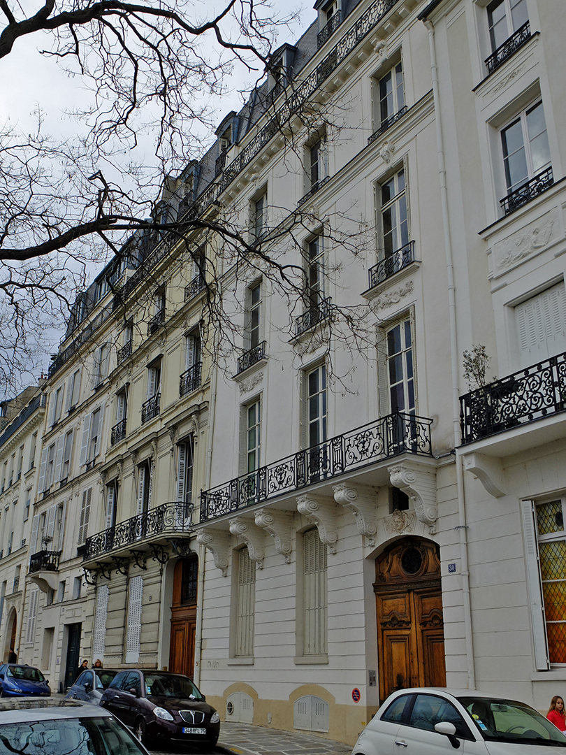
Each trip we stay in a different neighborhood, and this time our home base was Montmarte. We spent the first day wandering every nook and cranny of the village. Despite being in the midst of metropolitan Paris these days, the area does still retain a somewhat villagey atmosphere with curved streets navigating the terrain and a small, low scale of building stock. Especially intriguing were a few standalone houses with gardens behind fences that must be worth millions upon millions today. At the end of winter, the neighborhood’s vineyard wasn’t especially atmospheric but I love that it has survived.

Visiting Sacre Coeur has never been on the top of my list, probably because it is only a century old and doesn’t have the history of the great Gothic cathedrals. But since the church was just up the street from our hotel, we definitely had to stop in—especially given the church’s strangely shaped domes.


My favorite part of the Montmarte village is that despite all the tourists, despite the refinement of the once bohemian and artsy atmosphere, the village has retained a sense of everyday life through its numerous small shops. Within a block of our hotel there were at least four bakeries, two delis, two cheese shops, a wine shop, a fish merchant, and a butcher. Being exhausted at the end of the day, the cheese shop provided an excellent solution—we could enjoy a gourmet picnic with delicious French cheeses, French wine, baguettes, and pastries without having to sit through a long dinner. We ate a lot of cheese over the course of our long weekend!

The next day was supposed to be rainy so we headed to the Museé d’Orsay to revel in the museum’s famous collection of impressionist paintings. The museum was very crowded, so while we did enjoy the exhibits, the experience was a bit diminished by the jostling crowds. I was also struck by how the museum has changed since my last visit in 1999. Then, nearly the entire museum was devoted to Impressionism, but now, they’ve broadened their perspective and more than half of the museum is devoted to other artistic movements. This meant that the impressionist exhibit was very culled and many of the paintings that I fell in love with then were no longer on display.
This visit, I also began to notice how very narrow the museum’s presentation of Impressionism is. At the beginning of the exhibit, the text was clear that the museum’s collection comes primarily from a few private collections, so the museum’s collection reflects the taste of those few collectors. As a result, those few collectors have shaped the world’s view, understanding, and taste in Impressionist art for all time. All of the artists represented were men, all were French (the French have conveniently adopted van Gogh as their own), all painted in Paris at the turn of the century. Basically, the entire collection consists of seven primary artists: Monet, Manet, Renoir, Degas, Pissaro, Sisley, and van Gogh. A few other artists are represented with one painting each, but it’s really fascinating how the Impressionist cannon was defined by just a couple of wealthy taste makers.
In addition to the paintings and sculptures, the museum’s cafe in front of one of the huge train station clocks was also a work of art with beautiful light fixtures made of riveted brass sheets.

We spent a couple of hours wandering the St. Germain neighborhood, stopping in at the ancient St. Germain des Pres and the Neoclassical St. Sulpice churches. I was especially struck by the unusual medieval column capitals in St. Germain.


Passing by Notre Dame on the way to dinner, we were totally captivated by the front facade in the golden evening light. The clear sunlight really brought out all of the details in the stonework, it’s really incredible how detailed the carvings are.


While we weren’t successful in visiting Notre Dame, we did get inside at Sainte Chapelle (after losing our fork in security—luckily the security guard thought it was too great of a sin to throw away pate and chutney even though they were encased in prohibited glass jars!)


This time at Sainte Chapelle I began to notice details that I had been too awe-struck and dazed by the glassy lightness to notice before. The symbolically painted floor tiles are beautiful, and in addition to the soaring stained glass windows, stained glass is also incorporated into the wall decorations. Jewel-like marbles are incorporated into the statuary. The pilasters and wall decorations and ceiling are painted in shimmering, gold leaf. In candlelight, every surface would have sparkled, creating an even more magical and even mystical atmosphere.

It was a long subway ride out into the Parisian suburbs, but visiting the Basilica of St. Denis was worth the trip. This basilica is where all of the French monarchy, from 639 A.D. to the 1800’s, were interred. While the royal remains were removed and destroyed during the French Revolution, the sarcophagi and funerary sculpture were left behind and today they comprise a collection of beautiful medieval sculpture.


St. Denis is also important in architecture history because it was (one of?) the first major Gothic churches. You can clearly see in the facade how the rounded Romanesque


As always with medieval churches, I am fascinated how both “pagan” and “Christian” imagery are used side by side. St. Denis’s stone ogres, dragons, and mythological creatures which are peppered all over the facades are a common feature of Gothic churches, and the floor of the altar area even feature the signs of the zodiac as well as more dragons and mythological creatures. It’s as if the old beliefs with powerful, dark creatures and the new beliefs with the Light of God are joined together to fight evil at all costs, even at the cost of an unadulterated Christianity.

Later that day we strolled on Ile Saint-Louis and stopped in a cafe for a snack. The café was part Parisian bistro, part Parisian café, and part American diner with its gleaming white tiles and chrome details. It was one of the most fantastic snacks of my life with deeply flavored French onion soup with delicious melted cheese, grilled escargot in a garlic butter sauce, and delectable, crisp white wine.
We took a day trip by train outside of Paris to the Chateau de Fontainebleau. Fontainebleau dates back to at least the 1100’s as a medieval castle. It was rebuilt into a Renaissance palace in the 1500’s and succeeding generations of royals used it as their country palace, adding on wings until the palace reached its current 1900 rooms. 1900 rooms!

The palace faded in importance when Louis XIV felt the need to break from tradition and built his own country palace at Versailles, but Fontainebleau continued to be used through to the rein of Napoleon III.
 |
| These buildings are just the servants' quarters. |
The palace’s sprawling form with wings spiraling outward from a central hub along with its varied steep roofs, dormer windows, and numerous chimneys make the palace look like an entire village from a distance. Although huge, the palace looks deceptively small. You can never see the entirety of the palace in one view. Also, the palace is “only” three floors plus an attic when you look at the rows of windows. However, everything is so out of scale that it’s hard to see that each floor is more like 2 ½ or 3 floors! So really, the palace is more like 9 stories tall with voluminous rooms.

Many of the palace interiors from the 15- and 1600’s are intact and they are so sumptuously over-the-top that it’s hard to take everything in. Every surface of every room is smothered with luxurious finishings from gilded leather wallpaper to silk carpets to medieval tapestries to heavily moulded, gilded ceilings to giant crystal chandeliers. It’s interesting to see these rooms and to compare them to contemporary palace rooms in Sweden. Sweden was forever trying to imitate French fashion and reproduce the French level of luxury, but the coffers just were never as deep nor the craftsmanship as skilled.

Fontainebleau’s grounds aren’t as extensive nor as original as Versailles’s, but even so we managed to walk about 10 kilometers while covering the various gardens and parks. The arrow-straight canal, for example, is 1.2 kilometers long (the one at Versailles is 1.6 km, Louis XIV had to outdo Fontainebleau in every way). We had a lovely picnic on a bench overlooking the palace from the other side of the lake.

I was enchanted by Fontainebleau. I loved the organic way that the various wings sprouted out from the original castle over time. I loved the brick detailing, which I think is fairly unique in the Parisian region. The tall roofs and chimneys felt like a romantic overlay contrasting the strict geometries of the Renaissance facades. The interiors were unfathomably rich. The views over the lake and pond to the sprawling palace were straight out of a fairytale.

Our last day in Paris, we took a tourist boat along the Seine and up the St. Martin canal. The canal was dug for business and shipping purposes to link up two sides of the winding Seine with northern Paris. It was bustling but unsightly until Haussmann dug the southern part of the canal underground in order to create neighborhoods for the bourgeoisie.


The tree-lined canal is scenic, but I didn’t fall in love with the St. Martin neighborhood as we strolled through it after our boat trip. It’s a relatively un-touristy neighborhood and I appreciated the “realness” of it, but it just didn’t have the same charm as some of the other neighborhoods that we’ve strolled through.
We were excited to get home to Gordon, but our five days in Paris passed all too quickly. We are, as always, looking forward to our next visit.
No comments:
Post a Comment