I have previously written about Stockholm’s insanely contentious and drawn-out process for drawing up and ratifying a comprehensive city plan. It proved too complex to ratify a plan for the entire city at one time—the plan for Östermalm was approved first, and Norrmalm followed a while later. Both of these processes were notable for all of the back-and-forth proposals and counter-proposals spanning over a decade. I have already covered Norrmalm’s North-South boulevards; in this post I will complete my coverage of the Plan for Norrmalm: its remaining boulevards as well as its parks, setbacks, and grids.
 |
Reality today. Orange = St. Eriksgatan. Red = St. Eriksplan (St. Erik's Square). Green = Karlbergvägen. Brown = Vanadislunden. Pink = Vanadisplan (Vanadis Square). Yellow = Vasagatan to the south and Torsgatan to the north. Blue = Odengatan. Turquoise = Odenplan (Oden Square). Dark lilac = Kungsgatan. Purple = Hötorget (Hay Square). The two dark green parks are Tegnerlunden (the smaller one) and Vanadislunden (the larger one).
|
Before I get any farther, it would be helpful to know a few Swedish suffixes which appear in many of the place names I mention below:
-gatan = street
-vägen = road
-lunden = grove
-plan = square (as in a urban meeting place)
The Original Idea
The
Lindhagen Plan from 1886 featured several East-West boulevards connecting Norrmalm to other parts of the city and beyond. On the northern side of the district, two boulevards radiated westward from a common start point at Observatorielunden, a green area where an 18th century astronomical observatory is perched on the extremely steep Brunkeberg Ridge.
 |
| Observatorielunden: the steep Brunkeberg Ridge and the 18th century astronomical observatory on top |
The northern boulevard was an extension of the already existing Karlberg Allé (today’s Karlbergsvägen) leading to the Karlberg Slott Palace just to the west of the city. The southern boulevard would eventually evolve into today’s street Odengatan; Lindhagen envisioned that it would connect to another boulevard leading up from the southern part of the Norrmalm district and the central train station (today’s Vasagatan and Torsgatan) at a Baroque-inspired
rond-pointe (today’s St. Eriksplan or St. Erik’s Square) which then connected across a bridge to the island of Kungsholmen along what is today the street of St. Eriksgatan. The new part of Karlbergsvägen would be tree-lined like the original allé, but while Odengatan, Vasagatan/Torsgatan, and St. Eriksgatan were to be wide, they would not be particularly green.
Farther south in the district, Lindhagen envisioned another important East-West link from Kungsholmen, over a bridge, across all of Norrmalm, through the Brunkeberg Ridge, and across all of Östermalm. This link would eventually evolve into today’s Kungsgatan. It is unclear how Lindhagen planned this boulevard to negotiate the obstacle of Brunkeberg Ridge, but his plan did call for the removal of large sections of the ridge so perhaps this part of the ridge was to disappear also.
Lindhagen’s plan featured a grid of regular, perpendicular blocks stretching from the city center to the city’s boundary. Only the diagonal boulevards break the monotony of the grid. Another break from the monotony of the grid were the numerous green areas: basically all areas of Norrmalm that featured steep, hard-to-develop topography were to be parks in Lindhagen’s plan. Additionally, all of the blocks in the entire northern end of the district were to be set back from the street, providing a green zone between street and building.
 |
| The Lindhagen Plan from 1866. Orange = St. Eriksgatan. Red = St. Eriksplan (St. Erik's Square).
Green = Karlbergvägen. Brown = Vanadislunden. Yellow = Vasagatan to the south and Torsgatan to the
north. Blue = Odengatan. Turquoise = Odenplan (Oden Square). Dark
lilac = Kungsgatan. The two dark green parks are Tegnerlunden (the smaller one) and Vanadislunden (the larger one). |
Counter-ProposalsLindhagen’s plan was criticized for many reasons including that it was too ambitious, too expensive, ignored topography, and that it affected too much of the already existing urban fabric. When the idea of a comprehensive city plan was reawakened a decade after Lindhagen’s first proposal, Lindhagen drew up a slightly compromised plan. In this plan from 1876, all of the above mentioned features are still shown with three modifications. First, the East-West boulevard of Odengatan has become extremely wide and features a tree-planted allé in the middle of the street. Secondly, St. Eriksgatan which ties Karlbergsvägen, Odengatan, and Vasagatan/Torsgatan together has also become very wide with a tree-planted allé in the middle, and this boulevard becomes a dividing line between two shifted grids at the western end of the district. Finally, Kungsgatan is extremely short and no longer cuts across the already developed areas of Norrmalm and Östermalm.
 |
| Lindhagen's revised plan from 1876. In this plan you can see which blocks were already developed and which blocks represented completely new development. Orange = St. Eriksgatan. Red = St. Eriksplan (St. Erik's Square).
Green = Karlbergvägen. Brown = Vanadislunden. Yellow = Vasagatan to the south and Torsgatan to the
north. Blue = Odengatan. Turquoise = Odenplan (Oden Square). Dark
lilac = Kungsgatan. Purple = Hötorget (Hay Square). The two dark green
parks are Tegnerlunden (the smaller one) and Vanadislunden (the larger
one). |
A long string of counter-proposals, debates, and votes followed Lindhagen’s revised proposal. The city building authority and the City Engineer drew up a counter-proposal in 1876 where Odengatan would be moved farther north. At the eastern end of the district, an existing street would simply be widened. The boulevard would then jog a block southward to avoid some steep terrain. The jog would occur in what is today Odenplan, or Oden Square. Karlbergsvägen would then feed into the resulting square where Odengatan jogged. The boulevard Vasagatan/Torsgatan leading northward from the train station would continue wrapping around the north end of the district creating a ring road, but there would be no rond-pointe and the few blocks to the west of the ring road would hang awkwardly outside of the main mass of the city. Karlbergsvägen would be planted but Odengatan and Vasagatan/Torsgatan would not be given trees. Kungsgatan would be extended through the existing urban fabric to the square at Hötorget.
This counter-proposal would result in a much less green city than Lindhagen’s plan as it allowed for only one block-sized park in all of Norrmalm: Tegnerlunden. Additionally, no blocks would be set back providing front gardens as in Lindhagen’s plan.
 |
| The city's counter-proposal from 1876. New blocks are shaded in pink, already developed blocks are grey. Green = Karlbergvägen. Brown = Vanadislunden. Yellow = Vasagatan to the south and Torsgatan to the
north. Blue = Odengatan. Turquoise = Odenplan (Oden Square). Dark
lilac = Kungsgatan. Purple = Hötorget (Hay Square). The sole dark green
park is Tegnerlunden. |
A vote in January of 1877 set a few parameters that were somewhat of a compromise between the two competing plans (although the debate would continue unabated for some time yet). According to the vote, Odengatan would jog, two streets (Karlbergsvägen and Vanadisvägen) in Norrmalm would have setbacks, Vasagatan/Torsgatan/St. Eriksgatan would act as a ring road and connect to Odengatan at a small green square (St. Eriksplan), the blocks to the west of St. Eriksgatan would be disjointed from the rest of the city, Kungsgatan would not cut through the densely developed city center, and Norrmalm would feature two parks—the small, block-sized Tegnerlunden as well as a large park at Vanadislunden. In this way, Norrmalm would be punctuated with green even if it wasn’t as green as Lindhagen had envisioned. A new plan was drawn up in 1877 showing the result of this vote.
 |
| The plan after the January 1877 vote. Orange = St. Eriksgatan. Red = St. Eriksplan (St. Erik's Square).
Green = Karlbergvägen. Brown = Vanadislunden. Yellow = Vasagatan to the south and Torsgatan to the
north. Blue = Odengatan. Turquoise = Odenplan (Oden Square). Dark
lilac = Kungsgatan. Purple = Hötorget (Hay Square). The two dark green
parks are Tegnerlunden (the smaller one) and Vanadislunden (the larger
one). |
Lindhagen accepted most of these compromises but in a counter-counter-proposal from 1877 he was adamant that Odengatan should provide a better connection to the island Kungsholmen, it should be straight, and it should be wide and parklike. Lindhagen drew a larger green square at St. Eriksplan where Odengatan and St. Eriksgatan would connect to Kungsholmen. St. Eriksgatan was once again drawn through the middle of the district instead of as a ring road, and while this boulevard would provide a boundary between two distinct areas with shifted rectilinear grids, the blocks to the west of the boulevard would still be an integral part of the city. He also insisted on one more green space at the western edge of the district bordering the Karlberg palace park.
 |
| Lindhagen's counter-counter proposal from 1877. Orange = St. Eriksgatan. Red = St. Eriksplan (St. Erik's Square).
Green = Karlbergvägen. Brown = Vanadislunden. Yellow = Vasagatan to the south and Torsgatan to the
north. Blue = Odengatan. Turquoise = Odenplan (Oden Square). Dark
lilac = Kungsgatan. Purple = Hötorget (Hay Square). The two dark green
parks are Tegnerlunden (the smaller one) and Vanadislunden (the larger
one). |
The city prepared another counter-counter-counter proposal in 1877 where Lindhagen’s pleas for Odengatan, a larger square at St. Eriksplan, a more integrated western part of the district, and a park at the western edge of the city were ignored. However, the city was now proposing that Kungsgatan should, much like Lindhagen’s plan from 1866, cut across the already-developed central part of the city to link Kungsholmen, Norrmalm, and Östermalm together.
 |
| The city's counter-counter-counter proposal from 1877. In this map, new blocks and new streets through developed areas are outlined in pink. Red = St. Eriksplan (St. Erik's Square).
Green = Karlbergvägen. Brown = Vanadislunden. Yellow = Vasagatan to the south and Torsgatan to the
north. Blue = Odengatan. Turquoise = Odenplan (Oden Square). Dark
lilac = Kungsgatan. Purple = Hötorget (Hay Square). The two dark green
parks are Tegnerlunden (the smaller one) and Vanadislunden (the larger
one). |
This “new” idea for Kungsgatan was deemed too ambitious and expensive by others in the city administration, and after several hearings and votes, the city was back to the same proposal as before, although now Lindhagen’s idea of a straight (but not tree-lined) boulevard for Odengatan had won out by one vote. St. Eriksplan lost its greenery in this plan. In this proposal, Karlbergsvägen split off of Odengatan a bit west of where Lindhagen had shown the split; the split is at today’s Odenplan (Oden Square).
 |
| The city's counter-counter-counter-counter-proposal from 1878. Red = St. Eriksplan (St. Erik's Square).
Green = Karlbergvägen. Brown = Vanadislunden. Yellow = Vasagatan to the south and Torsgatan to the
north. Blue = Odengatan. Turquoise = Odenplan (Oden Square). Dark
lilac = Kungsgatan. Purple = Hötorget (Hay Square). The two dark green
parks are Tegnerlunden (the smaller one) and Vanadislunden (the larger
one). |
In 1878, Lindhagen insisted once again that it was important to provide a good link between Norrmalm and Kungsholmen and he drew another plan where he accepted the new proposal for Odengatan but moved the proposed bridge. This alignment allows St. Eriksgatan and the blocks to the west of it to be more of an integral part of Norrmalm.
 |
| Lindhagen's counter-counter-counter-counter-counter-proposal from 1878. Orange = St. Eriksgatan. Red = St. Eriksplan (St. Erik's Square).
Green = Karlbergvägen. Brown = Vanadislunden. Yellow = Torsgatan. Blue = Odengatan. |
The DecisionWhen the city’s plan with the narrower Odengatan was sent to the King for ratification, the King sent it back saying that it did not adhere to the
Building Code of 1874 which required broad avenues throughout the city to stop the spread of fires. The king asked the city to widen Odengatan from 30 to 42 meters, but Lindhagen stepped in and said that the boulevard should either be wide enough to accommodate a green strip in the middle, or it should remain at 30 meters. According to Lindhagen, 42 meters would be an awkward width. The King accepted Lindhagen’s judgement and the plan was ratified in 1878.
While Lindhagen did eventually win out by one vote for the straight Odengatan, his ideas for Vasagatan/Torsgatan/St. Eriksgatan, a more natural link to Kungsholmen, a green square at St. Eriksplan, and the western shifted grid were not included in the ratified plan for Norrmalm. However, the plan would continue to evolve before the entirety of Norrmalm was built out and these Lindhagen ideas would eventually make their way into later iterations of the official city plan.
 |
| A map from 1887 with the ratified plan drawn in. Red = St. Eriksplan (St. Erik's Square).
Green = Karlbergvägen. Brown = Vanadislunden. Yellow = Vasagatan to the south and Torsgatan to the
north. Blue = Odengatan. Turquoise = Odenplan (Oden Square). Dark
lilac = Kungsgatan. Purple = Hötorget (Hay Square). The two dark green
parks are Tegnerlunden (the smaller one) and Vanadislunden (the larger
one). |
The ResultThe much debated Odengatan
 |
| Odengatan |
did end up straight but is now tree-lined, even if it is nothing like the parklike Karlavägen. Odenplan (Oden Square) is not green as first envisioned but is instead a very urban, busy square punctuated by the church rising at one end.
 |
Odenplan (Oden's Square)
|
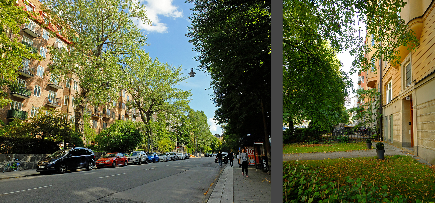
Karlbergsvägen is also tree-lined and its wide setbacks have created a lusciously green oasis in the middle of the dense city structure which real estate prices reflect.
 |
| Karlbergsvägen |
The eastern part of Vanadisvägen is tree-lined with setbacks, but further west, the setback is replaced by a planted strip toward one side of the street.
 |
| Vanadisvägen |
Vanadisvägen’s trees do provide some much-needed greenery in the otherwise dense city structure, and they do provide a continuous green connection between the parks of Vanadislunden and Rödabergen, but the overarching impression is not nearly as verdant as Karlbergsvägen.
In the end, the boulevard leading up from the train station to St. Eriksplan and beyond was built much as Lindhagen envisioned, complete with the awkward crook and hop at about the halfway point. Vasagatan is currently in the process of being planted today and will soon be a more pleasant place to stroll,
 |
| Vasagatan |
but Torsgatan is very much a thoroughfare. Its southern end is quite dead and while it does get more lively north of St. Eriksplan, it is still very trafficked.
 |
Torsgatan's southern and northern sections
|
There is also a lot of traffic on St. Eriksgatan but being tree-lined makes it a more pleasant place to stroll and to lounge outside at cafés and bars.
 |
| St. Eriksgatan |
St. Eriksplan or St. Erik’s Square did end up being a bit of a green oasis though with the large and leafy Vasa Park just across the street, there’s generally not a lot of people hanging out in the square.
 |
| St. Eriksplan (St. Erik’s Square) |
The northern blocks of Torsgatan and St. Eriksgatan provide an interesting apples-to-apples comparison of how small tweaks in the urban environment can cause big effects and create entirely different qualities of life. Both of the streets are heavily trafficked thoroughfares leading out to the suburbs and they are both lined with apartment buildings of approximately the same height, style, and time period. St. Eriksgatan is slightly wider than Torsgatan and is planted with trees (sometimes only on one side, sometimes on both sides, depending on the block) while Torsgatan is barren of greenery. These trees between the sidewalk and the street make a world of difference: suddenly the trafficked thoroughfare becomes a pleasant place to stroll and to hang out at café and bar sidewalk tables. St. Eriksgatan is lined with restaurants, bars, cafés, shops, salons, and even a theater while Torsgatan is nearly devoid of commercial and cultural activity.
 |
Torsgatan on the left, St. Eriksgatan on the right
|
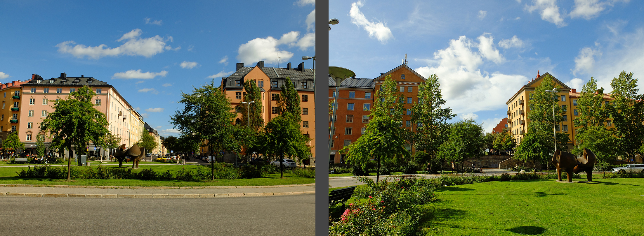
Interestingly, the city ended up building a rond-pointe at Vanadisplan that doesn’t appear in even Lindhagen’s earliest, most extravagant proposal. Vandadisplan or Vanadis Square is a large, grass and rose-planted roundabout at the junction of the tree-lined St. Eriksgatan and the tree-lined, setback Vanadisvägen. Unfortunately, the current crosswalks at Vanadisplan are situated so that the green roundabout acts more like a barrier than as a conduit from one greenspace along Vanadisvägen to the next greenspace at the top of Rödabergen. The relatively easy act of moving the crosswalks would make it much more natural for pedestrians to move through the city from one greenspace to another.
 |
| Vanadisplan |
In the ratified plan of 1878, Kungsgatan would be unchanged from its existing status. It would not be widened into a boulevard, and it would not cut across the Brunkeberg Ridge to connect to Östermalm. However, this part of the plan would be revised just a few months later and a more modern boulevard would eventually be built here in 1911.
 |
| Kungsgatan |
All in all, Norrmalm would be built out much like this ratified plan from 1878, but some of Lindhagen’s original ideas would creep back in. For example, the only parks in the ratified plan are Tegnerlunden
 |
| Tegnerlunden |
and Vanadislunden,
 |
| Vanadislunden |
but a several more areas with steep topography including Rödabergen, Hälsingehöjden and Vasaparken
 |
| Vasaparken |
would never be developed but would eventually be reserved as parks. The northern part of Norrmalm is now strewn with small pocket parks, making this area one of Stockholm’s greenest despite its density.
 |
Dark green = all of Normalm's parks today (I have not included churchyards as parks)
|
Torsgatan was built as a neighborhood boulevard instead of as a ring road, making the area west of the boulevard an integral part of the district. These blocks would be built on a shifted grid as Lindhagen had proposed so that bridge to Kungsholmen could lead directly from St. Eriksplan instead of being a jog from this node.
Furthermore, a few small neighborhoods deviate completely from the ratified plan. Because the steep areas were the hardest to build upon, they were the last areas to be developed. By that time, planning ideals had changed and the rectilinear grid system was no longer the ideal du jour. A more romantic view of planning coupled with the challenging topography resulted in a few small neighborhoods where the planning diverges drastically from the unwavering, rectilinear ratified plan from 1878.
 |
Diverging neighborhoods are bordered in red.
|
These divergent neighborhoods provide a welcome contrast to the dense city which was built according to the ratified plan from 1878, but without the ocean of rectilinear blocks, the deviating islands wouldn’t be special oases. It is my studied opinion that cities need both a background as well as occasional counter-points. This is just as true for individual buildings as for entire neighborhoods and districts. Without a calm “background,” cities become too disjointed and chaotic. And without the eye-catching “counterpoints,” they become too monotonous and dull.
 |
The Atlas Området or Atlas Area, one of the more romantic, divering neighborhoods in Norrmalm/Vasastan
|
Real estate prices show that the population prefers to live in the diverging neighborhoods over the more common areas with a rigid grid system. This isn’t just because these neighborhoods are a little different—I think it has much more to do with the lower scale, increased coziness, and the sense of living in a small, defined neighborhood amidst a big city.
The diagonally thrusting boulevards create a sense of dynamism in the neighborhood and a contrast to the otherwise regularly marching street grid. This dynamism is not only because of the accompanying traffic and speed and commercial activity, but also because the diagonal thoroughfares leave non-rectilinear blocks which promoted a more prominent, dominant architecture than the general background architecture.

Norrmalm/Vasastan has been much criticized for its high density and especially for the large courtyard buildings which cause the inner courtyards to be cramped and dark. I can agree with this criticism—we briefly considered buying one of these courtyard apartments at one point in time but ultimately decided that the long, linear, dark courtyard was too impersonal and that the apartment was also too dark and furthermore we didn’t like that our windows would look directly into the apartment across the courtyard creating a complete lack of privacy while in the apartment or on the balcony. The later diverging neighborhoods with their lower scale and absence of courtyard buildings are a pointed reaction against the crowded turn-of-the-century blocks.
 |
Left: A turn of the century block where the center of the block is filled with courtyard building. Right: A slightly more recent block where the courtyards are not filled in with buildings.
|
The ratified plan of 1878 is a much watered-down version of Lindhagen’s vision, for better and for worse. However, enough of the essential ideas of the Lindhagen Plan survived and still other of his ideas crept back into later revised city plans to make Stockholm one of the world’s most beautiful cities and Norrmalm/Vasastan a very desirable, livable neighborhood.
Sources:
Gösta Selling, Esplanadsystemet och Albert Lindhagen: Stadsplanering i Stockholm åren 1857-1887 (1970)
Thomas Hall, Stockholm: The Making of a Metropolis (2009)
Thomas Hall, Huvudstad i Omvandling (2002)
Alla Tiders Stockholm (2014)
Images:
All of the images are my own except for the maps which come from
Gösta Selling, Esplanadsystemet och Albert Lindhagen: Stadsplanering i Stockholm åren 1857-1887 (1970)


No comments:
Post a Comment